MyTopo
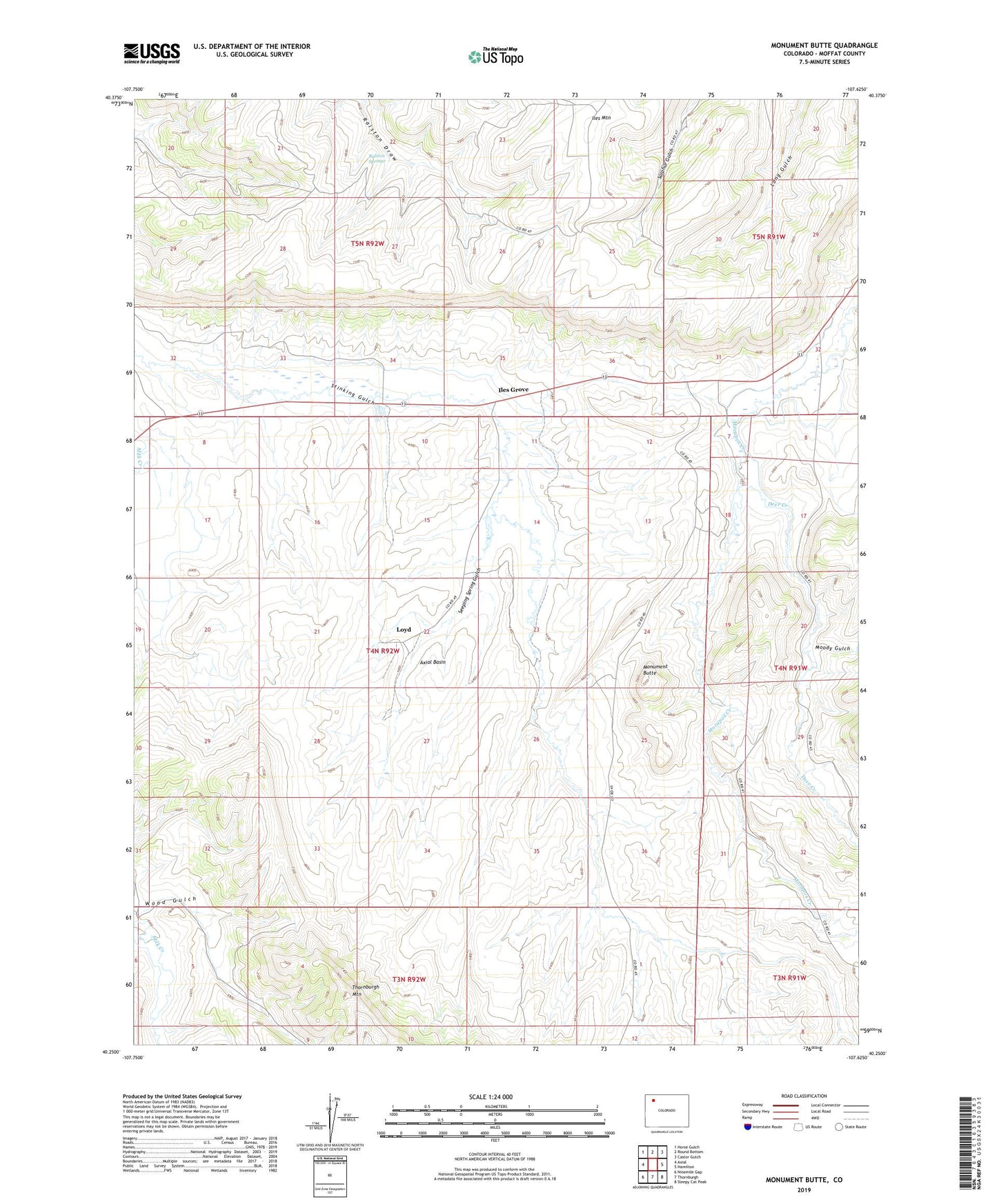
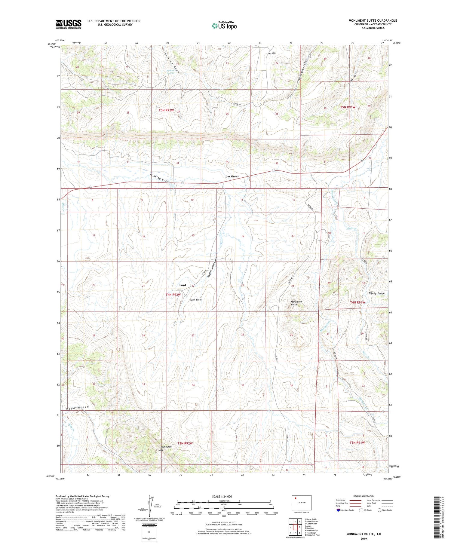
Monument Butte Colorado US Topo Map
Couldn't load pickup availability
2022 topographic map quadrangle Monument Butte in the state of Colorado. Scale: 1:24000. Based on the newly updated USGS 7.5' US Topo map series, this map is in the following counties: Moffat. The map contains contour data, water features, and other items you are used to seeing on USGS maps, but also has updated roads and other features. This is the next generation of topographic maps. Printed on high-quality waterproof paper with UV fade-resistant inks.
Quads adjacent to this one:
West: Axial
Northwest: Horse Gulch
North: Round Bottom
Northeast: Castor Gulch
East: Hamilton
Southeast: Sleepy Cat Peak
South: Thornburgh
Southwest: Ninemile Gap
This map covers the same area as the classic USGS quad with code o40107c6.
Contains the following named places: Deer Creek, Iles Dome Oil Field, Iles Grove, Iles Mountain, Loyd, Monument Butte, Moody Gulch, Ralston Springs, Seeping Spring Gulch, Weisbeck Mine, Wood Gulch