MyTopo
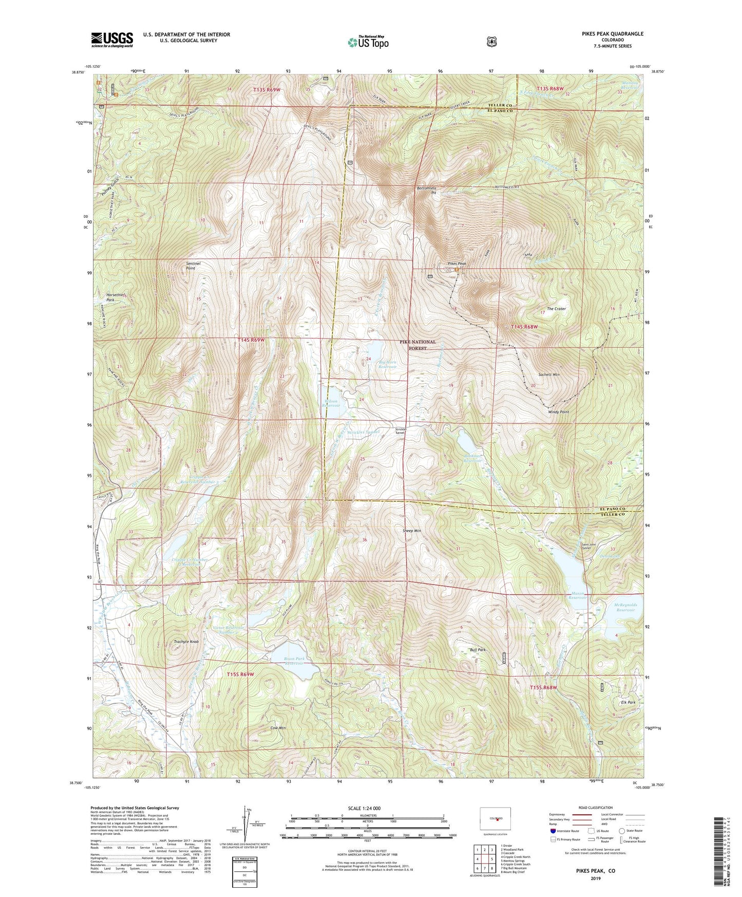
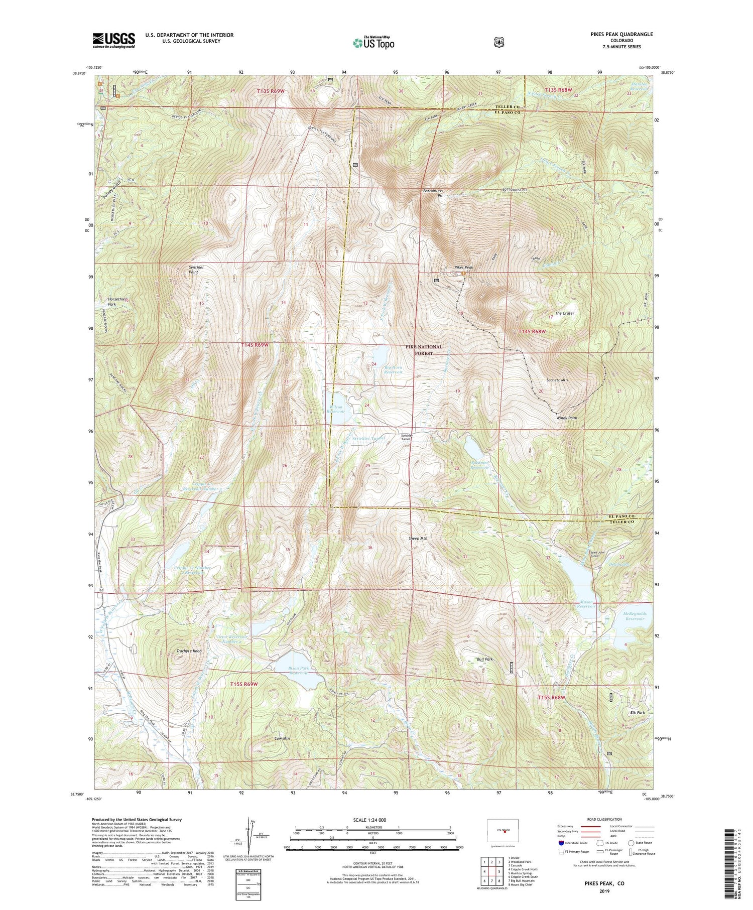
Pikes Peak Colorado US Topo Map
Couldn't load pickup availability
Also explore the Pikes Peak Forest Service Topo of this same quad for updated USFS data
2022 topographic map quadrangle Pikes Peak in the state of Colorado. Scale: 1:24000. Based on the newly updated USGS 7.5' US Topo map series, this map is in the following counties: Teller, El Paso. The map contains contour data, water features, and other items you are used to seeing on USGS maps, but also has updated roads and other features. This is the next generation of topographic maps. Printed on high-quality waterproof paper with UV fade-resistant inks.
Quads adjacent to this one:
West: Cripple Creek North
Northwest: Divide
North: Woodland Park
Northeast: Cascade
East: Manitou Springs
Southeast: Mount Big Chief
South: Big Bull Mountain
Southwest: Cripple Creek South
This map covers the same area as the classic USGS quad with code o38105g1.
Contains the following named places: Altman Dam, Barr Trail, Big Horn Dam, Bighorn Reservoir, Bison Park Dam, Bison Reservoir, Black Forest, Boehmer Creek, Boehmer Dam, Boehmer Reservoir, Bottomless Pit, Bull Park, Cow Mountain, Cripple Creek Number 2 Dam, Cripple Creek Number 2 Reservoir, Cripple Creek Number 3 Dam, Cripple Creek Reservoir Number 3, Dead Lake, Devils Playground, East Fork West Beaver Creek, Elk Park, Gillett, Horsethief Park, Mason Dam, Mason Reservoir, McReynolds Dam, McReynolds Reservoir, Pikes Peak, Sachett Mountain, Saint John Tunnel, Sentinel Point, Seven Lakes, Sheep Mountain, Strickler Tunnel, Summit House, The Crags Campground, The Crater, Trachyte Knob, Tracie Group Mine, Victor Number 2 Dam, Victor Reservoir Number 2, West Fork West Beaver Creek, Wilson Dam, Wilson Reservoir, Windy Point, ZIP Code: 80809