
MyTopo
Shawnee Colorado US Topo Map
Couldn't load pickup availability
Also explore the Shawnee Forest Service Topo of this same quad for updated USFS data
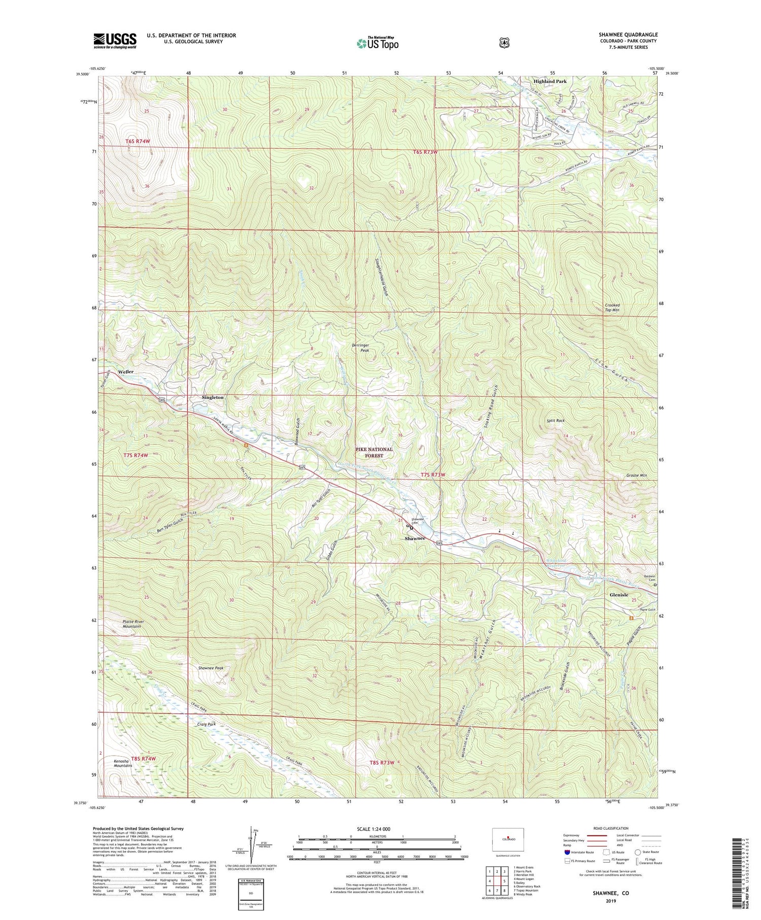
2022 topographic map quadrangle Shawnee in the state of Colorado. Scale: 1:24000. Based on the newly updated USGS 7.5' US Topo map series, this map is in the following counties: Park. The map contains contour data, water features, and other items you are used to seeing on USGS maps, but also has updated roads and other features. This is the next generation of topographic maps. Printed on high-quality waterproof paper with UV fade-resistant inks.
Quads adjacent to this one:
West: Mount Logan
Northwest: Mount Evans
North: Harris Park
Northeast: Meridian Hill
East: Bailey
Southeast: Windy Peak
South: Topaz Mountain
Southwest: Observatory Rock
This map covers the same area as the classic USGS quad with code o39105d5.
Contains the following named places: Baldwin Cemetery, Ben Tyler Gulch, Bill Tyler Gulch, Boxwood Gulch, Brookside Gulch, Case School, Craig Creek Trail, Craig Park, Crooked Top Mountain, Derringer Peak, Foster Gulch, Gibbs Gulch, Glenisle, Grouse Mountain, Highland Park, Jeffries Crawford Ditch, McArthur Gulch, Payne Creek, Payne Creek Trail, Payne Gulch, Platte River Mountains, Redskin Mines, Shawnee, Shawnee Cemetery, Shawnee Peak, Shawnee Post Office, Singleton, Slaughterhouse Gulch, Smith Creek, Snaking Road Gulch, Split Rock, Weller, Whiteford Lake Dam, Whiteford Reservoir, Willow Creek, Willow Creek Ranch, Wonder Ditch, ZIP Codes: 80421, 80475


