
MyTopo
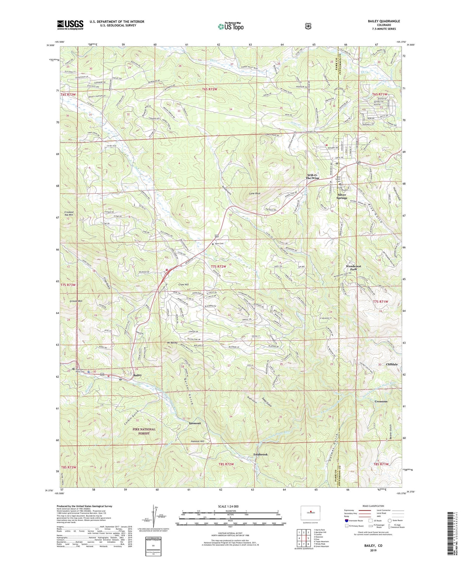
Bailey Colorado US Topo Map
Couldn't load pickup availability
Also explore the Bailey Forest Service Topo of this same quad for updated USFS data
2022 topographic map quadrangle Bailey in the state of Colorado. Scale: 1:24000. Based on the newly updated USGS 7.5' US Topo map series, this map is in the following counties: Park, Jefferson. The map contains contour data, water features, and other items you are used to seeing on USGS maps, but also has updated roads and other features. This is the next generation of topographic maps. Printed on high-quality waterproof paper with UV fade-resistant inks.
Quads adjacent to this one:
West: Shawnee
Northwest: Harris Park
North: Meridian Hill
Northeast: Conifer
East: Pine
Southeast: Green Mountain
South: Windy Peak
Southwest: Topaz Mountain
This map covers the same area as the classic USGS quad with code o39105d4.
Contains the following named places: Bailey, Bailey Camp Grounds, Bailey Post Office, Bailey Ranger Station, Beaver Gulch, Black Mountain Creek, Brush Gulch, Cliffdale, Cliffdale Post Office, Colorado State Patrol Bailey Office Post 3, Corbin Gulch, Craig Creek, Crossons, Crow Creek, Crow Gulch, Crow Hill, Davis Ranch, Day Ranch, Deep Gulch, Deer Creek, Dry Creek School, Earley Ranch, Elk Creek Fire Protection District - Station 2, Estabrook, Fitzsimmons Ranch, Glen Isle Point Cemetery, Hallack Mine, Holmes Gulch, Horn Cemetery, Insmont, Insmont Hill, Insmont Post Office, Isham Jones Ranch, Jones Creek, Lone Rock, Lydia Ranch, Mason Creek, McCarthy Ranch, Mount Bailey, North Elk Creek, Osirio Mine, Park County Sheriff's Office Bailey Substation, Parmalee Ditch 2 and 3, Peterson Ranch, Pine Gulch Cemetery, Pine Gulch School, Pine Junction, Pine Post Office, Platte Canyon Fire Protection District Station 1, Platte Canyon Fire Protection District Station 2, Potter Ranch, Quiner Gulch, Roark Creek, Rock Creek, Rosemont Ranch, Ruble Claims Mine, Shaffer Ranch, Shott Brothers Ranch, Silver Springs, Wandcrest Park, Will-O-The-Wisp, Wisp Creek


