MyTopo
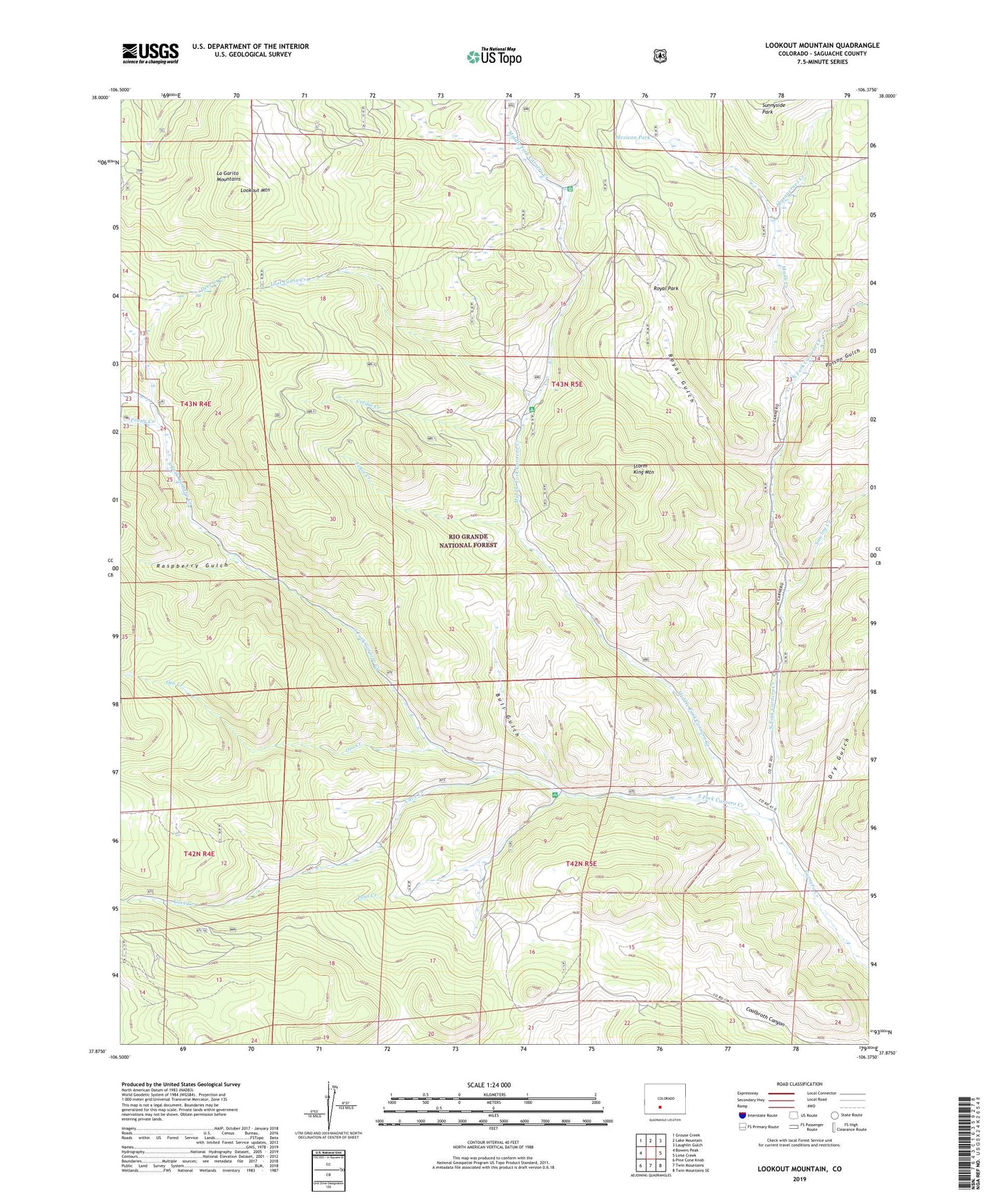
Lookout Mountain Colorado US Topo Map
Couldn't load pickup availability
Also explore the Lookout Mountain Forest Service Topo of this same quad for updated USFS data
2022 topographic map quadrangle Lookout Mountain in the state of Colorado. Scale: 1:24000. Based on the newly updated USGS 7.5' US Topo map series, this map is in the following counties: Saguache. The map contains contour data, water features, and other items you are used to seeing on USGS maps, but also has updated roads and other features. This is the next generation of topographic maps. Printed on high-quality waterproof paper with UV fade-resistant inks.
Quads adjacent to this one:
West: Bowers Peak
Northwest: Grouse Creek
North: Lake Mountain
Northeast: Laughlin Gulch
East: Lime Creek
Southeast: Twin Mountains SE
South: Twin Mountains
Southwest: Pine Cone Knob
This map covers the same area as the classic USGS quad with code o37106h4.
Contains the following named places: Bull Gulch, Carnero Guard Station, Cave Creek, Cecilia Creek, Deer Creek, Dry Gulch, Fence Creek, Laughlin Stock Driveway, Lime Creek Stock Driveway, Lookout Mountain, Lost Cabin Creek, Mann Creek, Masauernez Creek, Mexican Park, Middle Fork Carnero Creek, North Fork Carnero Creek, Oso Creek, Paradise Dam, Paradise Reservoir, Poison Gulch, Poso Campground, Poso Creek, Prong Creek, Raspberry Gulch, Royal Gulch, Royal Park, Sawlog Creek, South Fork Carnero Creek, Storm King Campground, Storm King Mountain, Sunnyside Park