MyTopo
Pinkerton Mesa Colorado US Topo Map
Couldn't load pickup availability
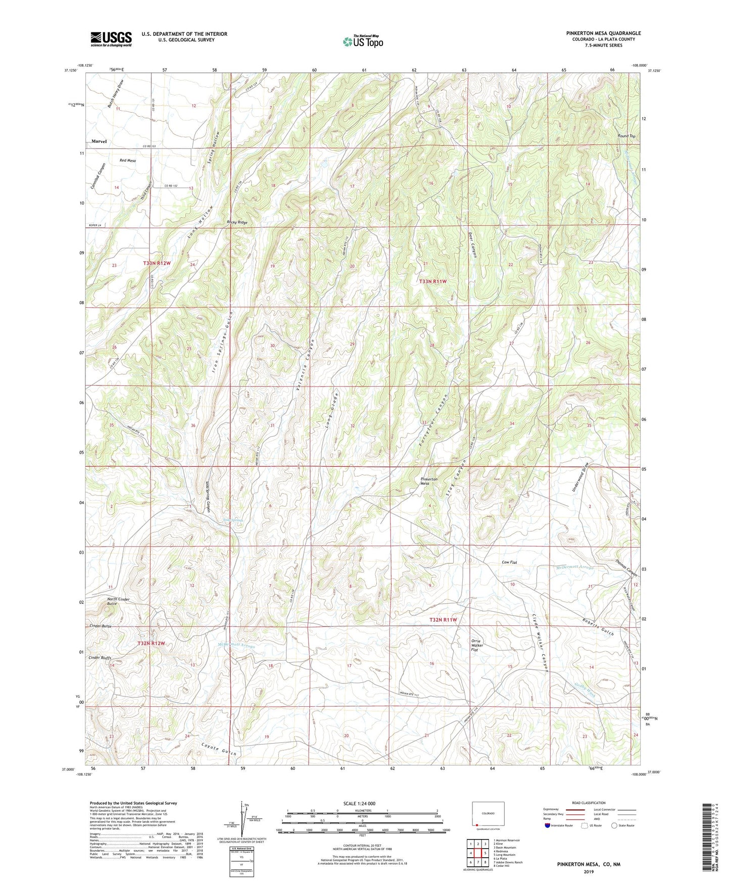
2022 topographic map quadrangle Pinkerton Mesa in the state of Colorado. Scale: 1:24000. Based on the newly updated USGS 7.5' US Topo map series, this map is in the following counties: La Plata, San Juan. The map contains contour data, water features, and other items you are used to seeing on USGS maps, but also has updated roads and other features. This is the next generation of topographic maps. Printed on high-quality waterproof paper with UV fade-resistant inks.
Quads adjacent to this one:
West: Redmesa
Northwest: Mormon Reservoir
North: Kline
Northeast: Basin Mountain
East: Long Mountain
Southeast: Cedar Hill
South: Adobe Downs Ranch
Southwest: La Plata
Contains the following named places: Cinder Butte, Cinder Butte Mine, Clyde Walker Canyon, Cow Flat, Coyote Gulch, Deer Canyon, Durango Southwest Division, Farmers Mine, Fort Lewis Mine, Fortyfour Canyon, Henderson Mine, Houston Well, Iron Springs Gulch, Long Glade, Mormon Mine, North Cinder Butte, Orrie Walker Flat, Pinkerton Mesa, Price Walters Canyon, Pruitt Mine, Roberts Gulch, Rocky Ridge, Soda Springs, Soda Springs Canyon, Spring Hollow, Stag Canyon, Thomas Canyon, Underwood Draw, Valencia Canyon