
MyTopo
Mormon Reservoir Colorado US Topo Map
Couldn't load pickup availability
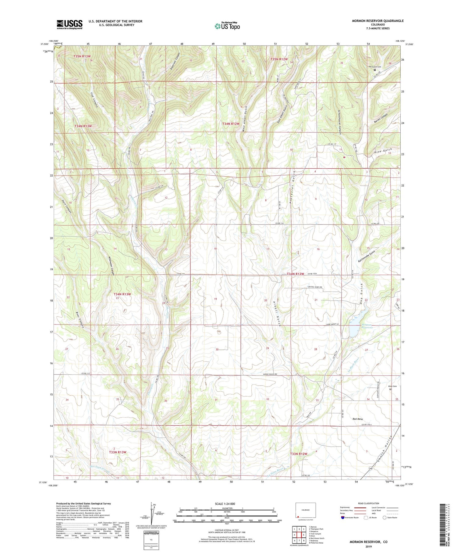
2022 topographic map quadrangle Mormon Reservoir in the state of Colorado. Scale: 1:24000. Based on the newly updated USGS 7.5' US Topo map series, this map is in the following counties: La Plata, Montezuma. The map contains contour data, water features, and other items you are used to seeing on USGS maps, but also has updated roads and other features. This is the next generation of topographic maps. Printed on high-quality waterproof paper with UV fade-resistant inks.
Quads adjacent to this one:
West: Trail Canyon
Northwest: Mancos
North: Thompson Park
Northeast: Hesperus
East: Kline
Southeast: Pinkerton Mesa
South: Redmesa
Southwest: Red Horse Gulch
This map covers the same area as the classic USGS quad with code o37108b2.
Contains the following named places: Alkali Gulch, Barnes Canyon, Bear Canyon, East Alkali Gulch, Flat Canyon, Fort Lewis Mesa Fire Protection District Station 5, Hay Gulch, Hay Gulch Cemetery, Hay Gulch Irrigation Ditch, Horn Canyon, Kline Cemetery, Mormon Reservoir, Pietetlot Gulch, Pine Gulch, Rattlesnake Gulch, Red Mesa Ward Dam, Reservoir Canyon, Rockvale School, Schoolhouse Canyon, Tepoch Mine, West Alkali Gulch, Wildwater Canyon, ZIP Code: 81326


