MyTopo
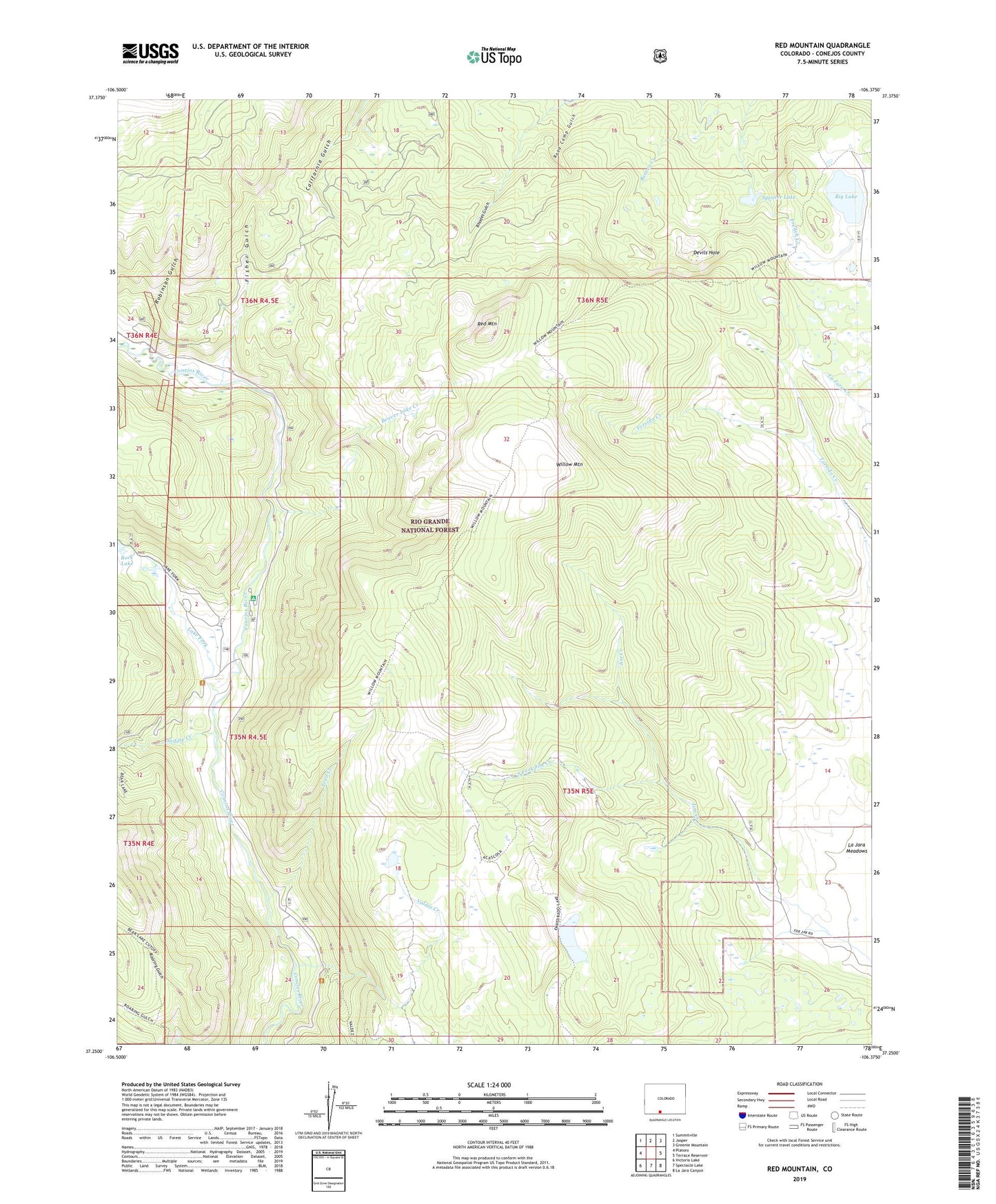
Red Mountain Colorado US Topo Map
Couldn't load pickup availability
Also explore the Red Mountain Forest Service Topo of this same quad for updated USFS data
2022 topographic map quadrangle Red Mountain in the state of Colorado. Scale: 1:24000. Based on the newly updated USGS 7.5' US Topo map series, this map is in the following counties: Conejos. The map contains contour data, water features, and other items you are used to seeing on USGS maps, but also has updated roads and other features. This is the next generation of topographic maps. Printed on high-quality waterproof paper with UV fade-resistant inks.
Quads adjacent to this one:
West: Platoro
Northwest: Summitville
North: Jasper
Northeast: Greenie Mountain
East: Terrace Reservoir
Southeast: La Jara Canyon
South: Spectacle Lake
Southwest: Victoria Lake
This map covers the same area as the classic USGS quad with code o37106c4.
Contains the following named places: Acascosa Lake, Beaver Lake, Beaver Lake Creek, Big Lake, Congress Mine, Devils Hole, Empedrado Lake, Fisher Gulch, Hot Creek Stock Driveway, Jim Creek Cow Camp, Johns Ditch, La Jara Meadows, Lake Fork, Lake Fork Campground, Lake Fork Ranch, Red Mountain, Road Camp Gulch, Robinson Gulch, Rock Lake, Saddle Creek, South Fork Jim Creek, Spencer Lake, Trail Creek, Valdez Creek, Willow Mountain