MyTopo
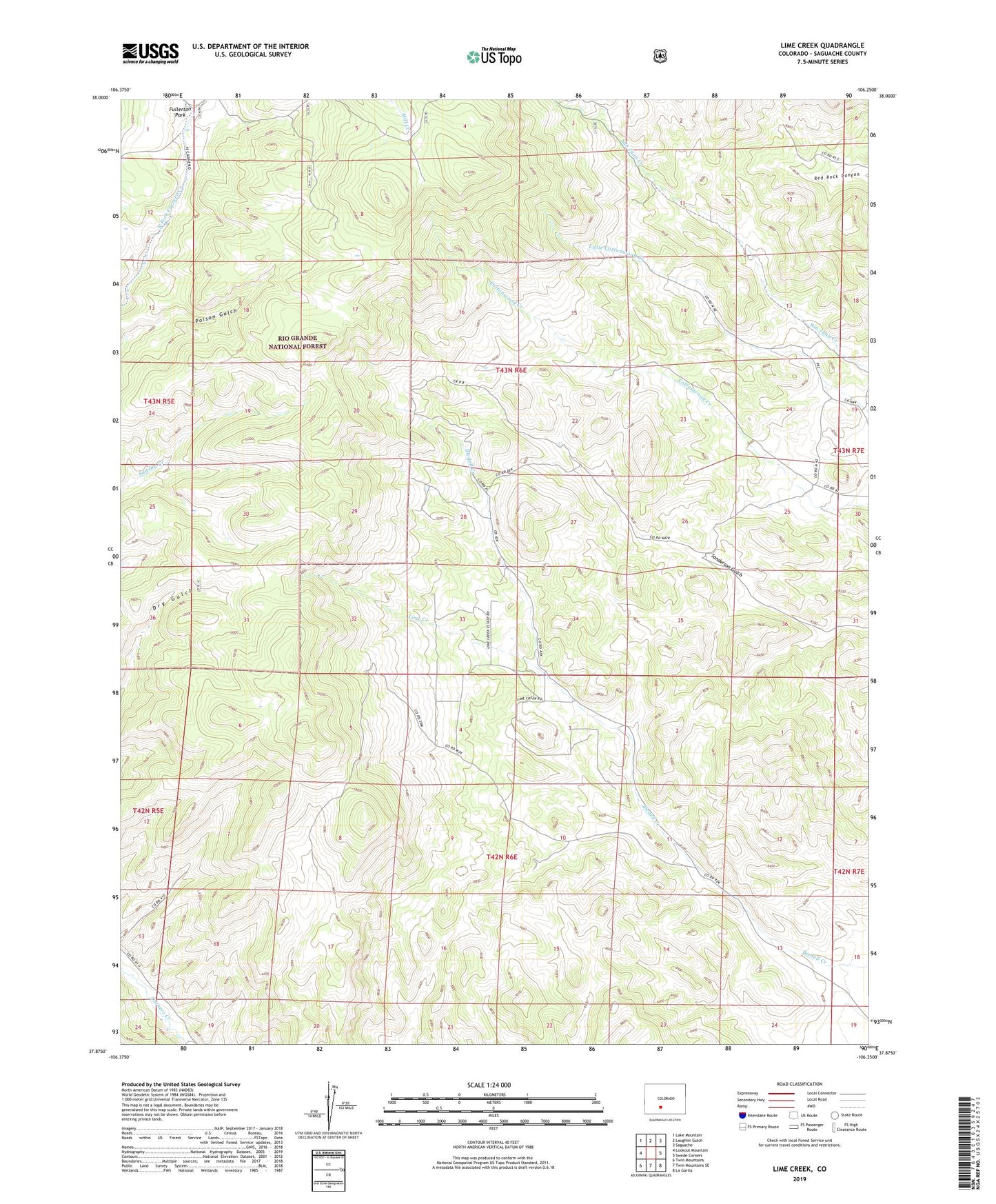
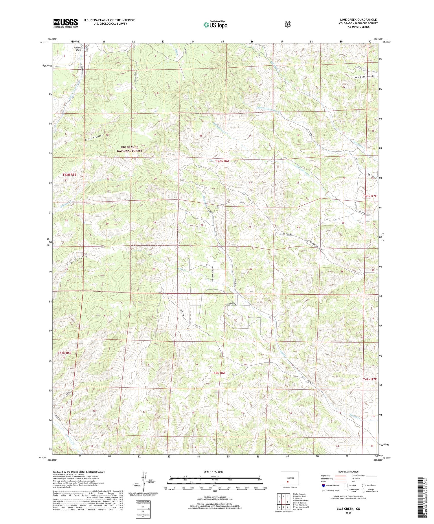
Lime Creek Colorado US Topo Map
Couldn't load pickup availability
Also explore the Lime Creek Forest Service Topo of this same quad for updated USFS data
2022 topographic map quadrangle Lime Creek in the state of Colorado. Scale: 1:24000. Based on the newly updated USGS 7.5' US Topo map series, this map is in the following counties: Saguache. The map contains contour data, water features, and other items you are used to seeing on USGS maps, but also has updated roads and other features. This is the next generation of topographic maps. Printed on high-quality waterproof paper with UV fade-resistant inks.
Quads adjacent to this one:
West: Lookout Mountain
Northwest: Lake Mountain
North: Laughlin Gulch
Northeast: Saguache
East: Swede Corners
Southeast: La Garita
South: Twin Mountains SE
Southwest: Twin Mountains
This map covers the same area as the classic USGS quad with code o37106h3.
Contains the following named places: Esperanza Claims Group Mine, Fullerton Park, Lime Creek