MyTopo
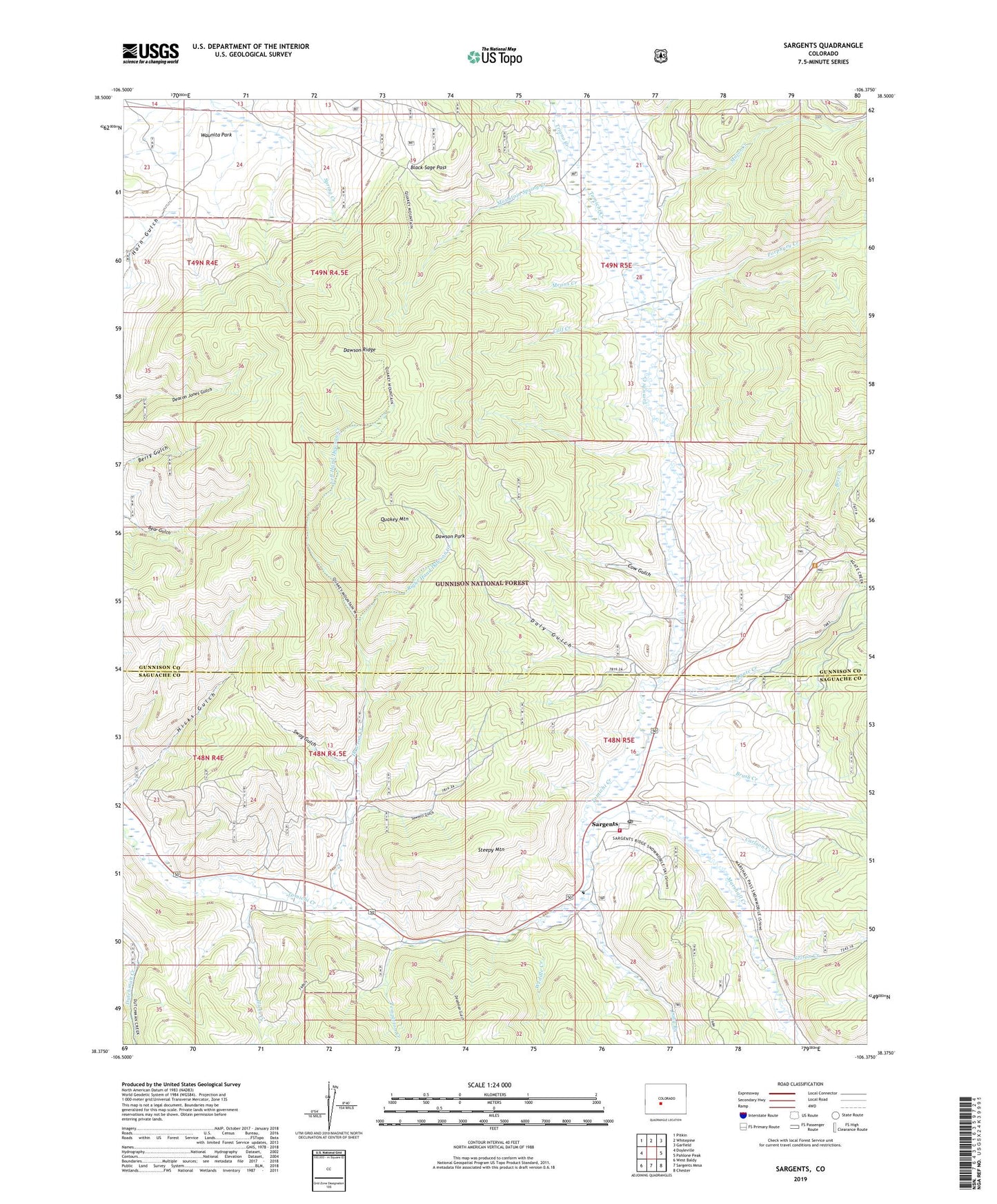
Sargents Colorado US Topo Map
Couldn't load pickup availability
Also explore the Sargents Forest Service Topo of this same quad for updated USFS data
2022 topographic map quadrangle Sargents in the state of Colorado. Scale: 1:24000. Based on the newly updated USGS 7.5' US Topo map series, this map is in the following counties: Gunnison, Saguache. The map contains contour data, water features, and other items you are used to seeing on USGS maps, but also has updated roads and other features. This is the next generation of topographic maps. Printed on high-quality waterproof paper with UV fade-resistant inks.
Quads adjacent to this one:
West: Doyleville
Northwest: Pitkin
North: Whitepine
Northeast: Garfield
East: Pahlone Peak
Southeast: Chester
South: Sargents Mesa
Southwest: West Baldy
This map covers the same area as the classic USGS quad with code o38106d4.
Contains the following named places: Agate Campground, Agate Creek, Black Sage Pass, Brier Creek, Brush Creek, Calf Creek, Carlson Creek, Cow Creek, Cow Gulch, Daly Gulch, Dawson Creek, Dawson Park, Dawson Ridge, Deadman Gulch, Hicks Creek, Hicks Gulch, Left Hand Dawson Creek, Long Branch, Major Creek, Marshall Creek, Means Creek, Mountain Spring Creek, Nelson Creek, No Name Creek, Porphyry Creek, Quakey Mountain, Quakey Mountain Trail, Right Hand Dawson Creek, Sargents, Sargents Fire Department, Sargents Post Office, Sawmill Gulch, Steepy Mountain, Swag Gulch, Templeton Creek, Tomichi Picnic Area, Triano Creek, Waunita Park, Weddle Creek, ZIP Code: 81248