
MyTopo
Sawtooth Mountain Colorado US Topo Map
Couldn't load pickup availability
Also explore the Sawtooth Mountain Forest Service Topo of this same quad for updated USFS data
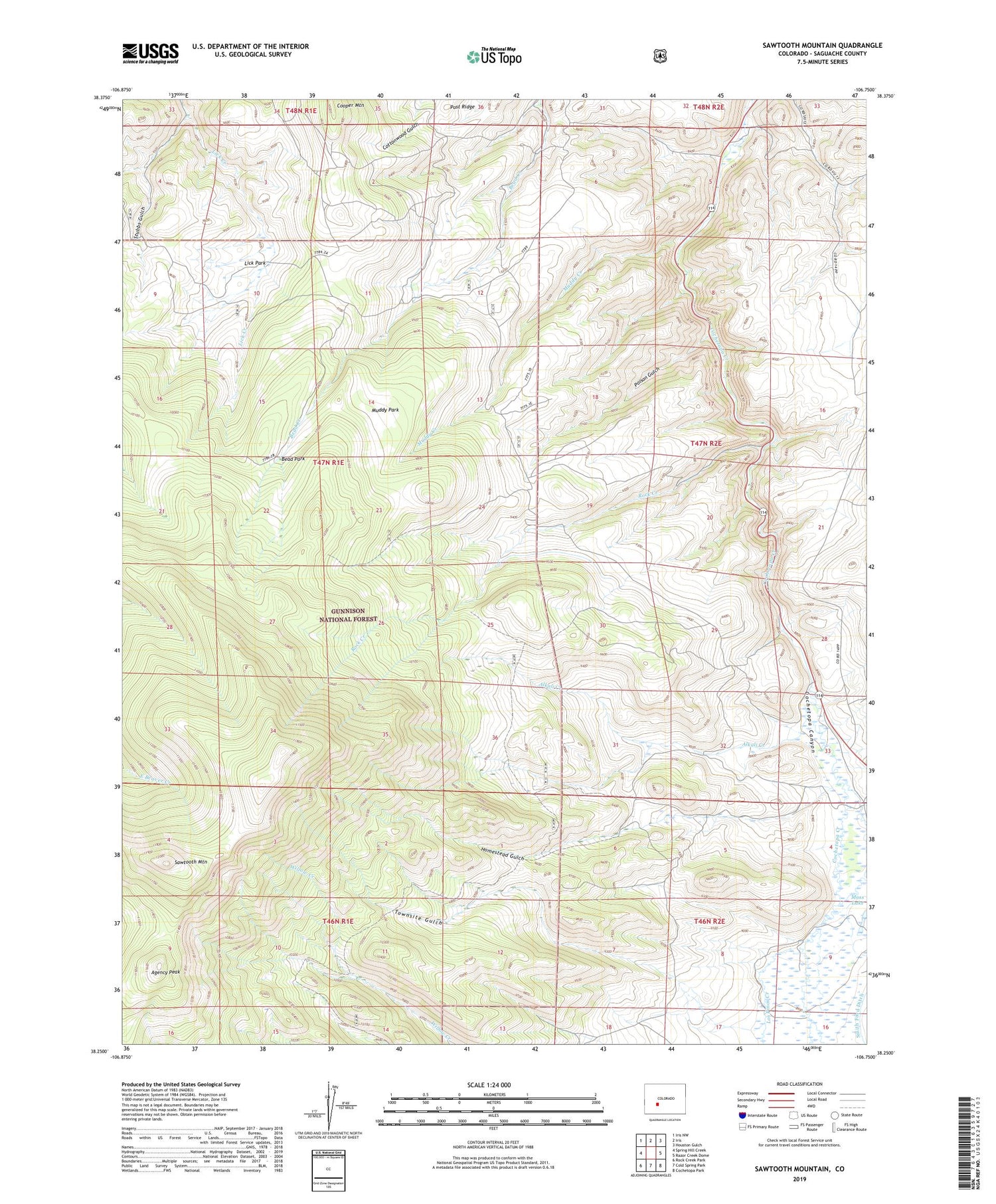
2022 topographic map quadrangle Sawtooth Mountain in the state of Colorado. Scale: 1:24000. Based on the newly updated USGS 7.5' US Topo map series, this map is in the following counties: Saguache. The map contains contour data, water features, and other items you are used to seeing on USGS maps, but also has updated roads and other features. This is the next generation of topographic maps. Printed on high-quality waterproof paper with UV fade-resistant inks.
Quads adjacent to this one:
West: Spring Hill Creek
Northwest: Iris NW
North: Iris
Northeast: Houston Gulch
East: Razor Creek Dome
Southeast: Cochetopa Park
South: Cold Spring Park
Southwest: Rock Creek Park
This map covers the same area as the classic USGS quad with code o38106c7.
Contains the following named places: Agency Peak, Alkali Creek, Bead Park, Boston Mine, Cochetopa Creek Mine, Cooper Mountain, Corson Place, Elisha Group Mine, Fairview Mine, Homestead Gulch, La Rue Number Two Mine, Lick Creek, Lick Park, Los Ocho Mine, Los Pinos Creek, M and W Group Mine, Mercury Alpine Mine, Mercury Mine, Muddy Creek, Muddy Park, Poison Gulch, Ridgeway Number Three Claim Mine, Rock Creek, Sawtooth Mountain, Shurshot Claims Mine, Snowshoe Mine, Townsite Gulch


