MyTopo
Segar Mountain Colorado US Topo Map
Couldn't load pickup availability
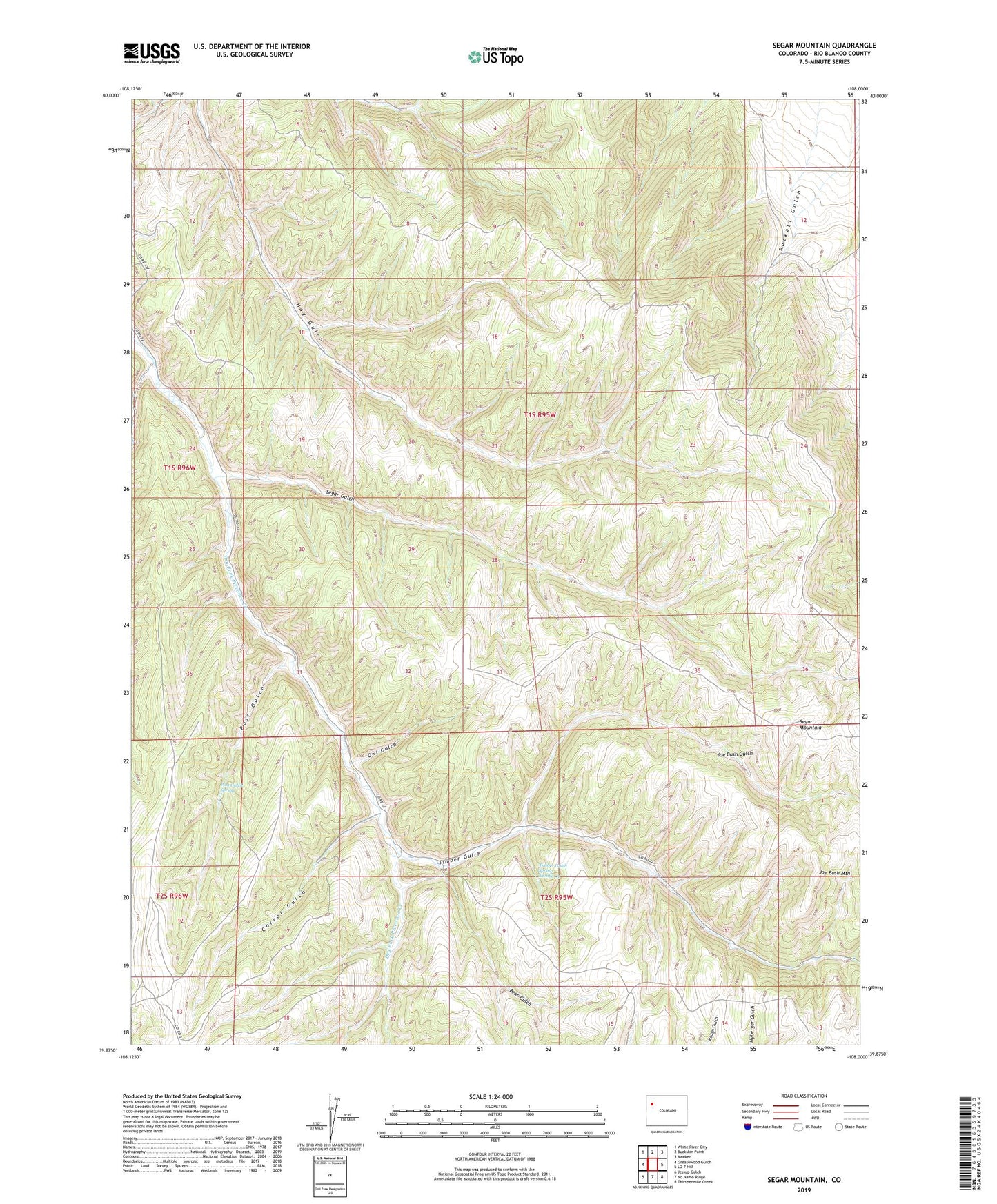
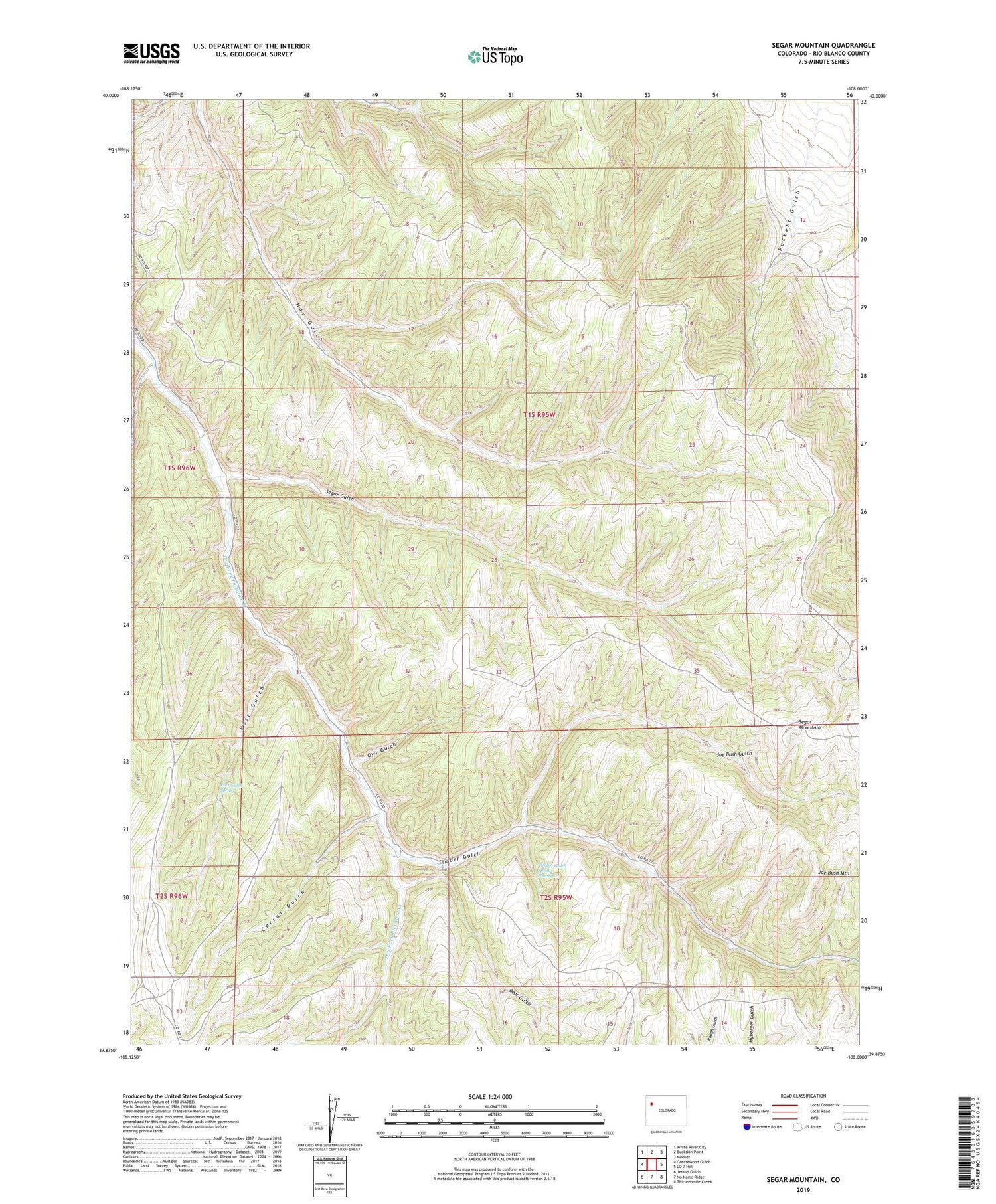
2022 topographic map quadrangle Segar Mountain in the state of Colorado. Scale: 1:24000. Based on the newly updated USGS 7.5' US Topo map series, this map is in the following counties: Rio Blanco. The map contains contour data, water features, and other items you are used to seeing on USGS maps, but also has updated roads and other features. This is the next generation of topographic maps. Printed on high-quality waterproof paper with UV fade-resistant inks.
Quads adjacent to this one:
West: Greasewood Gulch
Northwest: White River City
North: Buckskin Point
Northeast: Meeker
East: LO 7 Hill
Southeast: Thirteenmile Creek
South: No Name Ridge
Southwest: Jessup Gulch
This map covers the same area as the classic USGS quad with code o39108h1.
Contains the following named places: Bear Gulch, Corral Gulch, Dark Canyon, Dry Prong, Joe Bush Gulch, Joe Bush Mountain, Little Hils Game Experiment Station, Main Prong Dry Fork Piceance Creek, Oldland Cow Camp, Owl Gulch, Pitcairn Reservoir, Post Gulch, Post Gulch Spring, Segar Gulch, Segar Mountain, Timber Gulch, Timber Gulch Spring Number 3