MyTopo
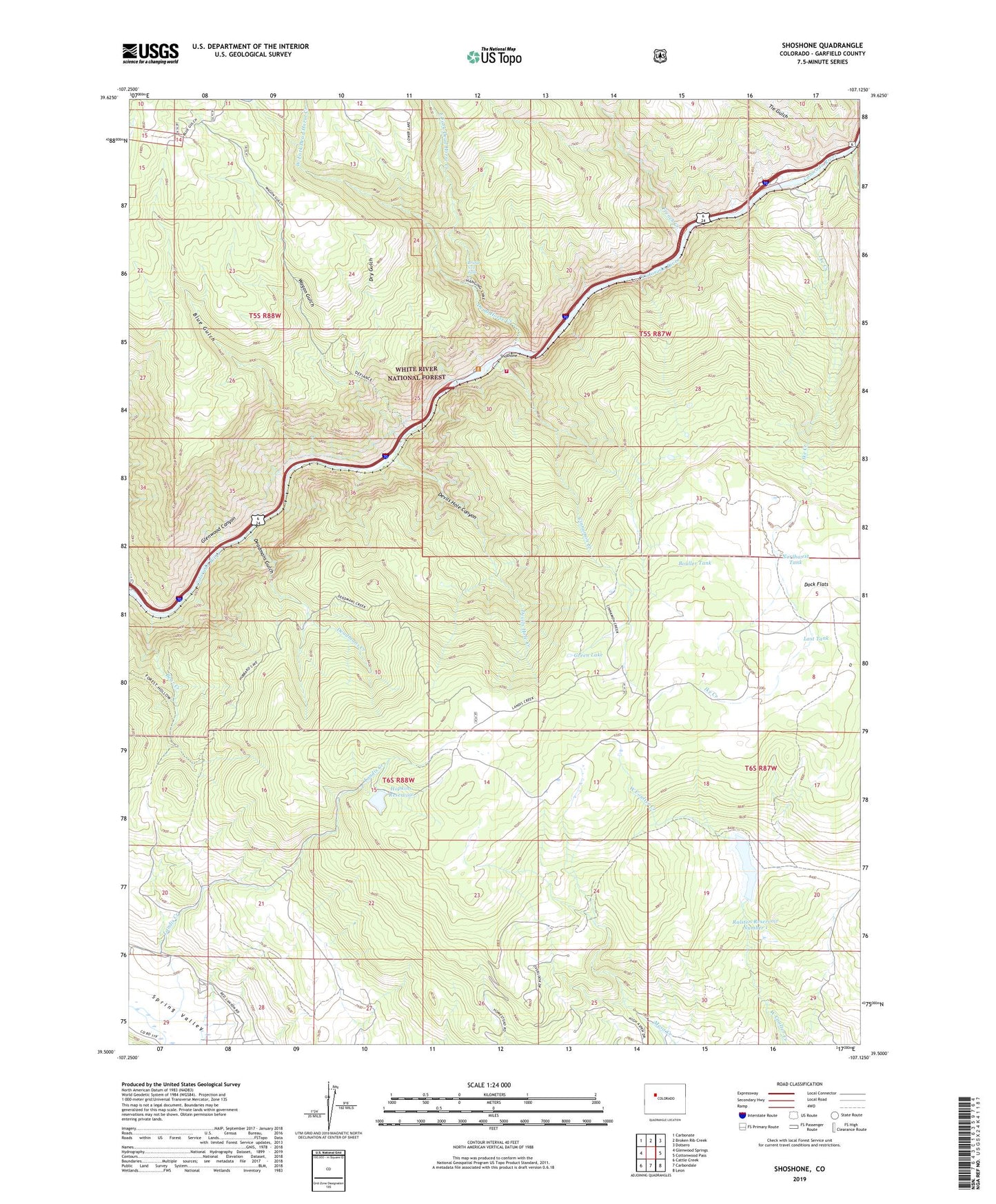
Shoshone Colorado US Topo Map
Couldn't load pickup availability
Also explore the Shoshone Forest Service Topo of this same quad for updated USFS data
2022 topographic map quadrangle Shoshone in the state of Colorado. Scale: 1:24000. Based on the newly updated USGS 7.5' US Topo map series, this map is in the following counties: Garfield. The map contains contour data, water features, and other items you are used to seeing on USGS maps, but also has updated roads and other features. This is the next generation of topographic maps. Printed on high-quality waterproof paper with UV fade-resistant inks.
Quads adjacent to this one:
West: Glenwood Springs
Northwest: Carbonate
North: Broken Rib Creek
Northeast: Dotsero
East: Cottonwood Pass
Southeast: Leon
South: Carbondale
Southwest: Cattle Creek
This map covers the same area as the classic USGS quad with code o39107e2.
Contains the following named places: Allen, Bear Creek, Blue Gulch, Bouller Tank, Bridal Veil Falls, Cinnamon Creek, Consolidated Dam, Consolidated Reservoir, Dead Horse Creek, Deadmans Creek, Deadmans Gulch, Devils Hole Canyon, Devils Hole Creek, Dock Flats, Dry Gulch, East Fork Dead Horse Creek, French Creek, Green Lake, Grizzly, Grizzly Creek Picnic Ground, Hanging Lake, Hanging Lake Park, Hanging Lake Tunnels Fire Department, Higby, Hopkins Dam, Hopkins Homestead, Hopkins Reservoir, Ike Creek, Landis Creek, Last Tank, Northwest Tank, Ralston Number 1 Dam, Ralston Reservoir Number 1, Shoshone, Shoshone Dam, Shoshone Powerplant, Spruce Creek, Tie Gulch, Wagon Gulch, West Fork Dead Horse Creek