MyTopo
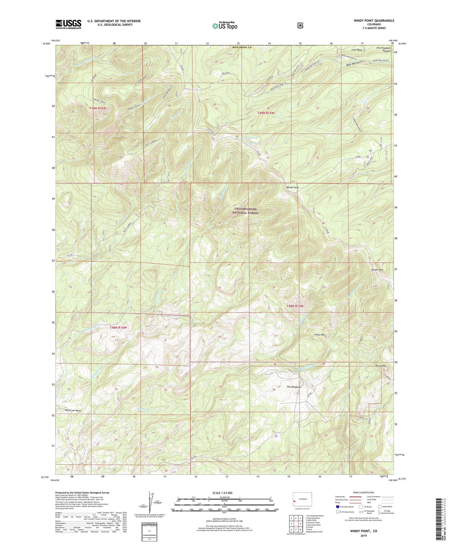
Windy Point Colorado US Topo Map
Couldn't load pickup availability
Also explore the Windy Point Forest Service Topo of this same quad for updated USFS data
2022 topographic map quadrangle Windy Point in the state of Colorado. Scale: 1:24000. Based on the newly updated USGS 7.5' US Topo map series, this map is in the following counties: Montrose, Mesa. The map contains contour data, water features, and other items you are used to seeing on USGS maps, but also has updated roads and other features. This is the next generation of topographic maps. Printed on high-quality waterproof paper with UV fade-resistant inks.
Quads adjacent to this one:
West: Atkinson Creek
Northwest: Uncompahgre Butte
North: Snipe Mountain
Northeast: Kelso Point
East: Starvation Point
Southeast: Big Bucktail Creek
South: Nucla
Southwest: Uravan
This map covers the same area as the classic USGS quad with code o38108d5.
Contains the following named places: Campbell Creek Trail, East Branch Shavano Creek, Fortyseven and Meadow Trail, Fortyseven Trail, Indian Trail, Love Mesa, Pinon Mountain, Porters Cow Camp, Round Mountain, Spring Creek Trail, Spruce Mountain, T Bone Spring Campground, T-Bone Spring, The Meadows, The Meadows Ranch, The Meadows Trail, Wild Cow Mesa, Windy Point