MyTopo
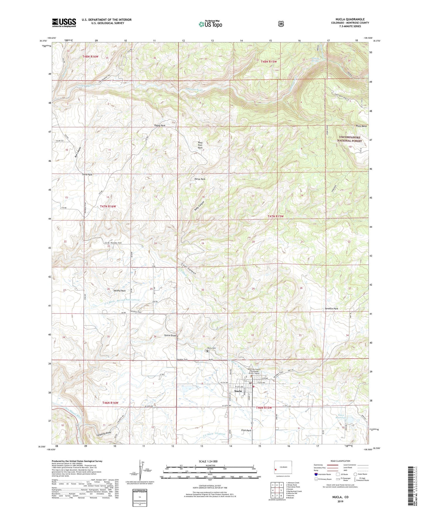
Nucla Colorado US Topo Map
Couldn't load pickup availability
Also explore the Nucla Forest Service Topo of this same quad for updated USFS data
2022 topographic map quadrangle Nucla in the state of Colorado. Scale: 1:24000. Based on the newly updated USGS 7.5' US Topo map series, this map is in the following counties: Montrose. The map contains contour data, water features, and other items you are used to seeing on USGS maps, but also has updated roads and other features. This is the next generation of topographic maps. Printed on high-quality waterproof paper with UV fade-resistant inks.
Quads adjacent to this one:
West: Uravan
Northwest: Atkinson Creek
North: Windy Point
Northeast: Starvation Point
East: Big Bucktail Creek
Southeast: Redvale
South: Naturita
Southwest: Naturita NW
This map covers the same area as the classic USGS quad with code o38108c5.
Contains the following named places: C C Ditch - Second Park Lateral, C C Ditch - South Lateral, C C Ditch - West Lateral, Calamity Bridge, Calamity Draw, Cottonwood Mine, Doby Canyon, Farmer Boy Mine, Forty-seven Creek, Gypsy Park, Horse Park, Navajo Mine, Nix Mine, Nucla, Nucla - Naturita Fire Department Station 1, Nucla Cemetery, Nucla Division, Nucla Domestic Dam, Nucla Post Office, Oberding Mine, Ross Fort Park, Second Park, Shavano Creek, Spradlin Park, Stinking Springs, Tabeguache Wilderness, Templeton Ranch, Town of Nucla, Town Reservoir, Tuttle Draw, USV Mine