MyTopo
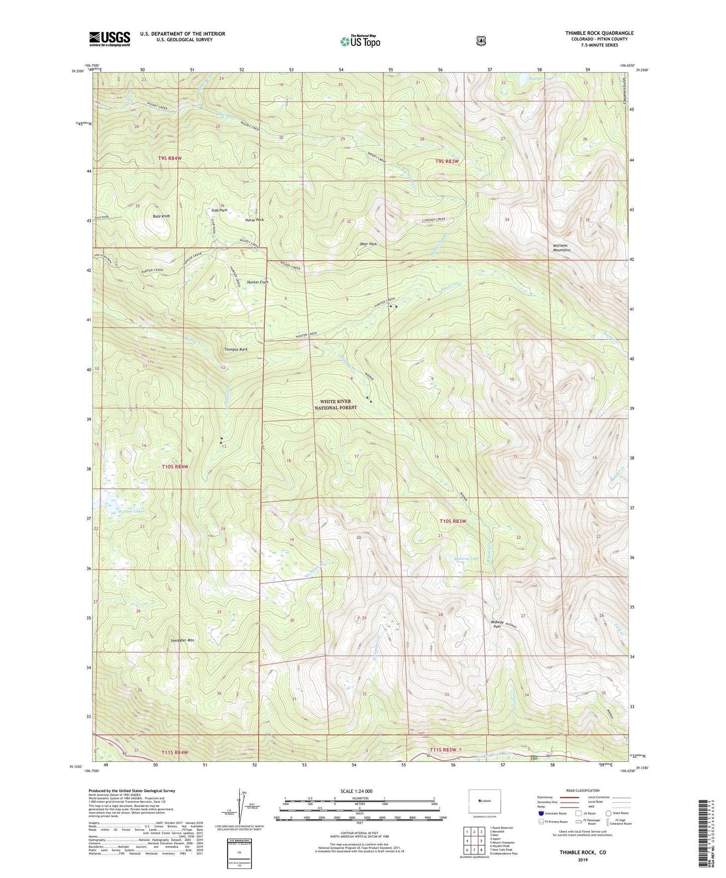
Thimble Rock Colorado US Topo Map
Couldn't load pickup availability
Also explore the Thimble Rock Forest Service Topo of this same quad for updated USFS data
2022 topographic map quadrangle Thimble Rock in the state of Colorado. Scale: 1:24000. Based on the newly updated USGS 7.5' US Topo map series, this map is in the following counties: Pitkin. The map contains contour data, water features, and other items you are used to seeing on USGS maps, but also has updated roads and other features. This is the next generation of topographic maps. Printed on high-quality waterproof paper with UV fade-resistant inks.
Quads adjacent to this one:
West: Aspen
Northwest: Ruedi Reservoir
North: Meredith
Northeast: Nast
East: Mount Champion
Southeast: Independence Pass
South: New York Peak
Southwest: Hayden Peak
This map covers the same area as the classic USGS quad with code o39106b6.
Contains the following named places: Aspen Division, Bald Knob, Cliff Creek, Coleman Creek, Deer Park, Horse Park, Hunter Flats, Hunter Tunnel, Hunter-Fryingpan Wilderness, Midway Creek, Midway Lake, Midway Pass, No Name Creek, Sawyer Lake, Slab Park, Smuggler Mountain, Spruce Creek, Thimble Rock, Warren Lakes, ZIP Code: 81611