MyTopo
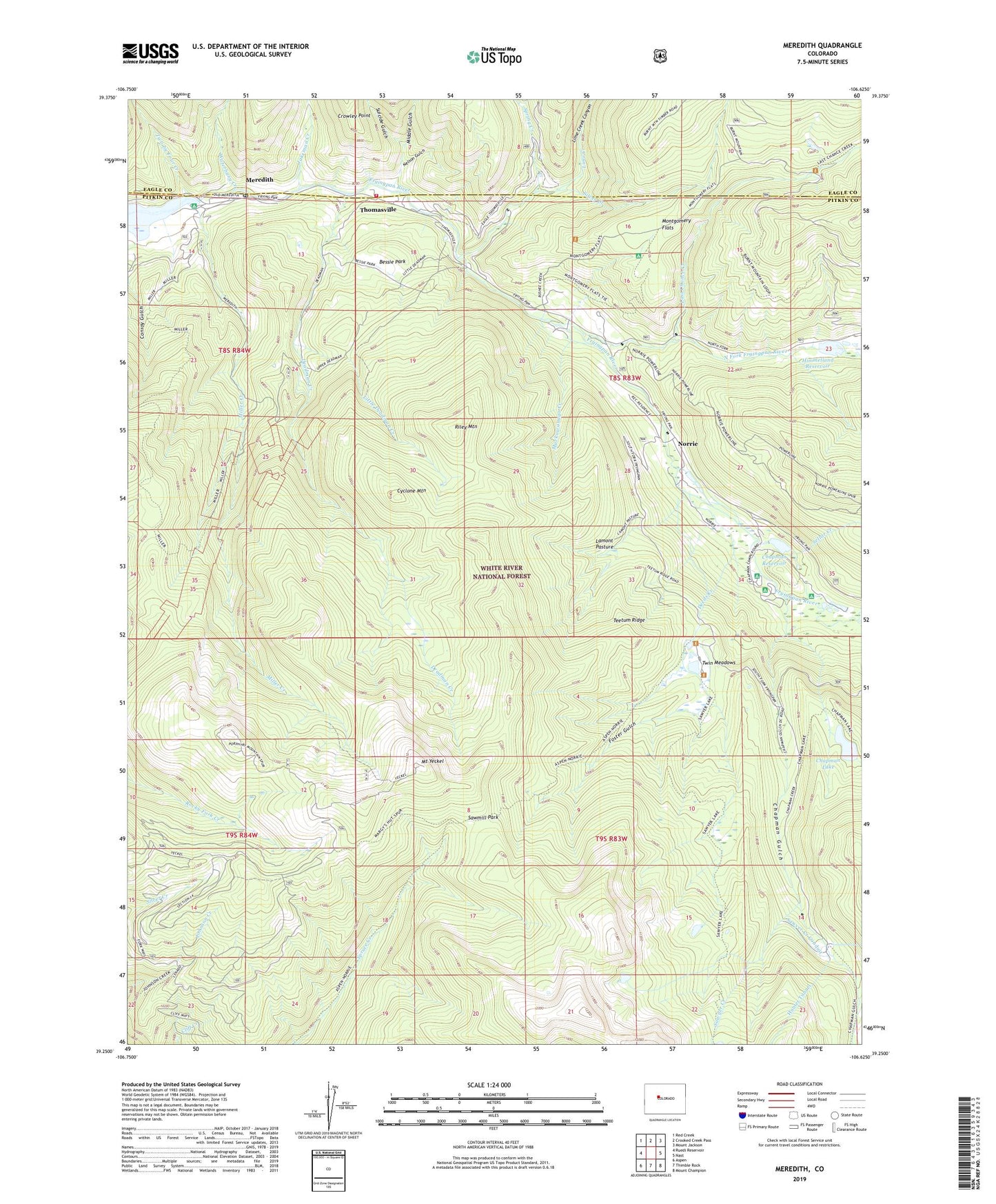
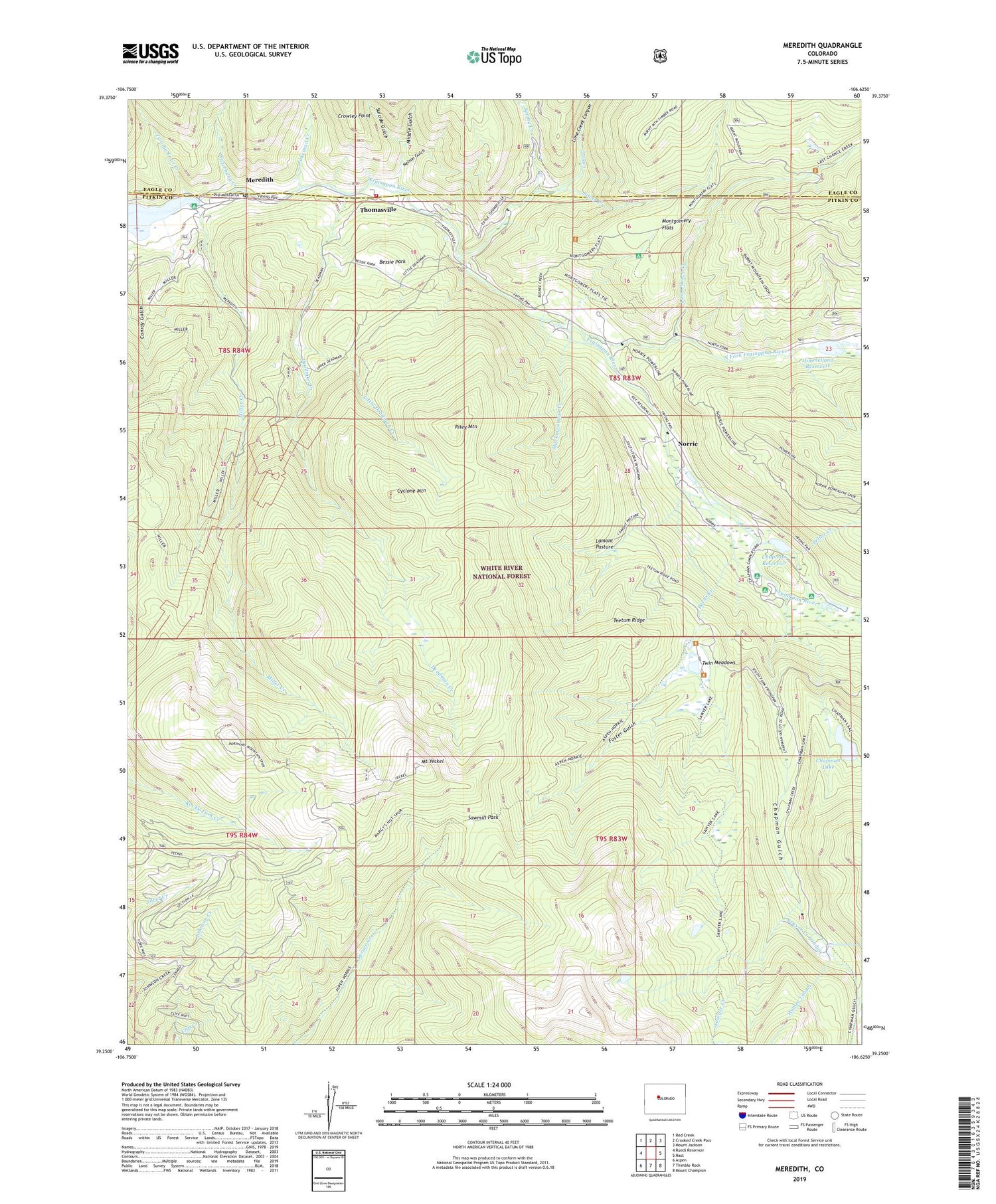
Meredith Colorado US Topo Map
Couldn't load pickup availability
Also explore the Meredith Forest Service Topo of this same quad for updated USFS data
2022 topographic map quadrangle Meredith in the state of Colorado. Scale: 1:24000. Based on the newly updated USGS 7.5' US Topo map series, this map is in the following counties: Pitkin, Eagle. The map contains contour data, water features, and other items you are used to seeing on USGS maps, but also has updated roads and other features. This is the next generation of topographic maps. Printed on high-quality waterproof paper with UV fade-resistant inks.
Quads adjacent to this one:
West: Ruedi Reservoir
Northwest: Red Creek
North: Crooked Creek Pass
Northeast: Mount Jackson
East: Nast
Southeast: Mount Champion
South: Thimble Rock
Southwest: Aspen
This map covers the same area as the classic USGS quad with code o39106c6.
Contains the following named places: Basalt and Rural Fire Protection District Station 43, Bessie Park, Biglow, Chapman Campground, Chapman Dam, Chapman Gulch, Chapman Lake, Chapman Reservoir, Chapman Trail, Conroy Gulch, Country Boy Mine, Crowley Point, Cyclone Mountain, Deadman Creek, Dearhamer Campground, Deeds Creek, Diamond J Ranch, Foster Gulch, Fryingpan Group Mine, Fryingpan-Arkansaw South Side Collection System, Himmelland Dam, Himmelland Reservoir, Jakeman Creek, Lamont Pasture, Last Chance Creek, Lime Creek, Lime Creek Canyon, Little Deadman Creek, Meredith, Meredith Forest Service Facility, Meredith Mine, Meredith Post Office, Middle Gulch, Miller Creek, Montgomery Flats, Mount Yeckel, Muckawanago Creek, Nelson Gulch, Norrie, Norrie Census Designated Place, Norrrie Guard Station, North Fork Fryingpan River, Riley Mountain, Sawmill Park, Sawyer Creek, Sawyer Creek Conduit, Sawyer Lake Trail, Sellar Creek, Silver Creek, Spring Creek, Suicide Gulch, Teetum Ridge, Thomasville, Twin Meadows, Two by Four Creek, Waterbury Creek, Wellington Mine, ZIP Code: 81642