
MyTopo
Thompson Park Colorado US Topo Map
Couldn't load pickup availability
Also explore the Thompson Park Forest Service Topo of this same quad for updated USFS data
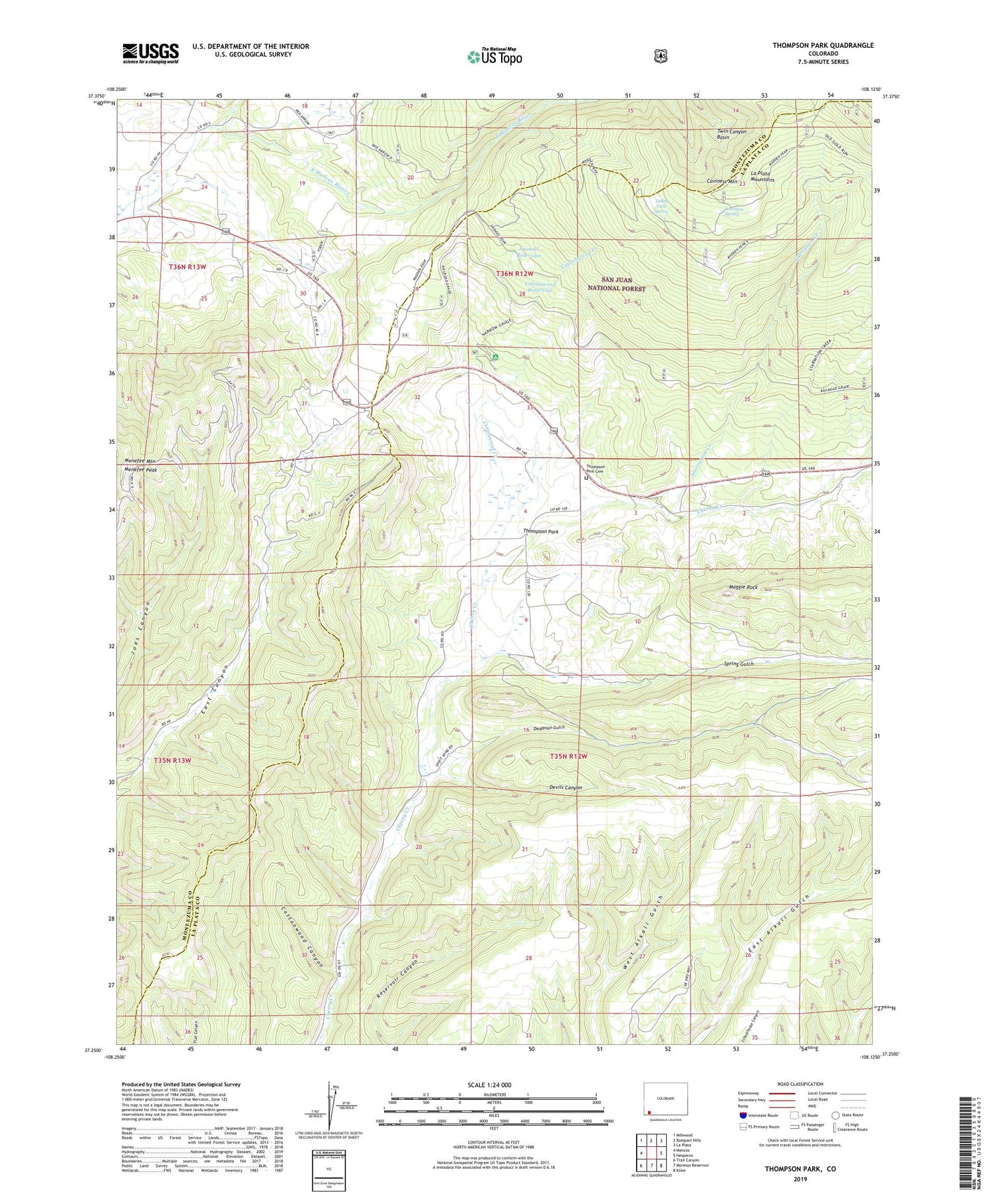
2022 topographic map quadrangle Thompson Park in the state of Colorado. Scale: 1:24000. Based on the newly updated USGS 7.5' US Topo map series, this map is in the following counties: La Plata, Montezuma. The map contains contour data, water features, and other items you are used to seeing on USGS maps, but also has updated roads and other features. This is the next generation of topographic maps. Printed on high-quality waterproof paper with UV fade-resistant inks.
Quads adjacent to this one:
West: Mancos
Northwest: Millwood
North: Rampart Hills
Northeast: La Plata
East: Hesperus
Southeast: Kline
South: Mormon Reservoir
Southwest: Trail Canyon
This map covers the same area as the classic USGS quad with code o37108c2.
Contains the following named places: Caviness Mountain, Caviness Spring, Charlene Mine, Cottonwood Canyon, Cottonwood Creek, Cottonwood Reservoir, Deadman Gulch, Devils Canyon, E A K Mine, Havert Mine, KISZ-FM (Cortez), Little Jim Mine, Madden Peak Heliport, Maggie Rock, Mancos Hill Mine, Menefee Mountain, Menefee Peak, Middle Mancos River, Red Arrow Mine, Southern Cross Mine, Sponsel Reservoir, Spring Gulch, Starvation Creek, Target Tree Campground, Thompson Park, Thompson Park Cemetery, Thompson Park School, Twin Canyon Basin, Valley View Mine, Valley View Spring, West Mancos River Placers, Willden Mine, Wood Mine


