MyTopo
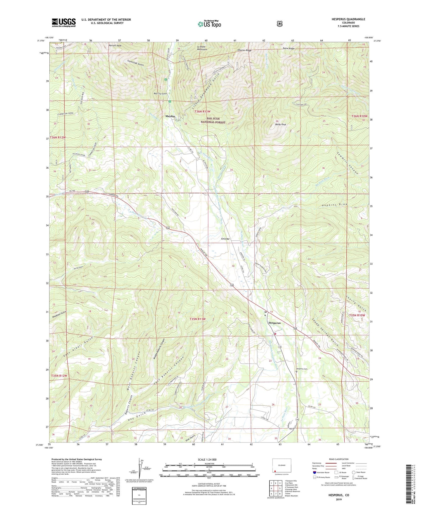
Hesperus Colorado US Topo Map
Couldn't load pickup availability
Also explore the Hesperus Forest Service Topo of this same quad for updated USFS data
2022 topographic map quadrangle Hesperus in the state of Colorado. Scale: 1:24000. Based on the newly updated USGS 7.5' US Topo map series, this map is in the following counties: La Plata, Montezuma. The map contains contour data, water features, and other items you are used to seeing on USGS maps, but also has updated roads and other features. This is the next generation of topographic maps. Printed on high-quality waterproof paper with UV fade-resistant inks.
Quads adjacent to this one:
West: Thompson Park
Northwest: Rampart Hills
North: La Plata
Northeast: Monument Hill
East: Durango West
Southeast: Basin Mountain
South: Kline
Southwest: Mormon Reservoir
This map covers the same area as the classic USGS quad with code o37108c1.
Contains the following named places: Baldy Peak, Bay City Gulch, Bay City Mine, Big Stick Ditch, Blackhawk Mine, Blue Flame Mine, Brawner Tunnel Mine, Burnt Timber Creek, Burnwell Mine Number 1, Burnwell Mine Number 2, Carbon Junction Strip Mine, Cherry Creek Campground, Coal King Mine, Cunningham Mine, Deadwood Creek, East Fork Cherry Creek, East Roberts Canyon, Escalante Mine, Farmer Boy Mine, Former Bay Mine, Fort Lewis Mesa Fire Protection District Station 3, Gold Bar, Golden Girl Mine, Gustas Brothers Mine, Hay Gulch Mine Number 1, Hesperus, Hesperus Baptist Church, Hesperus Cemetery, Hesperus Mine, Hesperus Post Office, Hesperus Ski Center, Idaho Mine, Inca Claims, Jumbo Mine, King Coal Mine, King Mine, Klondyke Mine, La Plata River and Cherry Creek Ditch, Lady Eleanora Mine, Little Deadwood Gulch, Little Nona Mine, Lucky Four Mine, Mammoth Mine, May Day Mine, Mayday, Middle Roberts Canyon, Minoletti Mine, Morovoratz Mine, Oro Negro Group Mine, Parrott Creek, Pat Lode Mine, Rasmussen Mine, Roberts Canyon, Ruby Tunnel Mine, Small Hope Mine, Snowslide Gulch, Southern Boy and Girl Mine, Supreme Mine, Texas Chief Mine, Ute Mine, Van Emmett Mine, West Roberts Canyon, Western View Mining Group Mine, Wright Number 1 Mine, Wright Number 2 Mine