MyTopo
Starkville Colorado US Topo Map
Couldn't load pickup availability
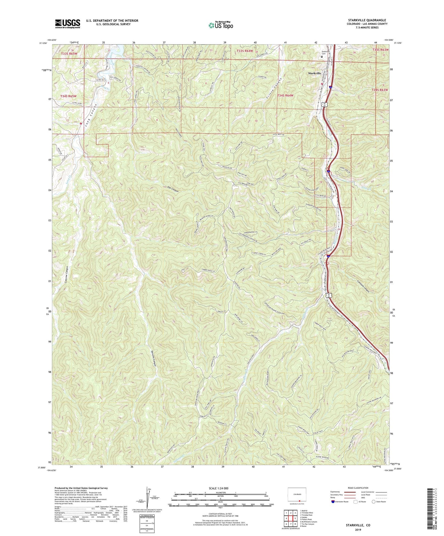
2023 topographic map quadrangle Starkville in the state of Colorado. Scale: 1:24000. Based on the newly updated USGS 7.5' US Topo map series, this map is in the following counties: Las Animas. The map contains contour data, water features, and other items you are used to seeing on USGS maps, but also has updated roads and other features. This is the next generation of topographic maps. Printed on high-quality waterproof paper with UV fade-resistant inks.
Quads adjacent to this one:
West: Valdez
Northwest: Madrid
North: Trinidad West
Northeast: Trinidad East
East: Fishers Peak
Southeast: Raton
South: Tin Pan Canyon
Southwest: McWilliams Canyon
This map covers the same area as the classic USGS quad with code o37104a5.
Contains the following named places: Central Starkville School, Clear Creek, Coalbank Canyon, Colorow Canyon, Fishers Peak Fire Protection District Station 1, Fraternide de Nuestro Padre Jesus Mi Senora Del Carmel, Gallinas Creek, Long Creek, Morley, Morley Mine, North Starkville School, Osito Canyon, Oso Canyon, Saruche Canyon, South Starkville School, Starkville, Starkville Cemetery, Starkville Mines, Stonewall Fire Protection District Long Canyon Station, Town of Starkville, Twentythree Canyon