MyTopo
Whiteley Peak Colorado US Topo Map
Couldn't load pickup availability
Also explore the Whiteley Peak Forest Service Topo of this same quad for updated USFS data
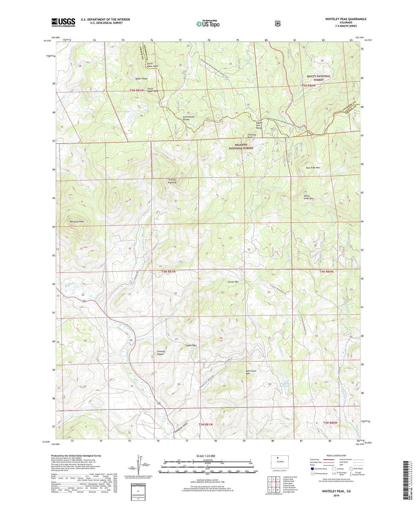
2022 topographic map quadrangle Whiteley Peak in the state of Colorado. Scale: 1:24000. Based on the newly updated USGS 7.5' US Topo map series, this map is in the following counties: Grand, Jackson. The map contains contour data, water features, and other items you are used to seeing on USGS maps, but also has updated roads and other features. This is the next generation of topographic maps. Printed on high-quality waterproof paper with UV fade-resistant inks.
Quads adjacent to this one:
West: Lake Agnes
Northwest: Rabbit Ears Peak
North: Spicer Peak
Northeast: Buffalo Peak
East: Hyannis Peak
Southeast: Gunsight Pass
South: Hinman Reservoir
Southwest: Tyler Mountain
This map covers the same area as the classic USGS quad with code o40106c4.
Contains the following named places: Badger Creek, Carter Mountain, Carter Mountain Ranch, Chimney Rock, Dietrich Ranch, Eastern Gulch, Grannys Nightcap, Grannys Nipple, Harrison Creek Picnic Area, Haworth Ranch, Indian Pass, Middle Carter Mountain, Muddy Valley School, North Ryder Peak, Parsons Dam, Parsons Reservoir, Red Slide Mountain, Ritschard Ranch, Ryder Lakes, Ryder Peaks, Slaughter Gulch, South Ryder Peak, White Slide Mountain, Whiteley Peak