MyTopo
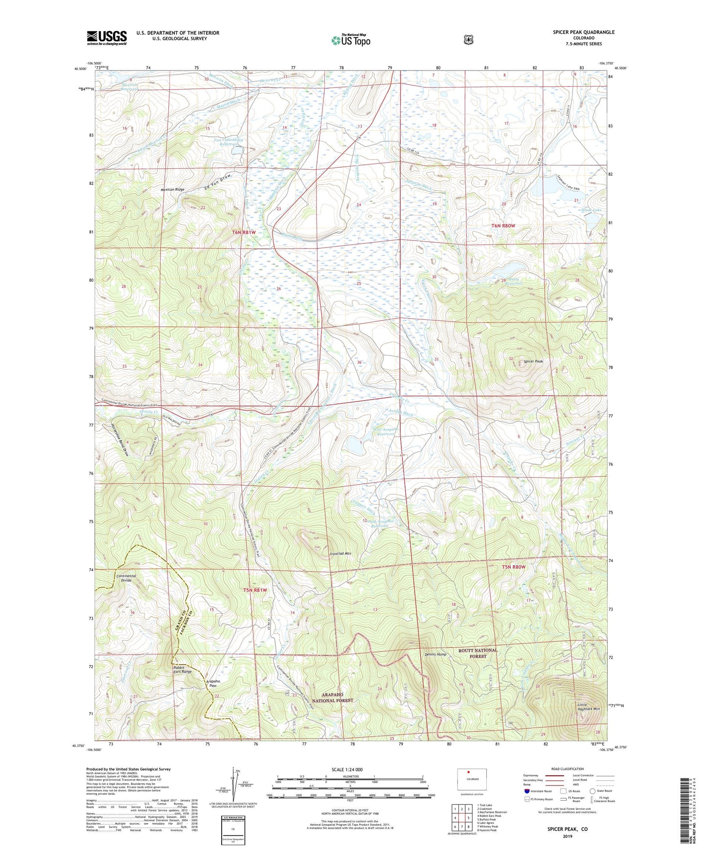
Spicer Peak Colorado US Topo Map
Couldn't load pickup availability
Also explore the Spicer Peak Forest Service Topo of this same quad for updated USFS data
2022 topographic map quadrangle Spicer Peak in the state of Colorado. Scale: 1:24000. Based on the newly updated USGS 7.5' US Topo map series, this map is in the following counties: Jackson, Grand. The map contains contour data, water features, and other items you are used to seeing on USGS maps, but also has updated roads and other features. This is the next generation of topographic maps. Printed on high-quality waterproof paper with UV fade-resistant inks.
Quads adjacent to this one:
West: Rabbit Ears Peak
Northwest: Teal Lake
North: Coalmont
Northeast: MacFarlane Reservoir
East: Buffalo Peak
Southeast: Hyannis Peak
South: Whiteley Peak
Southwest: Lake Agnes
This map covers the same area as the classic USGS quad with code o40106d4.
Contains the following named places: Arapaho Creek, Arapaho Ditch, Arapaho Pass, Bailey Ranch, Chas Murphy Ranch, Coyte Dam, Coyte Reservoir, Dennis Hump, Ed Van Draw, Eureka Ditch, Experiment Ditch, F P Murphy Ranch, Hecla Dam, Hecla Reservoir, Horseshoe Bend Draw, Indian Creek, Ironclad Mountain, Jordan Ditch, Koping Ditch, Larsen Ditch, Lawrence Number 1 Ditch, Little Haystack Mountain, Martin Ditch, Mexican Creek, Mexican Creek Dam, Mexican Reservoir, Mexican Ridge, Middle Fork Arapaho Creek, Middle Fork Mexican Creek, Murphy Desert Ranch, Ninegar Creek, Seymour Dam, Seymour Ditch Number 1, Seymour Ditch Number 2, Seymour Lake, South Arapaho Reservoir, South Fork Arapaho Creek, South Fork Mexican Creek, Spicer, Spicer Peak, Surprise Ditch, Titantic Ditch, Van Valkenburg Dam, Van Valkenburg Ranch, Van Valkenburg Reservoir, Wade Dam, Wade Lake, Waste Ditch, West Arapaho Reservoir, West Arapahoe Dam, West Arapahoe Feeder Ditch, West Arapahoe Feeder Ditch Number 2, West Home Ranch