MyTopo
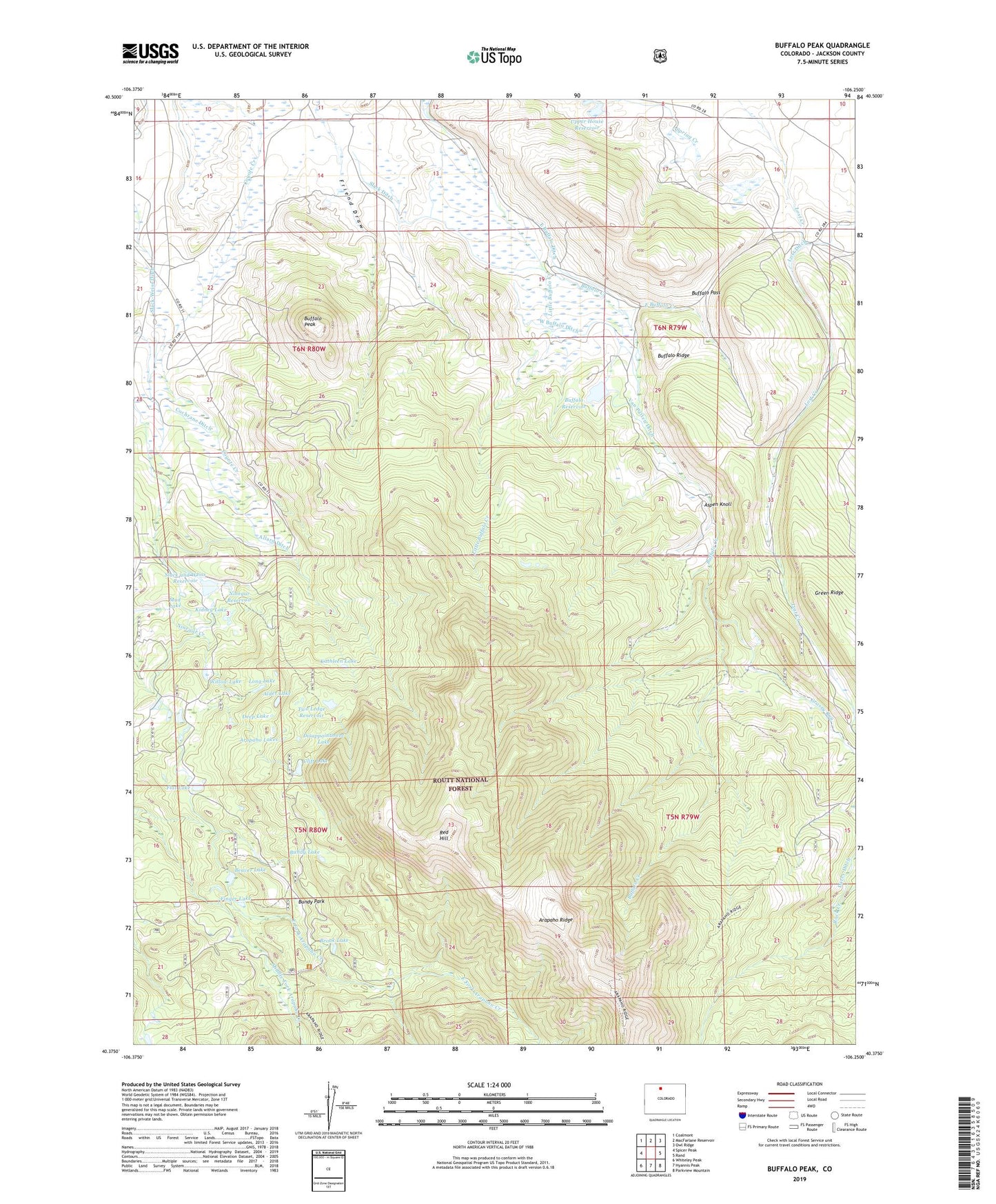
Buffalo Peak Colorado US Topo Map
Couldn't load pickup availability
Also explore the Buffalo Peak Forest Service Topo of this same quad for updated USFS data
2022 topographic map quadrangle Buffalo Peak in the state of Colorado. Scale: 1:24000. Based on the newly updated USGS 7.5' US Topo map series, this map is in the following counties: Jackson. The map contains contour data, water features, and other items you are used to seeing on USGS maps, but also has updated roads and other features. This is the next generation of topographic maps. Printed on high-quality waterproof paper with UV fade-resistant inks.
Quads adjacent to this one:
West: Spicer Peak
Northwest: Coalmont
North: MacFarlane Reservoir
Northeast: Owl Ridge
East: Rand
Southeast: Parkview Mountain
South: Hyannis Peak
Southwest: Whiteley Peak
This map covers the same area as the classic USGS quad with code o40106d3.
Contains the following named places: Alder Lake, Allard Ditch, Arapaho Lakes, Arapaho Ridge, Aspen Knoll Cabin, Beaver Lake, Brook Lake, Buffalo Dam, Buffalo Pass, Buffalo Peak, Buffalo Ranch, Buffalo Reservoir, Buffalo Ridge, Bundy Lake, Bundy Park, Cliff Lake, Cochrane Ditch, Deep Lake, Disappointment Lake, East Buffalo Creek, East Buffalo Ditch, East Fork Arapaho Creek, Finger Lake, Flat Lake, Grassy Run, Grassy Run Trail, Kathleen Lake, Kidney Lake, Little Buffalo Creek, Long Lake, McIsaac Ditch Number 2, Mud Lake, Ninegar Reservoir, Red Hill, Shamrock Ranch, Slack and Weiss Dam, Slack Ditch, Slack-Weiss Ditch, Slack-Weiss Reservoir, Timothy Hill Ditch, Two Ledge Dam, Two Ledge Reservoir, Upper House Dam, Upper House Reservoir, Van Patten Ditch, Wade Ranch, West Buffalo Ditch, Wheatley Ranch, Willow Lake