
MyTopo
Canyon of Lodore South Colorado US Topo Map
Couldn't load pickup availability
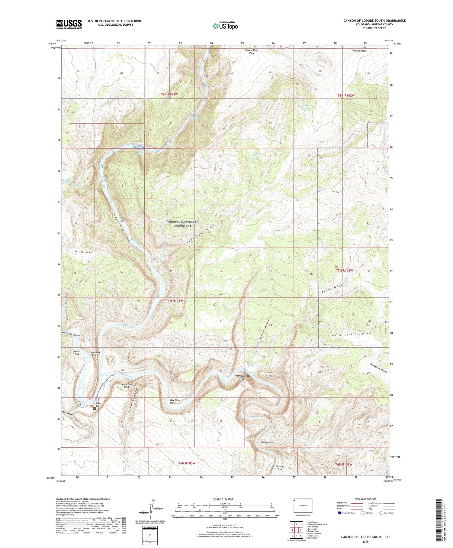
2022 topographic map quadrangle Canyon of Lodore South in the state of Colorado. Scale: 1:24000. Based on the newly updated USGS 7.5' US Topo map series, this map is in the following counties: Moffat. The map contains contour data, water features, and other items you are used to seeing on USGS maps, but also has updated roads and other features. This is the next generation of topographic maps. Printed on high-quality waterproof paper with UV fade-resistant inks.
Quads adjacent to this one:
West: Jones Hole
Northwest: Hoy Mountain
North: Canyon of Lodore North
Northeast: Jack Springs
East: Zenobia Peak
Southeast: Tanks Peak
South: Hells Canyon
Southwest: Stuntz Reservoir
This map covers the same area as the classic USGS quad with code o40108e8.
Contains the following named places: Alcove Brook, Box Elder Park, Buffham Place, Burnt Gulch, Canyon of Lodore, Chokecherry Spring, Dinosaur National Monument, Echo Park, Gardners Cabin, Green River Slope, Hells Half Mile, Iron Mine Draw, Iron Mine Ridge, Jenny Lind Rock, Limestone Draw, Limestone Ridge, Limestone Spring, Massey Cabin, Menlo Park, Outlaw Arch, Outlaw Park, Pats Draw, Pool Creek, Rippling Brook, Sand Canyon, Steamboat Rock, Triplet Falls, Warm Springs, Warm Springs Cedars, Warm Springs Draw, Warms Spring Cliff, Wild Canyon, Yampa River, Zenobia Basin


