MyTopo
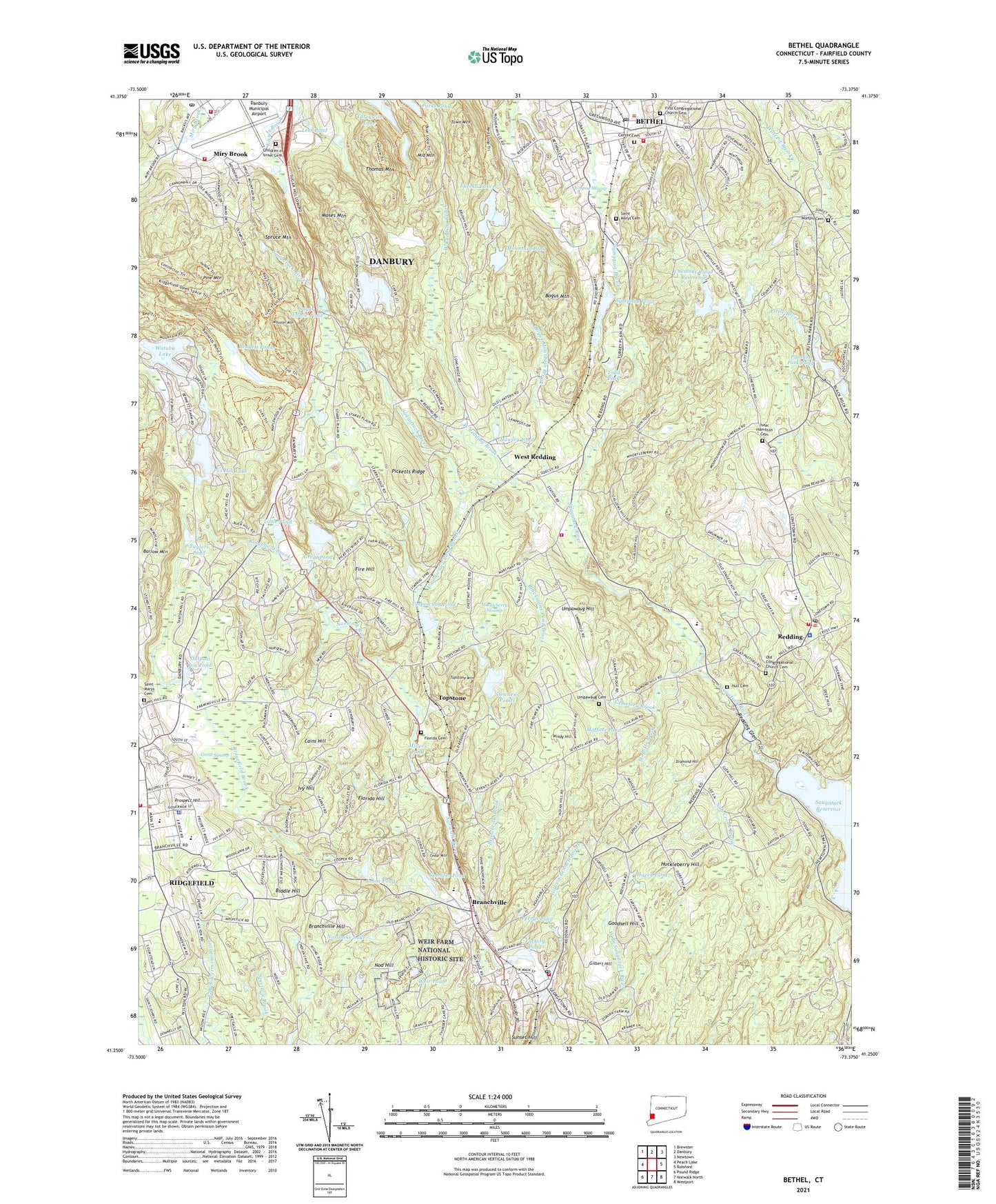
Bethel Connecticut US Topo Map
Couldn't load pickup availability
2024 topographic map quadrangle Bethel in the state of Connecticut. Scale: 1:24000. Based on the newly updated USGS 7.5' US Topo map series, this map is in the following counties: Fairfield. The map contains contour data, water features, and other items you are used to seeing on USGS maps, but also has updated roads and other features. This is the next generation of topographic maps. Printed on high-quality waterproof paper with UV fade-resistant inks.
Quads adjacent to this one:
West: Peach Lake
Northwest: Brewster
North: Danbury
Northeast: Newtown
East: Botsford
Southeast: Westport
South: Norwalk North
Southwest: Pound Ridge
This map covers the same area as the classic USGS quad with code o41073c4.
Contains the following named places: Addessi Center Shopping Center, Aldrich Contemporary Art Museum, Aldrich Park, Anna H Rockwell School, Barrow Mountain, Bennett Ponds, Bethel, Bethel Census Designated Place, Bethel Fire Department Headquarters, Bethel Fire Marshal's Office, Bethel Middle School, Bethel Plaza Shopping Center, Bethel Post Office, Bethel Public Library, Bethel Station, Bethel United Methodist Church, Bethel Village Square Shopping Center, Bethel Volunteer Fire Department, Bethels Pond, Bethels Pond Dam, Bethlehem Lutheran Church, Biddle Hill, Blackmans Pond Brook, Bogus Mountain, Bogus Mountain Brook, Boston, Branchville, Branchville Brook, Branchville Census Designated Place, Branchville Elementary School, Branchville Hill, Bushy Hill Pond, Bushy Hill Pond Dam, Cains Hill, Camp Arden, Candees Pond, Casagmo, Cedar Mountain, Cemetery Brook, Center Cemetery, Center School, Chestnut Ridge Reservoir, Chestnut Ridge Reservoir Dam, Children of Israel Cemetery, Circle of Friends School, Ciuccoli Field, Commerce Park, Cooper Pond Brook, Copps Hill Common, Copps Hill Plaza Shopping Center, Danbury Fire Department Engine 26, Danbury Municipal Airport, Danbury Post Office, David Wooster Middle School, Devils Den, Diamond Hill, Donnelly Plaza Shopping Center, East Ridge Middle School, East Ridge Recreation Area, Eureka Lake, Eureka Lake Dam, Factory Pond, Factory Pond Dam, Farmingville Elementary School, Fire Hill, First Church of Christ Scientist, First Congregational Church, First Congregational Church Cemetery, Florida Cemetery, Florida Hill, Fox Hill, Fox Hill Lake, Francis J Clarke Industrial Park, Georgetown, Georgetown Fire District, Georgetown Plaza Shopping Center, Georgetown Post Office, Georgetown United Methodist Church, Gilbert Bennett Brook, Gilbert Hill, Girolmetti Court Shopping Center, Goodsell Hill, Grassy Plain School, Great Pond, Great Swamp, Hattertown Pond, Hattertown Pond Dam, Hawley Pond, Hazen Pond, Heritage Square Shopping Center, Hoyt Boy Scout Center, Huckleberry Hill, Huckleberry Swamp, Hull Cemetery, Isaac Hamilton Cemetery, Ivy Hill, Jesse Lee Memorial United Methodist Church, John Read Middle School, Johns Pond, Keeler Tavern, Lakes East Census Designated Place, Lees Pond, Little Pond, Little Red School House, Lonetown, Long Ridge, Long Ridge United Methodist Church, Maimonides Academy of Western, Martin Park, Middle Mountain, Millers Pond, Miry Brook, Miry Brook Volunteer Fire Company 13, Moffitts Brook, Moffitts Pond, Moses Mountain, Mountain Pond, Mountain Pond Dam, Nob Crook Brook, Nod Hill, Noroneke Lake, Old Congregational Church Cemetery, Outpost Inn Pond, Overlook Park, P T Barnum Square, Parks Pond, Parks Pond Dam, Parloa Field, Pecks Pond, Perrys Pond, Picketts Ridge, Pine Mountain, Prospect Hill, Putnam Memorial State Park, Putnam Park Pond, Putnam Park Pond Dam, Ralph M T Johnson School, Redding, Redding Center Census Designated Place, Redding Center Post Office, Redding Country Club, Redding Elementary School, Redding Fire Department and Emergency Medical Services Company Station 2, Redding Glen, Redding Lookout Tower, Redding Paramedic Alliance, Redding Police Department, Redding Station, Ridgefield, Ridgefield Brook, Ridgefield Census Designated Place, Ridgefield Center Historic District, Ridgefield Community Center, Ridgefield Fire Department Headquarters, Ridgefield Library and Historical Association, Ridgefield Police Department, Ridgefield Shopping Center, Ridgefield Town Hall, Route 7 Gateway Census Designated Place, Saint Andrews Church, Saint Marys Cemetery, Saint Marys Church, Saint Marys School, Saint Stephens Episcopal Church, Saint Thomas Episcopal Church, Selleck Four Corners, Seth Low Pierrepont State Park Reserve, Spruce Mountain, Steichens Pond Dam, Steichens Ponds, Sugar Hollow Pond, Sunset Hill, Sympaug Pond, Tarrywile Lake, Taylors Pond, Terre Haute Golf Course and Industrial Complex, Thomas Mountain, Todd Park, Topstone, Topstone Census Designated Place, Topstone Mountain, Town Mountain, Town of Bethel, Town of Redding, Umpawaug Cemetery, Umpawaug Hill, Umpawaug Pond, Umpawaug Pond Brook, Umpog Swamp, Veterans Park, Veterans Park Elementary School, Wataba Lake, Wataba Lake Dam, Waubeeka Lake, Waubeeka Lake Dam, WDAQ-FM (Danbury), Weir Farm National Historic Site, Weir Pond, West Redding, West Redding Brook, West Redding Fire District 2, Windy Hill, WLAD-AM (Danbury), Wolfpit Cemetery, Wooster Mountain, Wooster Mountain State Park, Workshop Theatre Barn, WREF-AM (Ridgefield Center), WREF-AM (Ridgefield), Yankee Ridge Shopping Center, ZIP Codes: 06801, 06810, 06877, 06896


