MyTopo
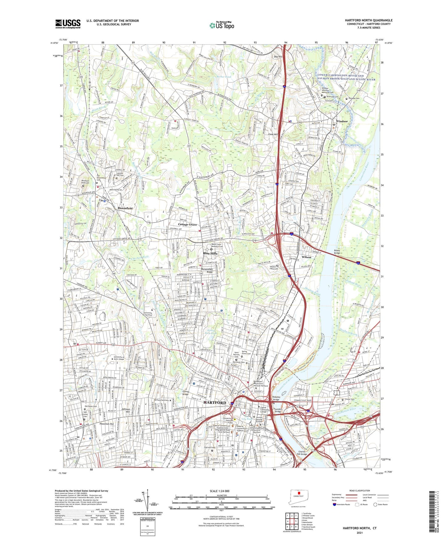
Hartford North Connecticut US Topo Map
Couldn't load pickup availability
2024 topographic map quadrangle Hartford North in the state of Connecticut. Scale: 1:24000. Based on the newly updated USGS 7.5' US Topo map series, this map is in the following counties: Hartford. The map contains contour data, water features, and other items you are used to seeing on USGS maps, but also has updated roads and other features. This is the next generation of topographic maps. Printed on high-quality waterproof paper with UV fade-resistant inks.
Quads adjacent to this one:
West: Avon
Northwest: Tariffville
North: Windsor Locks
Northeast: Broad Brook
East: Manchester
Southeast: Glastonbury
South: Hartford South
Southwest: New Britain
This map covers the same area as the classic USGS quad with code o41072g6.
Contains the following named places: 467 Main Street Shopping Center, Aaron Fien Square, Al-Marzook Athletic Fields, American School for the Deaf, Ancient Burying Ground, Ann Street Historic District, Arsenal School, Artsworks Gallery, Asylum Avenue District Historic District, Asylum Avenue Green, Ball Corner, Barber Pond, Barber Pond Dam, Barber Pond State Wildlife Area, Barbour School, Barnaby Park, Barnard Brown Elementary School, Beach Park, Beach Park School, Beamans Brook, Bell Pond Dam, Bellvue Square Park, Bishop Plaza Shopping Center, Bishops Corner West Shopping Center, Bissell Bridge, Bloomfield, Bloomfield Dam, Bloomfield Junior High School, Bloomfield Reservoir 3A, Bloomfield Shopping Center, Bloomfield Site 3A Dam, Bloomfield Town Green, Blue Hills, Blue Hills Census Designated Place, Blue Hills Dam, Blue Hills Industrial Park, Blue Hills Reservoir, Blue Hills School, Boulevard Shops Shopping Center, Bowles Park, Brackett Park, Broad Street Green, Buckingham Square Historic District, Buckingham Square Park, Bulkeley Bridge, Burgdorf Health Center, Burnham Brook, Burns Elementary School, Burr Mall Shopping Center, Bushnell Park, Bushnell Plaza Shopping Center, Capen-Clark Historic District, Capital Region Mental Health Center, Center Cemetery, Center Park, Center School, Chafee School, Charter Oak Bridge, Charter Oak Tree Memorial Park, Charter Oak Tree Site, Childrens Village of the Hartford Orphan Asylum, Church Corners, Cigna Heliport, City of Hartford, Civic Center Mall Shopping Center, Clay Hill Historic District, Clover Street Elementary School, Colt Park, Colt Pier, Coltsville Historic District, Columbus Green, Connecticut Agricultural Experiment Station, Connecticut Childrens Medical Center, Connecticut State Capitol Park, Connecticut State House Green, Constitution Plaza, Cook Hill, Copacos Shopping Center, Corneluis McAuliffe Park, Cottage Grove, Crossroads Plaza Shopping Center, Day Hill, Deckers Brook, Delocco Playground, Delta One Heliport, Dillon Stadium, Dutch Point Colony, Dutchtown, East Hartford Dike, East Hartford Shopping Center, Elizabeth Park, Elizabeth Park Rose Garden, Elizabeth Shea Park, Elm Street Historic District, Farmington River, Fernridge Place, Fernwood Hospital, Filley Park, Forster Heights Playground, Founders Bridge, Founders Plaza Shopping Center, Franklin Green, Frog Hollow Historic District, Gallows Hill, George H Day Playground, Goodwin Brook, Goodwin Corner, Gurney Bridge, Hall High School, Hamilton Hill, Hartford, Hartford Country Club, Hartford County, Hartford Golf Club Historic District, Hartford Hospital, Hartford Hospital Heliport, Hartford Seminary, Hartford Town Center Shopping Center, Hartford Union Station, Hayden School, Hebrew HealthCare, Hockanum River, Hubbard Street Tot Lot, Institute of Living, Johnson Hill, Joseph V Cronin Playground, Kaman Aerospace Corporation Heliport, Keney Park, Keney Park Pond, Kennedy Memorial Park, Latimer Hill Cemetery, Lily Pond, Little Hollywood Historic District, Lord Corner, Mary Baker Stanley Pool, Meadow Brook, Meadows Park, Mill Brook, Mill Brook State Park, Millbrook Golf Course, Mount Saint Benedict Cemetery, Mountain View Cemetery, Newberry Brook, Nofeldt Little League, Nook Farm, North Branch Park River, North Branch State Access Area, North End Park, North Meadows Dike, North Meadows Industrial Park, Old Center Cemetery, Old North Cemetery, Old Wintonbury Cemetery, Palisado Avenue Historic District, Palisado Cemetery, Palisado Green, Park Plaza Shopping Center, Park River, Parkville, Pavillion at State House Shopping Center, Pershing Park Playground, Pine Hill Golf Club, Podunk River, Pope Park, Porter Memorial Park, Pratt Street Historic District, Pratt Street Shops Shopping Center, Prospect Avenue Historic District, Prospect Shopping Plaza Shopping Center, Pulaski Circle, Pulaskin Mall Shopping Center, Riverside Cemetery, Riverside Park, Saint Francis Hospital and Medical Center, Saint Francis Hospital Heliport, Saint Patricks Cemetery, Sharshon Park, Sheeps Bridge, Shepard Corner, Shops at Bishops Corner Shopping Center, Sigourney Square District Historic District, Sigourney Square Park, Smith Tower Housing, Soldiers and Sailors Memorial Arch, Soldiers Field Cemetery, South Branch Park River, South Green, Spring Grove Cemetery, State Emergency Heliport, Sterling Field, Stowe Village Housing Project, Stroh Park, Terry Square, The Center of Bloomfield Shopping Center, Town of Bloomfield, Town of Hartford, Town of Windsor, Trent Drive Park, Tumble Brook, Tunxis Plaza Shopping Center, Union Place Shopping Center, United Technology Corporation Heliport, Upper Albany Historic District, Wash Brook, Washington Park, WDRC-AM (Hartford), West Eggleston Street Tot Lot, West End North Historic District, West End South Historic District, West Hartford, West Hill, Willow Brook, Wilson, Windsor, Windsor Meadows State Park, Windsor Place Shopping Center, Windsor Shopping Center, Windsor Veterans Memorial Cemetery, Wintonbury Dam, Wintonbury Hills Playground, Wintonbury Reservoir, WKND-AM (Windsor), WLVX-AM (Bloomfield), WQTQ-FM (Hartford), WRTC-FM (Hartford), WSAG-AM (Poquonock), Zion Hill Cemetery, ZIP Codes: 06002, 06095, 06103, 06105, 06112, 06119, 06120, 06160


