MyTopo
McLellan Florida US Topo Map
Couldn't load pickup availability
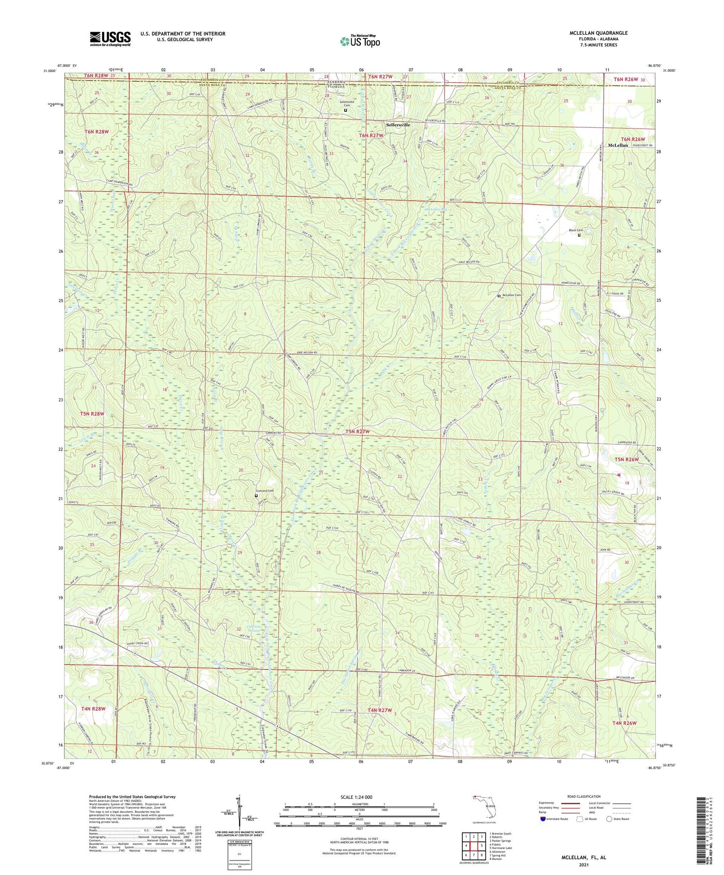
2024 topographic map quadrangle McLellan in the state of Florida. Scale: 1:24000. Based on the newly updated USGS 7.5' US Topo map series, this map is in the following counties: Santa Rosa, Escambia. The map contains contour data, water features, and other items you are used to seeing on USGS maps, but also has updated roads and other features. This is the next generation of topographic maps. Printed on high-quality waterproof paper with UV fade-resistant inks.
Quads adjacent to this one:
West: Fidelis
Northwest: Brewton South
North: Roberts
Northeast: Parker Springs
East: Hurricane Lake
Southeast: Munson
South: Spring Hill
Southwest: Allentown
This map covers the same area as the classic USGS quad with code o30086h8.
Contains the following named places: Berrydale Church, Black Cemetery, Buck Creek, Calloway Swamp, Camp Henderson Lookout Tower, Camp Lowry, Concord Cemetery, Dixon Creek, Dixon Wasteway, Fairview Church, Goodson Creek, Gum Landing, Hawkins Creek, Lewis Branch, Long Branch, McLellan, McLellan Bay, McLellan Cemetery, McLellan Church, Munson Volunteer Fire Department Station 3, Pringle Branch, Reedy Branch, Sellersville, Sellersville Cemetery, Sellersville Church, Short Creek, Simmons Crossing, Stump Spring Church, Thompson Spring Branch, Yellow Water Creek