MyTopo
Bronson SE Florida US Topo Map
Couldn't load pickup availability
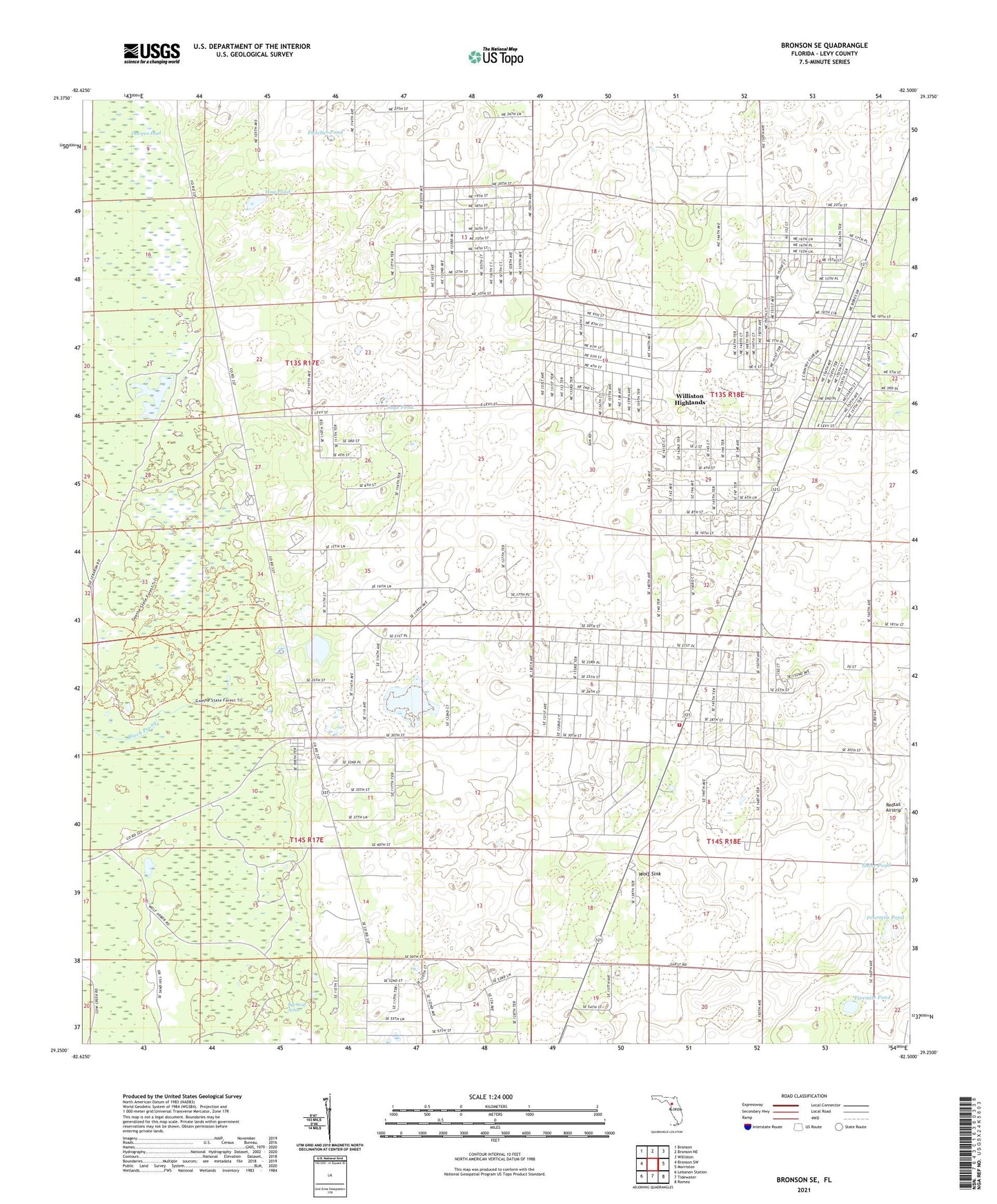
2024 topographic map quadrangle Bronson SE in the state of Florida. Scale: 1:24000. Based on the newly updated USGS 7.5' US Topo map series, this map is in the following counties: Levy. The map contains contour data, water features, and other items you are used to seeing on USGS maps, but also has updated roads and other features. This is the next generation of topographic maps. Printed on high-quality waterproof paper with UV fade-resistant inks.
Quads adjacent to this one:
West: Bronson SW
Northwest: Bronson
North: Bronson NE
Northeast: Williston
East: Morriston
Southeast: Romeo
South: Tidewater
Southwest: Lebanon Station
This map covers the same area as the classic USGS quad with code o29082c5.
Contains the following named places: Black Prong, Deerpen Pond, Fivemile Pond, Fletcher Pond, Fourmile Pond, Highlands Baptist Church, Morriston Montbrook Volunteer Fire Department Station 2 / County Station 11, Redtail Airstrip, Sage Pond, Shine Pond, Williston Highlands, Williston Highlands Census Designated Place, WKTK-FM (Crystal River), WKTK-FM (Gainesville), Wolf Sink