MyTopo
Portland Florida US Topo Map
Couldn't load pickup availability
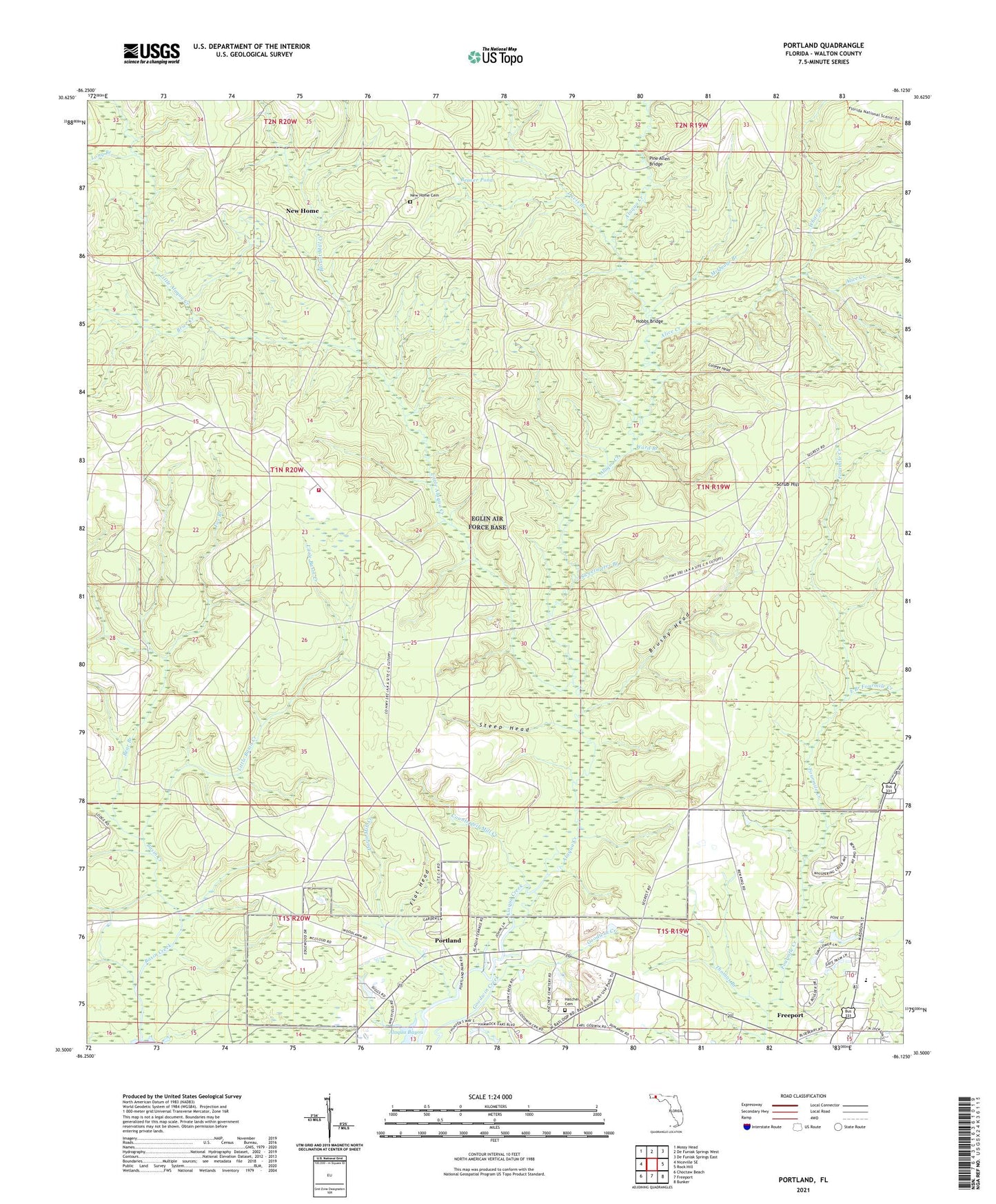
2024 topographic map quadrangle Portland in the state of Florida. Scale: 1:24000. Based on the newly updated USGS 7.5' US Topo map series, this map is in the following counties: Walton. The map contains contour data, water features, and other items you are used to seeing on USGS maps, but also has updated roads and other features. This is the next generation of topographic maps. Printed on high-quality waterproof paper with UV fade-resistant inks.
Quads adjacent to this one:
West: Niceville SE
Northwest: Mossy Head
North: De Funiak Springs West
Northeast: De Funiak Springs East
East: Rock Hill
Southeast: Bunker
South: Freeport
Southwest: Choctaw Beach
This map covers the same area as the classic USGS quad with code o30086e2.
Contains the following named places: Alice Creek, Basin Creek, Bear Branch, Beaver Pond, Blount Creek, Blount Mill Creek, Brier Creek, Brushy Head, City of Freeport, College Head, Counterfeit Mill Creek, Damascus Church, Davis Branch, Davis Mill Creek, East Branch Fourmile Creek, Eglin Air Force Base Fire Station C6, Flat Head, Fox Branch, Hatcher Cemetery, Hobbs Bridge, Little Alaqua Creek, Little Basin Creek, Long Branch, McQuage Branch, New Home, New Home Cemetery, Pine Allen Bridge, Portland, Scrub Hill, Steep Head, Sweetwater Branch, Thomas Branch, Walton County, Ward Branch, White Branch, WTNK-TV (Destin)