MyTopo
Madison SE Florida US Topo Map
Couldn't load pickup availability
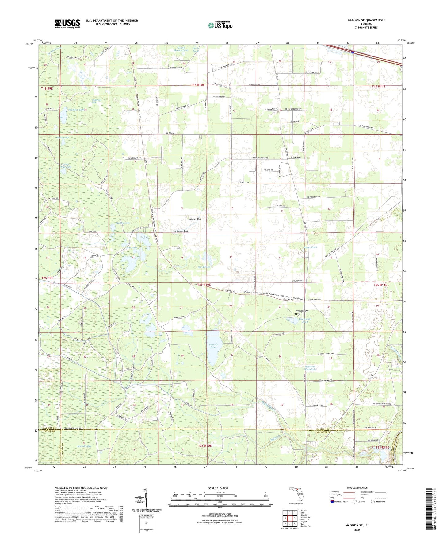
2024 topographic map quadrangle Madison SE in the state of Florida. Scale: 1:24000. Based on the newly updated USGS 7.5' US Topo map series, this map is in the following counties: Madison, Lafayette, Taylor, Suwannee. The map contains contour data, water features, and other items you are used to seeing on USGS maps, but also has updated roads and other features. This is the next generation of topographic maps. Printed on high-quality waterproof paper with UV fade-resistant inks.
Quads adjacent to this one:
West: Madison SW
Northwest: Madison
North: Lee
Northeast: Ellaville
East: Falmouth
Southeast: Dowling Park
South: Day
Southwest: Day NW
This map covers the same area as the classic USGS quad with code o30083c3.
Contains the following named places: Bethel Creek, Bethel Creek Church, Blacksnake Creek, Cross Way Lake, Davis Pond, Hicks Lake, Johnson Sink, McKay Lake, Midway Church, Millcreek Tower, Mitchel Sink, Pacolson Lake, Patterson Sink, Pine Lake, Round Brown Pond, Sand Pond, Tenmile Pond, Twelvemile Pond, Water Pond, Williams Waterhole, Winquepin Cemetery, Winquepin Pond