MyTopo
Falmouth Florida US Topo Map
Couldn't load pickup availability
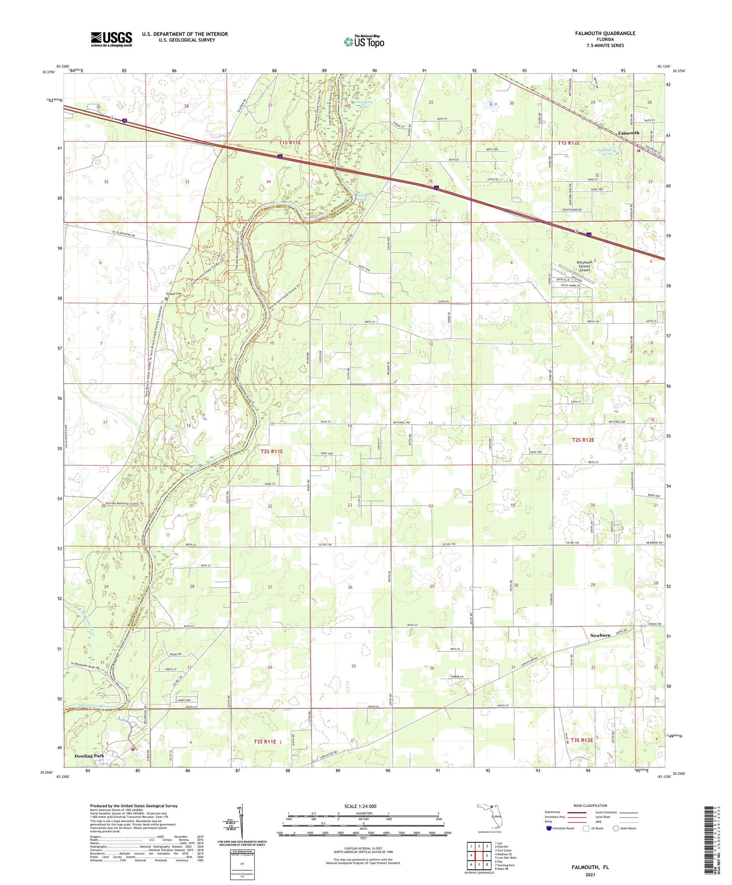
2024 topographic map quadrangle Falmouth in the state of Florida. Scale: 1:24000. Based on the newly updated USGS 7.5' US Topo map series, this map is in the following counties: Suwannee, Madison, Lafayette. The map contains contour data, water features, and other items you are used to seeing on USGS maps, but also has updated roads and other features. This is the next generation of topographic maps. Printed on high-quality waterproof paper with UV fade-resistant inks.
Quads adjacent to this one:
West: Madison SE
Northwest: Lee
North: Ellaville
Northeast: Fort Union
East: Live Oak West
Southeast: Mayo NE
South: Dowling Park
Southwest: Day
This map covers the same area as the classic USGS quad with code o30083c2.
Contains the following named places: Anderson Spring, Dempsey Lake, Dowling Park Volunteer Fire Department, Falmouth, Falmouth Fire Rescue, Falmouth Lookout Tower, Falmouth Spring, Kittyhawk Estates Airport, Mount Gilead Church, Newburn, Orange Church, Saint Johns Church, Shady Grove Church, Springhead Creek, Stroud Cemetery