MyTopo
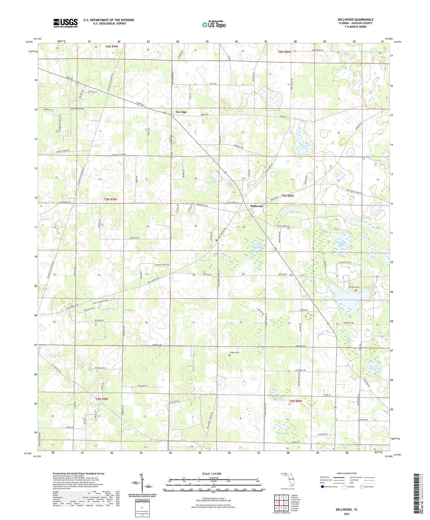
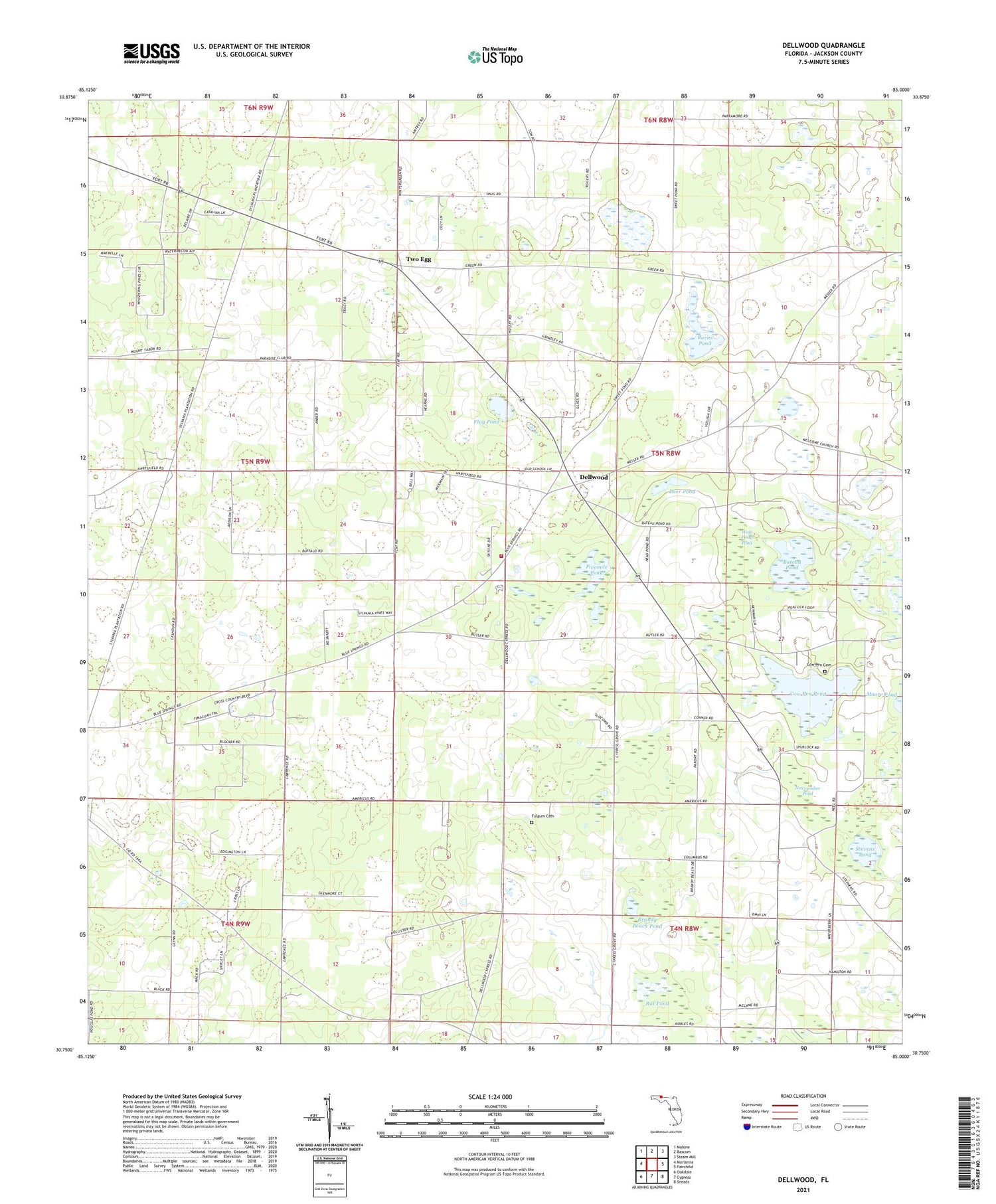
Dellwood Florida US Topo Map
Couldn't load pickup availability
2024 topographic map quadrangle Dellwood in the state of Florida. Scale: 1:24000. Based on the newly updated USGS 7.5' US Topo map series, this map is in the following counties: Jackson. The map contains contour data, water features, and other items you are used to seeing on USGS maps, but also has updated roads and other features. This is the next generation of topographic maps. Printed on high-quality waterproof paper with UV fade-resistant inks.
Quads adjacent to this one:
West: Marianna
Northwest: Malone
North: Bascom
Northeast: Steam Mill
East: Fairchild
Southeast: Sneads
South: Cypress
Southwest: Oakdale
This map covers the same area as the classic USGS quad with code o30085g1.
Contains the following named places: Allen Chapel, Bateau Pond, Brandy Beach Pond, Burns Pond, Cottage Hill Church, Cottage Hill School, Cow Pen Cemetery, Cow Pen Pond, Cypress Grove Church, Deer Pond, Dellwood, Dellwood Volunteer Fire Department, Fivemile Pond, Flag Pond, Fulgum Cemetery, Greenwood Division, Long Pond, New Hope Church, Newcumber Pond, Rat Pond, Stevens Pond, Sweet Pond, Two Egg, Welcome Church, Wildwood Church, Wolf Head Pond, ZIP Code: 32443