MyTopo
Steam Mill Georgia US Topo Map
Couldn't load pickup availability
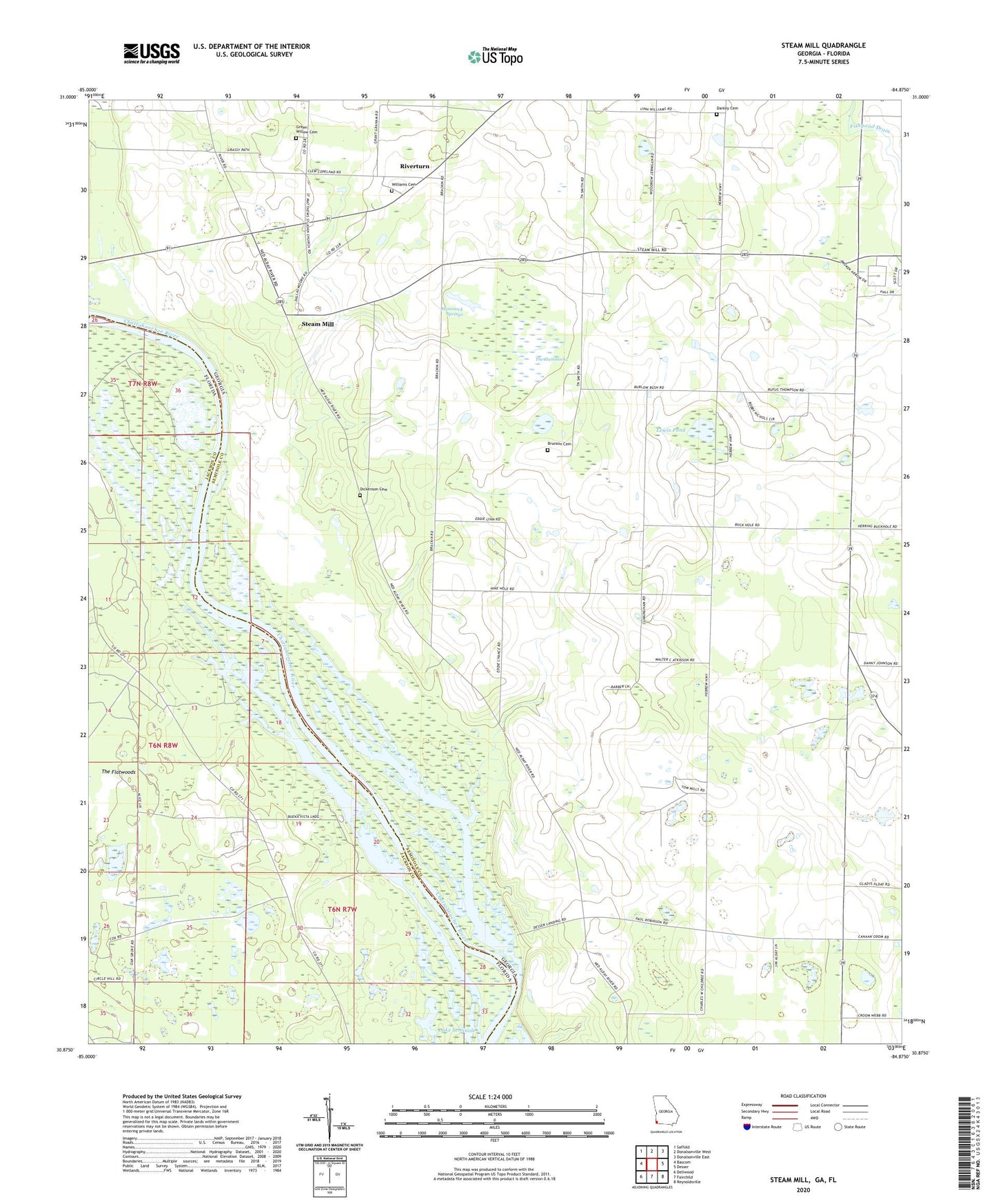
2024 topographic map quadrangle Steam Mill in the states of Georgia, Florida. Scale: 1:24000. Based on the newly updated USGS 7.5' US Topo map series, this map is in the following counties: Seminole, Jackson. The map contains contour data, water features, and other items you are used to seeing on USGS maps, but also has updated roads and other features. This is the next generation of topographic maps. Printed on high-quality waterproof paper with UV fade-resistant inks.
Quads adjacent to this one:
West: Bascom
Northwest: Saffold
North: Donalsonville West
Northeast: Donalsonville East
East: Desser
Southeast: Reynoldsville
South: Fairchild
Southwest: Dellwood
This map covers the same area as the classic USGS quad with code o30084h8.
Contains the following named places: Allen Cemetery, Brunson Cemetery, Circle Hill Church, Danley Cemetery, Desser Landing, Dickenson Cemetery, Green Willow Cemetery, Griselda School, Hammock Springs, Hammock Springs Church, Hebrew Church, Holy Neck Church, Holy Neck School, Lela Courthouse, Lewis Pond, Lynn Family Cemetery, Macedonia Church, Riverturn, Riverturn Church, Saint John A M E Cemetery, Saint Johns Church, Saint Johns School, Saint Marys Church, Steam Mill, Steam Mill Division, The Hammocks, Trinity Church, Williams Cemetery, ZIP Code: 39845