MyTopo
Fairchild Georgia US Topo Map
Couldn't load pickup availability
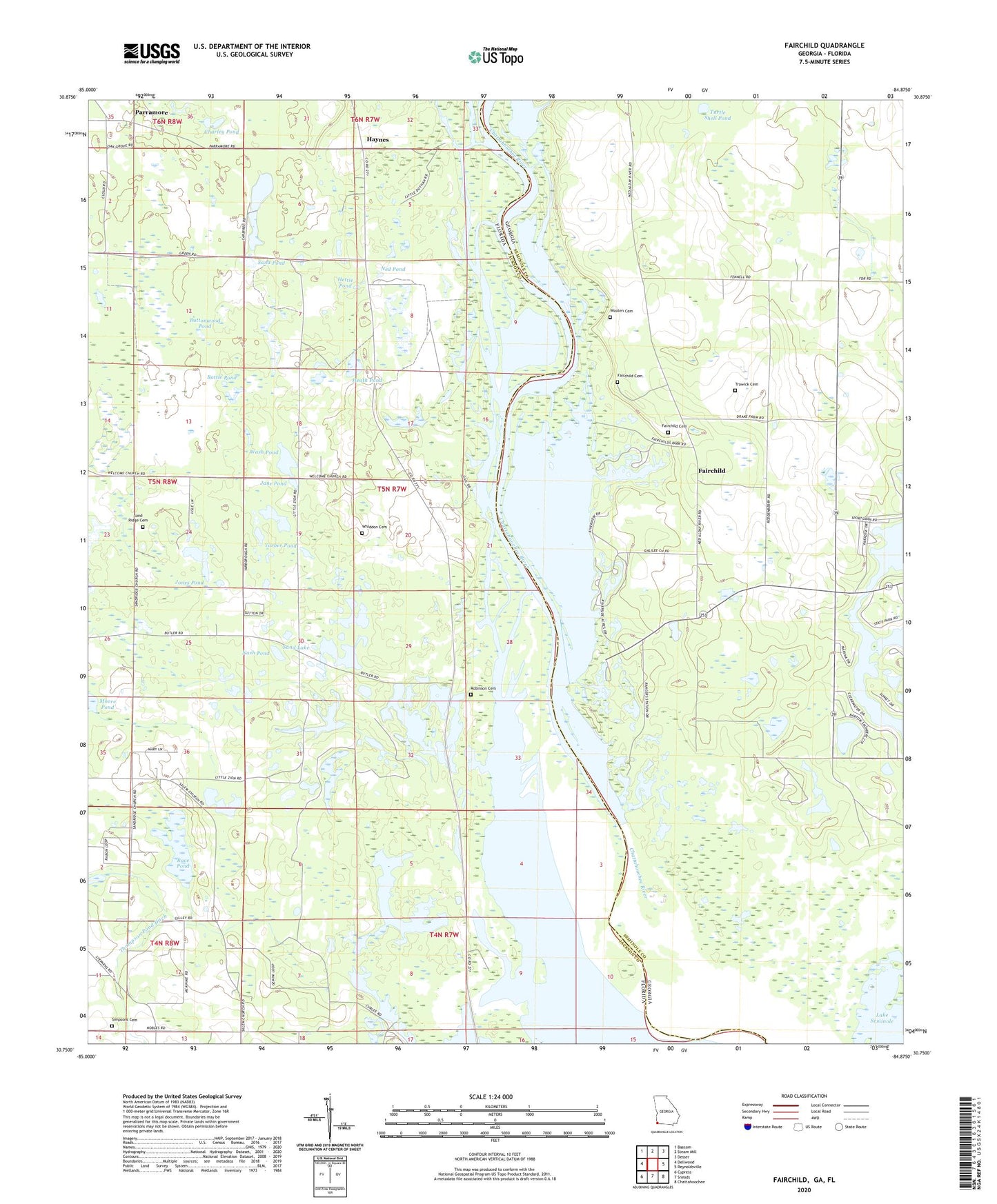
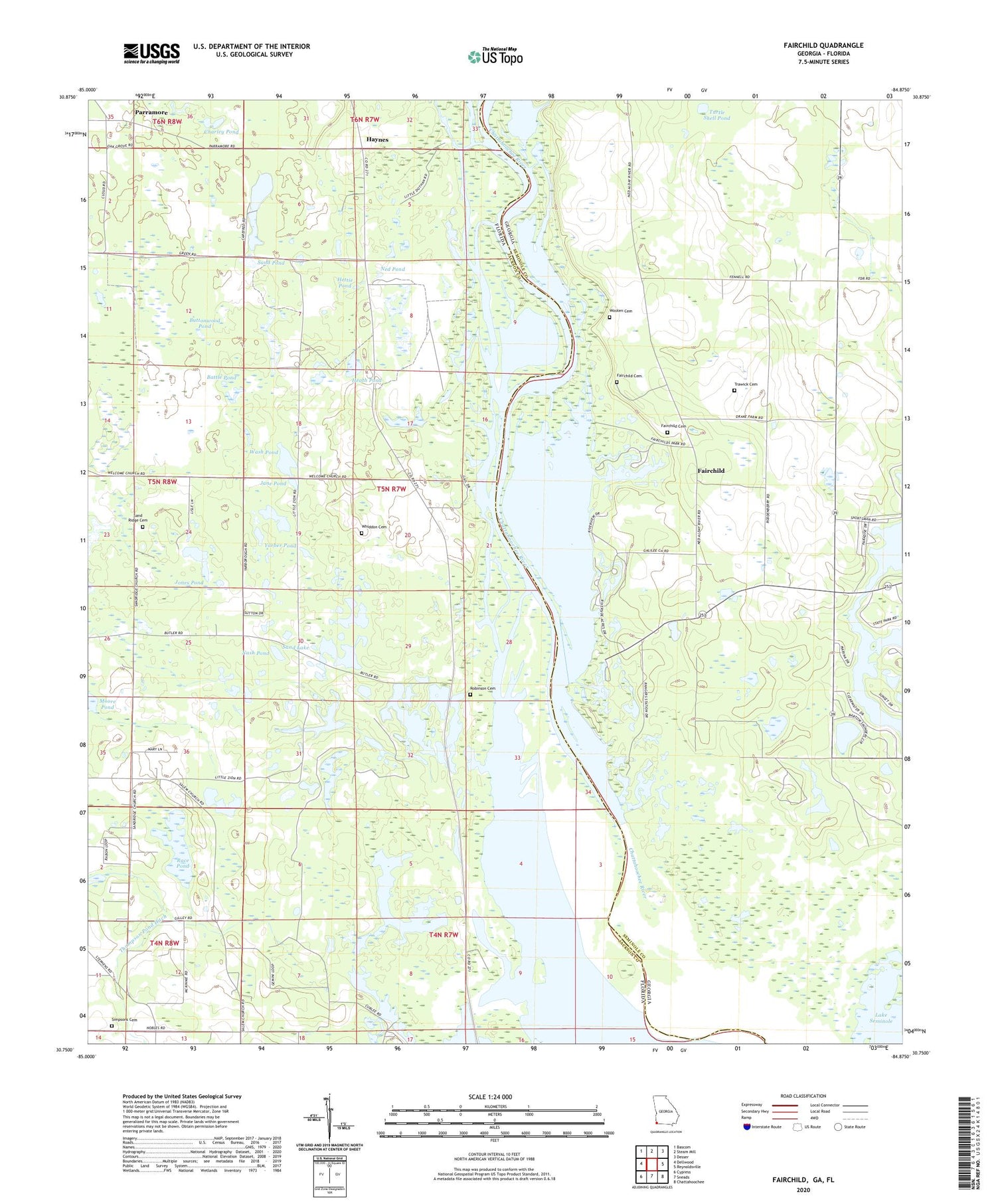
2024 topographic map quadrangle Fairchild in the states of Florida, Georgia. Scale: 1:24000. Based on the newly updated USGS 7.5' US Topo map series, this map is in the following counties: Seminole, Jackson. The map contains contour data, water features, and other items you are used to seeing on USGS maps, but also has updated roads and other features. This is the next generation of topographic maps. Printed on high-quality waterproof paper with UV fade-resistant inks.
Quads adjacent to this one:
West: Dellwood
Northwest: Bascom
North: Steam Mill
Northeast: Desser
East: Reynoldsville
Southeast: Chattahoochee
South: Sneads
Southwest: Cypress
This map covers the same area as the classic USGS quad with code o30084g8.
Contains the following named places: Apalachee Wildlife Management Area, Battle Pond, Bellview Church, Boram Lake, Butler, Butlers Ferry, Butlers Ferry Landing, Buttonwood Pond, Charley Pond, Cummings Landing, Drakes Still, Fairchild, Fairchild Cemetery, Fairchild Landing, Fairchild School, Fairchild State Park, Galilee Church, Half Moon Pond, Haynes, Heath Pond, Hettie Pond, Jane Pond, Jones Pond, Kit Hole, Little Zion School, Mill Pond, Moore Pond, Nash Pond, Ned Pond, Oak Grove Church, Paradise Acres, Parramore, Race Pond, Robinson Cemetery, Rock Pond, Salem Church, Sand Lake, Sand Pond, Sand Ridge Cemetery, Sand Ridge Church, Seminole State Park, Simpsons Cemetery, Sylvania School, Tabernacle Church, Thompson Pond Ditch, Tocktoethla, Trawick Cemetery, Turtle Shell Pond, Wash Pond, Whiddon Cemetery, Wooten Cemetery, Yarber Pond, ZIP Code: 32460