MyTopo
Crestview South Florida US Topo Map
Couldn't load pickup availability
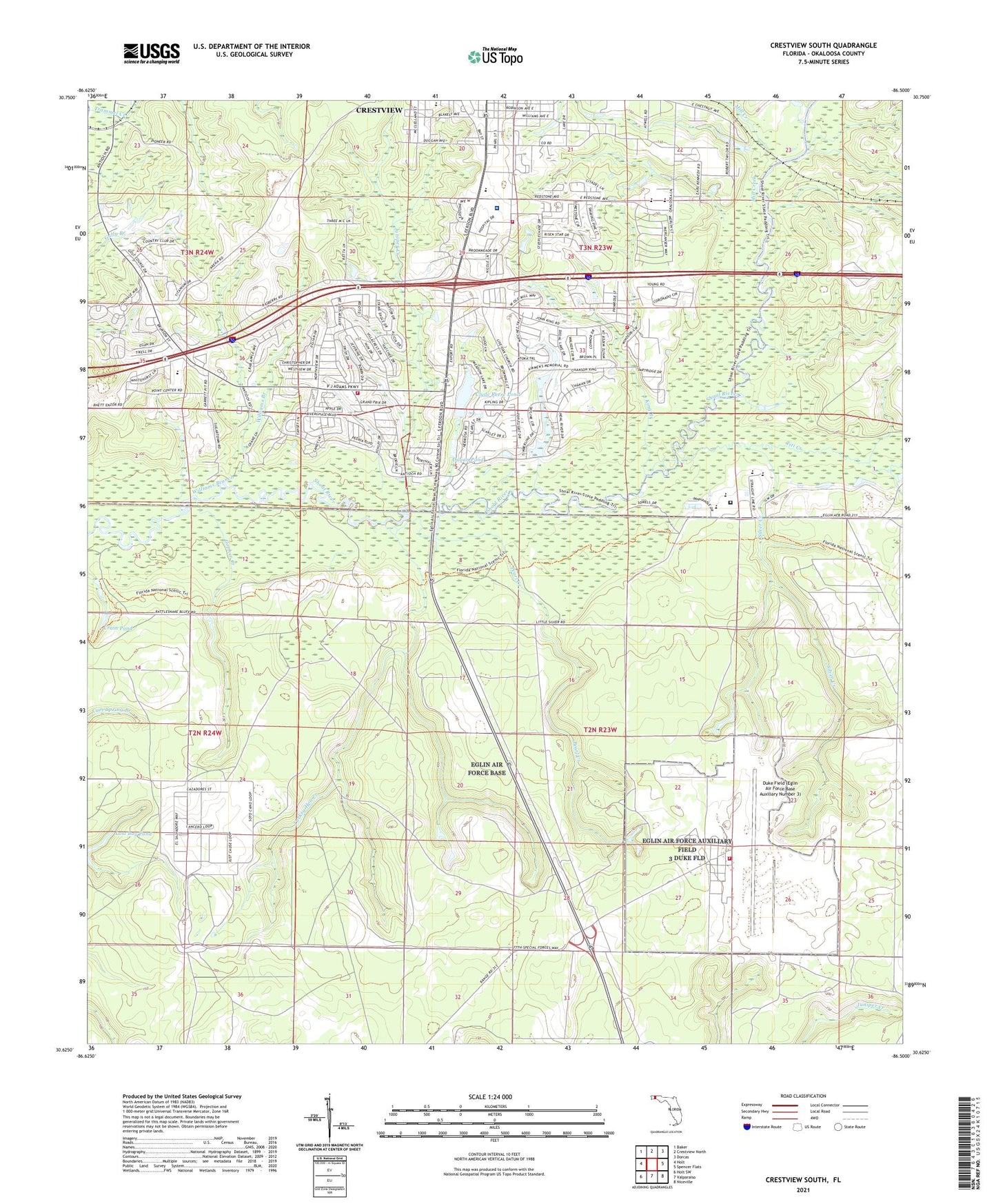
2024 topographic map quadrangle Crestview South in the state of Florida. Scale: 1:24000. Based on the newly updated USGS 7.5' US Topo map series, this map is in the following counties: Okaloosa. The map contains contour data, water features, and other items you are used to seeing on USGS maps, but also has updated roads and other features. This is the next generation of topographic maps. Printed on high-quality waterproof paper with UV fade-resistant inks.
Quads adjacent to this one:
West: Holt
Northwest: Baker
North: Crestview North
Northeast: Dorcas
East: Spencer Flats
Southeast: Niceville
South: Valparaiso
Southwest: Holt SW
This map covers the same area as the classic USGS quad with code o30086f5.
Contains the following named places: Antioch Church, Canaan Church, City of Crestview, Clyde Reese Pond, Crain Pond, Crestview Country Club, Crestview Fire Department Station 2, Dugan Pond, Duke Field (Eglin Air Force Base Auxiliary Number 3), Eglin Air Force Base Fire Station Duke Field 3, Friendship Church, Gopher Creek, Honey Creek, Juniper Creek, King Branch, Live Oak Church, Lost Boy Pond, Mill Creek, North Okaloosa Fire Department Station 84, North Okaloosa Medical Center, North Okaloosa Medical Center Heliport, Okaloosa Correctional Institution, Pearl Creek, Piney Woods Creek, Silver Creek, Titi Creek, Trammel Creek, Turkey Hen Creek, WCNU-AM (Crestview), Williams Branch