MyTopo
Spencer Flats Florida US Topo Map
Couldn't load pickup availability
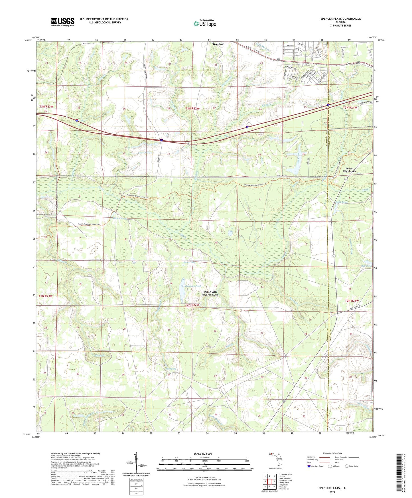
2024 topographic map quadrangle Spencer Flats in the state of Florida. Scale: 1:24000. Based on the newly updated USGS 7.5' US Topo map series, this map is in the following counties: Okaloosa, Walton. The map contains contour data, water features, and other items you are used to seeing on USGS maps, but also has updated roads and other features. This is the next generation of topographic maps. Printed on high-quality waterproof paper with UV fade-resistant inks.
Quads adjacent to this one:
West: Crestview South
Northwest: Crestview North
North: Dorcas
Northeast: New Harmony
East: Mossy Head
Southeast: Niceville SE
South: Niceville
Southwest: Valparaiso
This map covers the same area as the classic USGS quad with code o30086f4.
Contains the following named places: Big Fork, Blue Spring, Blue Spring Creek, Bull Creek, Bull Pond, Deerland Branch, Deserter Creek, Dog Creek, East Dog Creek, Forest Highlands, Gum Creek, Kemmons Pond, Long Creek, Ramer Creek, Ramer Lookout Tower, Speck Pond, Spencer Flats, Walton County Fire Rescue Station 11B, Walton Pond, West Dog Creek