MyTopo
Mossy Head Florida US Topo Map
Couldn't load pickup availability
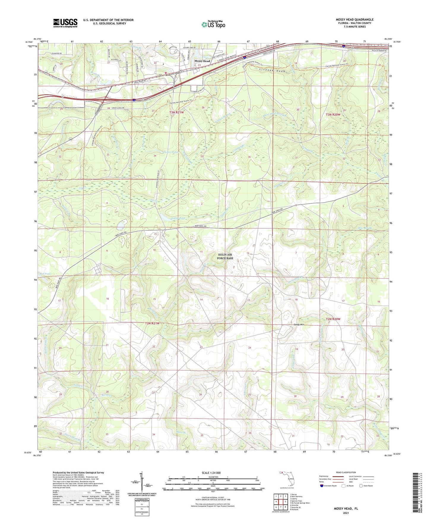
2024 topographic map quadrangle Mossy Head in the state of Florida. Scale: 1:24000. Based on the newly updated USGS 7.5' US Topo map series, this map is in the following counties: Walton. The map contains contour data, water features, and other items you are used to seeing on USGS maps, but also has updated roads and other features. This is the next generation of topographic maps. Printed on high-quality waterproof paper with UV fade-resistant inks.
Quads adjacent to this one:
West: Spencer Flats
Northwest: Dorcas
North: New Harmony
Northeast: Liberty
East: De Funiak Springs West
Southeast: Portland
South: Niceville SE
Southwest: Niceville
This map covers the same area as the classic USGS quad with code o30086f3.
Contains the following named places: Buck Branch, Bullhide Creek, Burntout Creek, Cawthon Branch, Cowpen Branch, Dogwood Head Branch, Exline Creek, Fishpond Branch, Green Head Branch, Hog Creek, Horseshoe Branch, Indigo Branch, Indigo Pond, Liveoak Branch, Liveoak Head, Mossy Head, Mossy Head Lookout Tower, Mount Sinai Branch, Red Deer Creek, Sandy Mountain, Sandy Mountain Lookout Tower, Steep Head Branch, Turner Ponds, White Head Spring Branch, Wildcat Branch, Wildcat Creek, Wise Creek