MyTopo
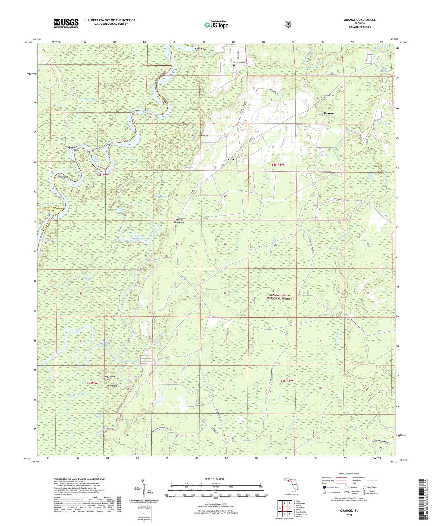
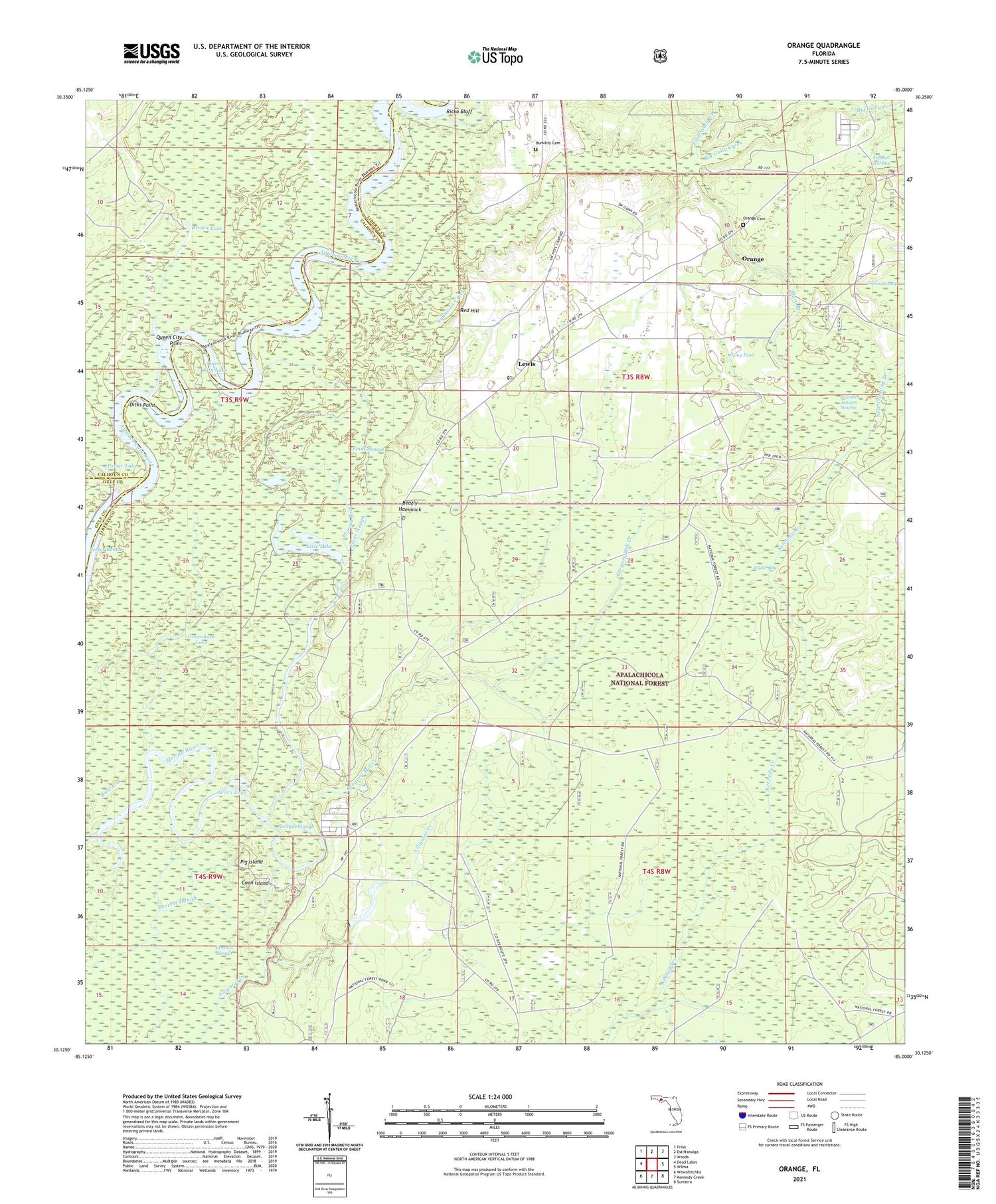
Orange Florida US Topo Map
Couldn't load pickup availability
Also explore the Orange Forest Service Topo of this same quad for updated USFS data
2024 topographic map quadrangle Orange in the state of Florida. Scale: 1:24000. Based on the newly updated USGS 7.5' US Topo map series, this map is in the following counties: Liberty, Calhoun, Gulf. The map contains contour data, water features, and other items you are used to seeing on USGS maps, but also has updated roads and other features. This is the next generation of topographic maps. Printed on high-quality waterproof paper with UV fade-resistant inks.
Quads adjacent to this one:
West: Dead Lakes
Northwest: Frink
North: Estiffanulga
Northeast: Woods
East: Wilma
Southeast: Sumatra
South: Kennedy Creek
Southwest: Wewahitchka
This map covers the same area as the classic USGS quad with code o30085b1.
Contains the following named places: Acorn Lake, Beazly Hammock, Big Gully Creek, Big Gully Landing, Big Gully Landing Campground, Bills Arm, Brown Lake, Coon Island, Devils Swamp, Dicks Point, Elsie Lake, Equaloxic Creek, Eureka Church, Everett Slough, Finns Slough, Franklin Juniper Swamp, Greenback Lake, Gregory Mill Creek, Gunn Landing, Humility Cemetery, Humility Church, Larkin Fish Camp, Larkin Slough, Lewis, Long Pond, Mary Branch, New Crossing Branch, Orange, Orange Cemetery, Orange Church, Patsy Branch, Pig Island, Porter Lake, Porter Landing, Porter Reach, Queen City Lake, Queen City Point, Red Hill, Ricko Bluff, Wilder Bay