MyTopo
Roberts Alabama US Topo Map
Couldn't load pickup availability
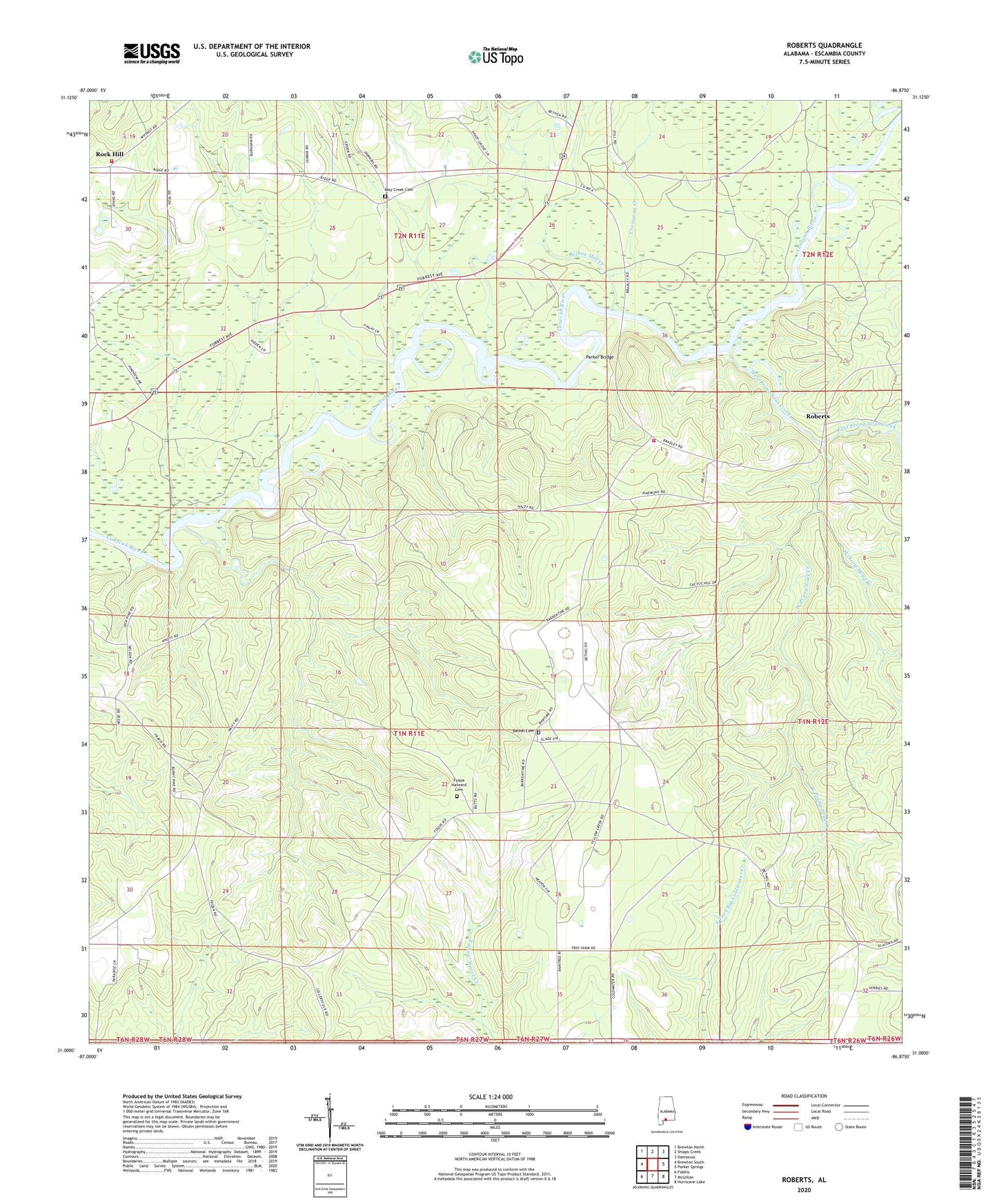
2024 topographic map quadrangle Roberts in the state of Alabama. Scale: 1:24000. Based on the newly updated USGS 7.5' US Topo map series, this map is in the following counties: Escambia. The map contains contour data, water features, and other items you are used to seeing on USGS maps, but also has updated roads and other features. This is the next generation of topographic maps. Printed on high-quality waterproof paper with UV fade-resistant inks.
Quads adjacent to this one:
West: Brewton South
Northwest: Brewton North
North: Shipps Creek
Northeast: Damascus
East: Parker Springs
Southeast: Hurricane Lake
South: McLellan
Southwest: Fidelis
This map covers the same area as the classic USGS quad with code o31086a8.
Contains the following named places: Bethea Mill Creek, Bethel Cemetery, Bethel Church, Crossway Creek, Dexter Hill School, East Escambia Division, East Prong Silas Creek, First Open Bible Church, Fuqua Haveard Cemetery, Harold Mill, Hickory Head Branch, May Creek Cemetery, May Creek United Methodist Church, Maye Creek, Mayo Mill Creek, Mayos Toll Bridge, Parker Bridge, Ridge Road Volunteer Fire Department, Roberts, Rock Hill, Rock Hill Assembly of God Church, School House Creek, Second Shady Grove Baptist Church, Shady Grove Church, Silas Creek, West Prong Silas Creek