MyTopo
Jasper Florida US Topo Map
Couldn't load pickup availability
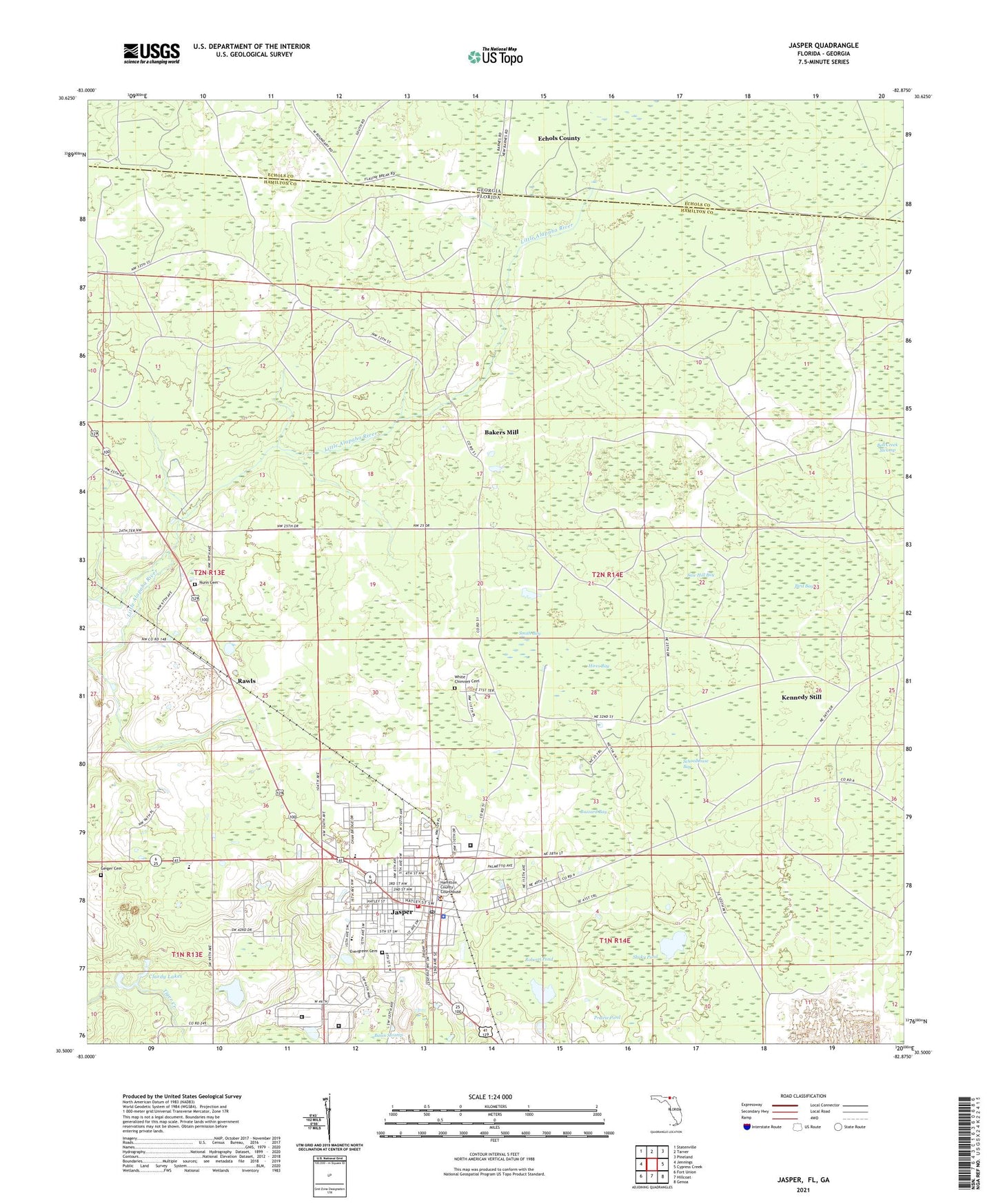
2024 topographic map quadrangle Jasper in the state of Florida. Scale: 1:24000. Based on the newly updated USGS 7.5' US Topo map series, this map is in the following counties: Hamilton, Echols. The map contains contour data, water features, and other items you are used to seeing on USGS maps, but also has updated roads and other features. This is the next generation of topographic maps. Printed on high-quality waterproof paper with UV fade-resistant inks.
Quads adjacent to this one:
West: Jennings
Northwest: Statenville
North: Tarver
Northeast: Pineland
East: Cypress Creek
Southeast: Genoa
South: Hillcoat
Southwest: Fort Union
Contains the following named places: Bakers Mill, Bird Bay, Bright Pond Church, Buzzard Bay, Central Hamilton Elementary School, City of Jasper, Clardy Lakes, Evergreen Cemetery, First Baptist Church of Jasper, First Presbyterian Church, First United Methodist Church, Geiger Cemetery, Greenwood Elementary School, Hamilton Correctional Institution, Hamilton Correctional Institution Annex, Hamilton County Emergency Medical Services, Hamilton County Jail, Hamilton County Memorial Hospital, Hamilton County Sheriff's Office, Hamilton Helistop, Hamilton Middle School, Hamilton Vocational Technical School, Hebron Church, Hires Bay, Jasper, Jasper Division, Jasper Fire Department, Jasper Police Department, Jasper Post Office, Jasper Wastewater Treatment Plant, Kennedy Still, Lee High School, Lee School, Mount Raha Church, New Bethel Church, Nunn Cemetery, Prairie Pond, Rawls, Roberts Pond, Saw Hill Bay, Schoolhouse Bay, Shaky Pond, Smith Bay, Suwannee River Regional Library System Jasper Branch Public Library, Trinity Community Hospital, White Chimney Cemetery