MyTopo
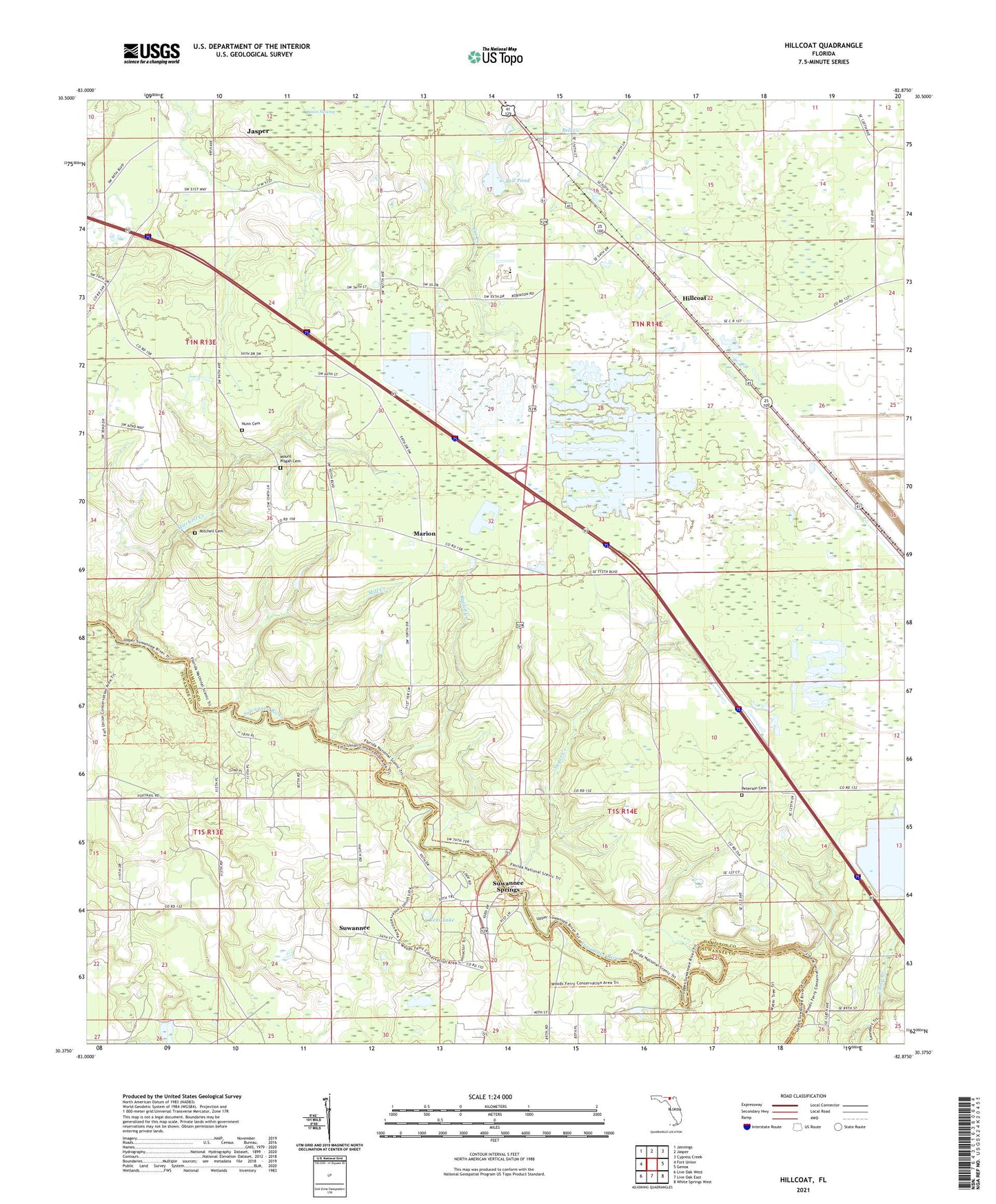
Hillcoat Florida US Topo Map
Couldn't load pickup availability
2024 topographic map quadrangle Hillcoat in the state of Florida. Scale: 1:24000. Based on the newly updated USGS 7.5' US Topo map series, this map is in the following counties: Hamilton, Suwannee. The map contains contour data, water features, and other items you are used to seeing on USGS maps, but also has updated roads and other features. This is the next generation of topographic maps. Printed on high-quality waterproof paper with UV fade-resistant inks.
Quads adjacent to this one:
West: Fort Union
Northwest: Jennings
North: Jasper
Northeast: Cypress Creek
East: Genoa
Southeast: White Springs West
South: Live Oak East
Southwest: Live Oak West
This map covers the same area as the classic USGS quad with code o30082d8.
Contains the following named places: Basin Swamp, Bell Creek, Bell Pond, Borrow Pit Pond, Cat Creek, Divonia Church, Hamilton County, Hamilton County High School, Harvest Fellowship Church, Highland Fairways Golf Course, Hillcoat, Marion, Midway Church, Mill Creek, Mitchell Cemetery, Mitchell Creek, Mount Pisgah Cemetery, Mount Pleasant Church, Nunn Cemetery, Peterson Cemetery, Ratliff Creek, Rees Lake, Sugar Creek, Suwannee, Suwannee Springs, Suwannee Springs Church, ZIP Code: 32052