MyTopo
Fort Union Florida US Topo Map
Couldn't load pickup availability
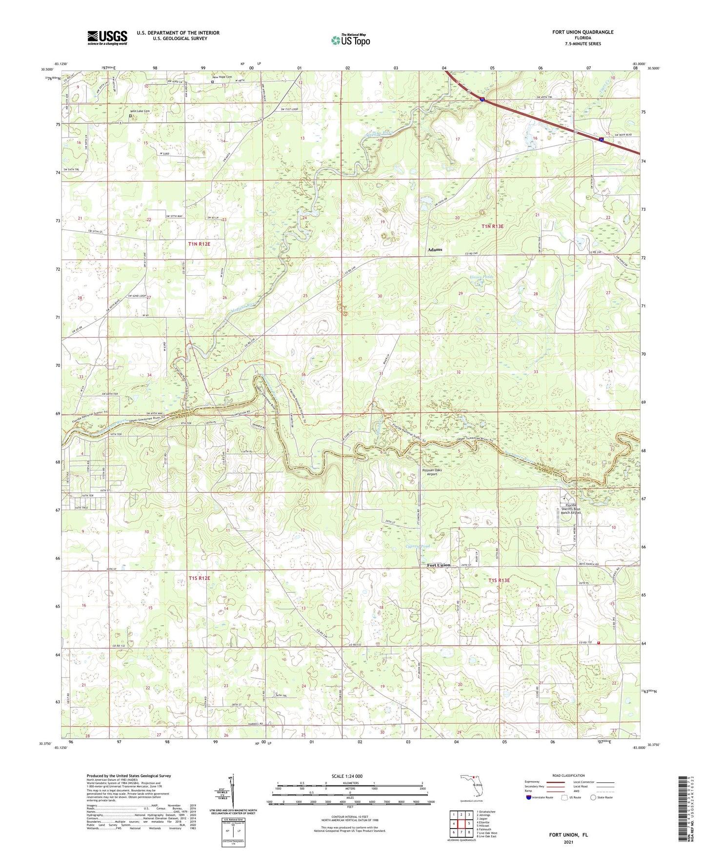
2024 topographic map quadrangle Fort Union in the state of Florida. Scale: 1:24000. Based on the newly updated USGS 7.5' US Topo map series, this map is in the following counties: Hamilton, Suwannee. The map contains contour data, water features, and other items you are used to seeing on USGS maps, but also has updated roads and other features. This is the next generation of topographic maps. Printed on high-quality waterproof paper with UV fade-resistant inks.
Quads adjacent to this one:
West: Ellaville
Northwest: Octahatchee
North: Jennings
Northeast: Jasper
East: Hillcoat
Southeast: Live Oak East
South: Live Oak West
Southwest: Falmouth
This map covers the same area as the classic USGS quad with code o30083d1.
Contains the following named places: Adams, Alapaha River, Cypress Pond, Eleven Ponds, Florida Sheriffs Boys Ranch, Florida Sheriffs Boys Ranch Airport, Fort Union, Friendship Church, Gibson County Park, Gohegan Millpond, Guinea Creek, Holton Creek, New Hope Cemetery, New Hope Church, Olive Branch Church, Pittman Oaks Airport, Rosemary Church, Stagecoach Volunteer Fire Department, Tiger Creek, West Lake Cemetery, West Lake Church