MyTopo
Jennings Florida US Topo Map
Couldn't load pickup availability
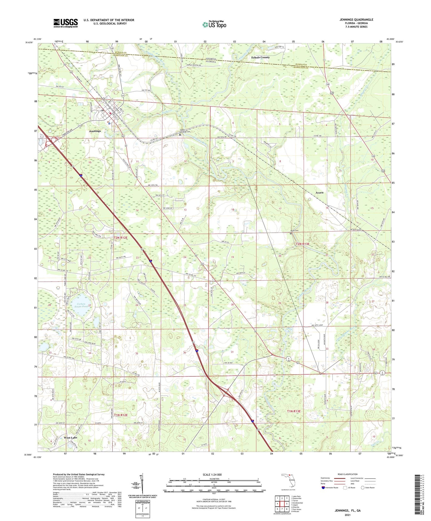
2024 topographic map quadrangle Jennings in the state of Florida. Scale: 1:24000. Based on the newly updated USGS 7.5' US Topo map series, this map is in the following counties: Hamilton, Echols. The map contains contour data, water features, and other items you are used to seeing on USGS maps, but also has updated roads and other features. This is the next generation of topographic maps. Printed on high-quality waterproof paper with UV fade-resistant inks.
Quads adjacent to this one:
West: Octahatchee
Northwest: Lake Park
North: Statenville
Northeast: Tarver
East: Jasper
Southeast: Hillcoat
South: Fort Union
Southwest: Ellaville
Contains the following named places: Alapaha, Alapaha Lookout Tower, Alapahoochee River, Alligator Creek, Avoca, Bluff Cemetery, Corbett Estate Pond, Dry Branch Church, Hilltop Mobile Home Park, Jennings, Jennings Fire Department, Jennings Police Department, Jennings Post Office, Jennings United Methodist Church, Lily of the Valley Church, Little Alapaha River, Morgan Millpond, North Hamilton Elementary School, Oak Grove Church, Saint Marys Baptist Church, Sasser Landing Cemetery, Town of Jennings, Turket Creek, West Lake