MyTopo
Holt Florida US Topo Map
Couldn't load pickup availability
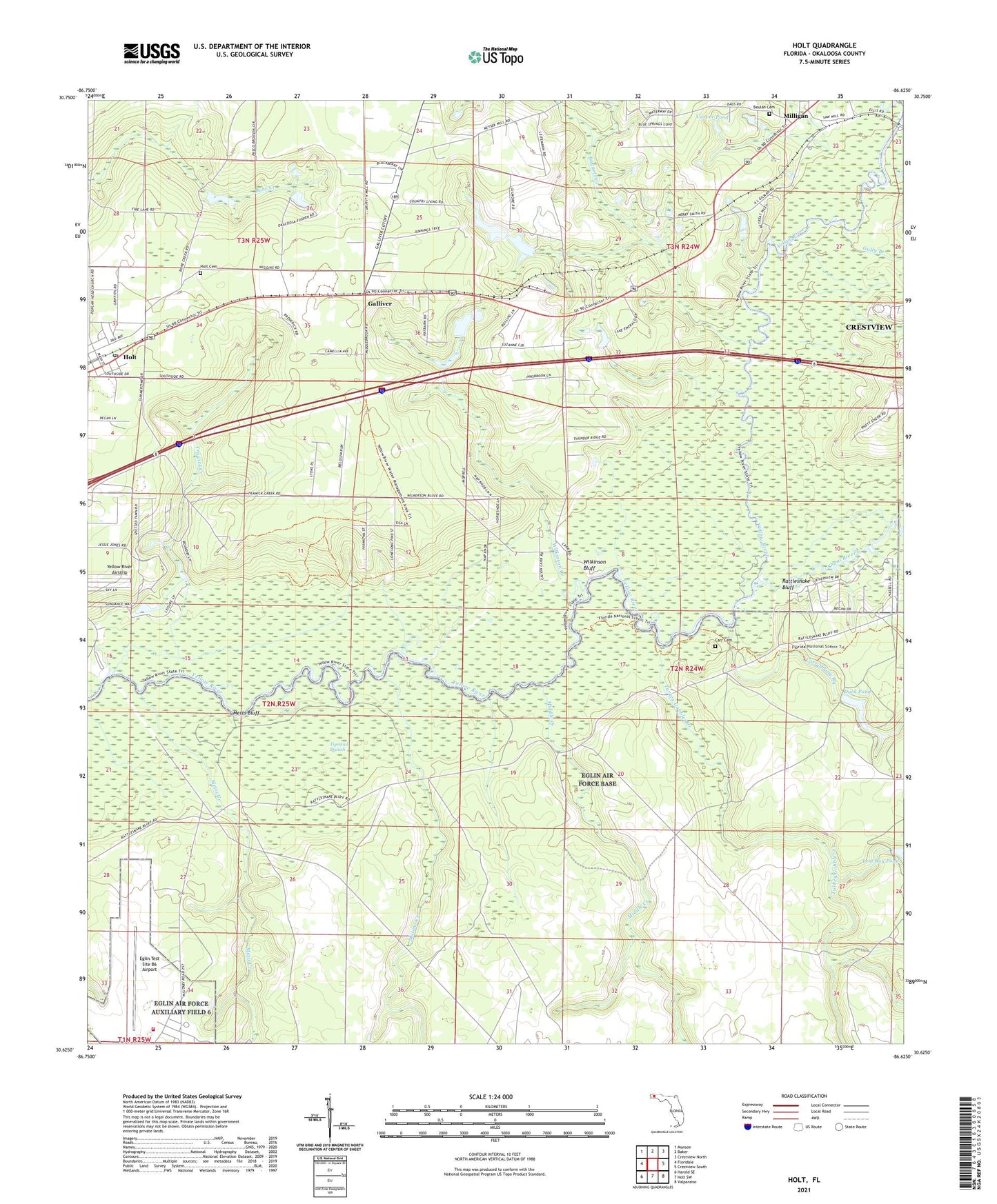
2024 topographic map quadrangle Holt in the state of Florida. Scale: 1:24000. Based on the newly updated USGS 7.5' US Topo map series, this map is in the following counties: Okaloosa. The map contains contour data, water features, and other items you are used to seeing on USGS maps, but also has updated roads and other features. This is the next generation of topographic maps. Printed on high-quality waterproof paper with UV fade-resistant inks.
Quads adjacent to this one:
West: Floridale
Northwest: Munson
North: Baker
Northeast: Crestview North
East: Crestview South
Southeast: Valparaiso
South: Holt SW
Southwest: Harold SE
This map covers the same area as the classic USGS quad with code o30086f6.
Contains the following named places: Baggett Creek, Beulah Cemetery, Carr Cemetery, Carr Landing, Carr Spring Branch, Carver Pond, Duck Pond, Eglin Air Force Base Fire Station Camp Rudder, Eglin Test Site B6 Airport, Galliver, Gin Hole Landing, Green Ponds, Gully Branch, Holt, Holt Post Office, Malone Creek, Metts Bluff, Metts Creek, Middle Creek, Old Holt Cemetery, Rattlesnake Bluff, Shoal River, Trawick Creek, Turkey Gobbler Creek, Wilkinson Bluff, Wilkinson Creek