MyTopo
Baker Florida US Topo Map
Couldn't load pickup availability
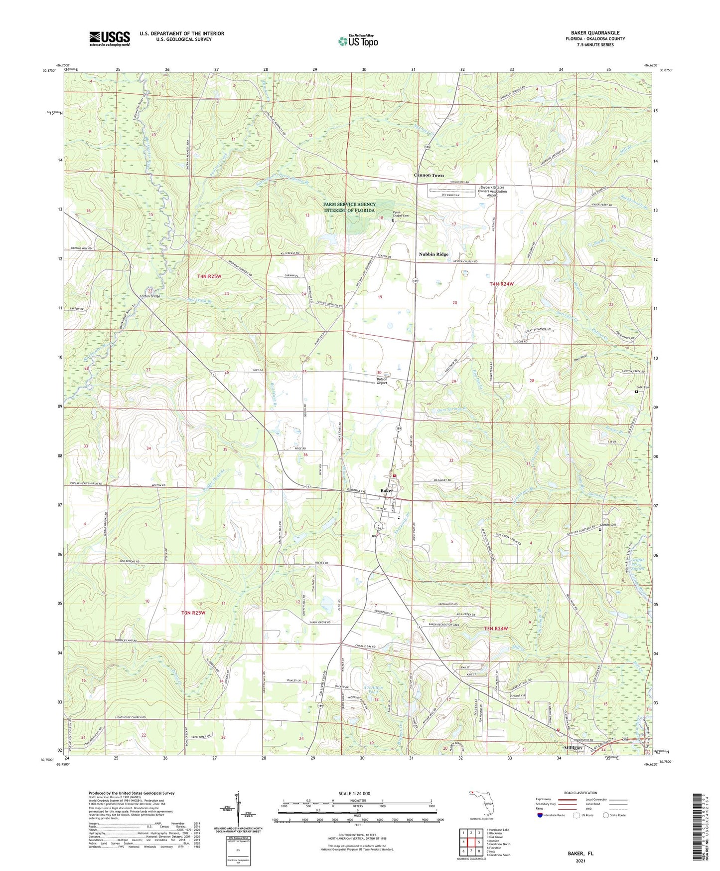
2024 topographic map quadrangle Baker in the state of Florida. Scale: 1:24000. Based on the newly updated USGS 7.5' US Topo map series, this map is in the following counties: Okaloosa. The map contains contour data, water features, and other items you are used to seeing on USGS maps, but also has updated roads and other features. This is the next generation of topographic maps. Printed on high-quality waterproof paper with UV fade-resistant inks.
Quads adjacent to this one:
West: Munson
Northwest: Hurricane Lake
North: Blackman
Northeast: Oak Grove
East: Crestview North
Southeast: Crestview South
South: Holt
Southwest: Floridale
This map covers the same area as the classic USGS quad with code o30086g6.
Contains the following named places: A A Hilton Pond, Baker, Baker Division, Baker Fire District, Baker Post Office, Baker School, Bear Creek, Bluff Landing, Cannon Town, Cobb Cemetery, Cotton Bridge, Deer Head, Dotson Airport, Golan Church, Griffith Cemetery, Griffith Ferry Stretch, Gum Springs Branch, Gunn Creek, Henderson Branch, Hester Church, Hog Pen Branch, Island Branch, Light House Church, Lighthouse Church, Lonesome Pines Airport, Long Branch, Meritt Landing, Mill Creek, Milligan, Narrows Creek, North Okaloosa Fire Department Station 83, Nubbin Ridge, Okaloosa County Emergency Medical Services Station 5, Panther Creek, Pilgrims Rest Church, Pyron Spring Branch, Pyron Spring Chapel, Red Wash Branch, Shady Grove Church, Skypark Estates Owners Association Airport, Surveyor Creek, Tan Vat Branch, Threemile Branch, WJUS-FM (Fort Walton Beach), WTJT-FM (Baker), WTJT-FM (Crestview)