MyTopo
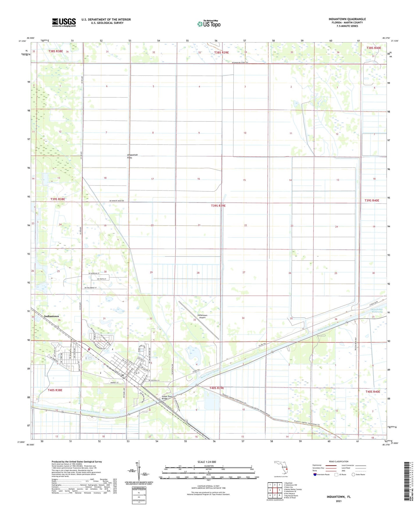
Indiantown Florida US Topo Map
Couldn't load pickup availability
2024 topographic map quadrangle Indiantown in the state of Florida. Scale: 1:24000. Based on the newly updated USGS 7.5' US Topo map series, this map is in the following counties: Martin. The map contains contour data, water features, and other items you are used to seeing on USGS maps, but also has updated roads and other features. This is the next generation of topographic maps. Printed on high-quality waterproof paper with UV fade-resistant inks.
Quads adjacent to this one:
West: Barley Barber Swamp
Northwest: Bluefield
North: Indiantown NW
Northeast: Palm City
East: Indiantown SE
Southeast: West of Rood
South: Big Mound North
Southwest: Port Mayaca
This map covers the same area as the classic USGS quad with code o27080a4.
Contains the following named places: Booker Park Fire Department, Evangelical Haitian Church of the Nazarene, Evergreen First Baptist Church, Family Worship Center, First United Methodist Church, Grasslands Golf and Country Club, Hope Rural School, Indian Town Bridge, Indiantown, Indiantown Airport, Indiantown Baptist Church, Indiantown Census Designated Place, Indiantown Middle School, Indiantown Post Office, Martin County, Martin County Fire Rescue Station 24, Martin County Public Library System Indiantown Branch Library, Martin County Sheriff's Office Indiantown Substation, Rowland Canal, Saint Lucie Canal, Sheltras Trailer Park, Village of Indiantown, Warfield Elementary School, WCNO-FM (Palm City), WKGR-FM (Fort Pierce), WOVV-FM (Fort Pierce), WPBF-TV (Tequesta), WTVX-TV (Fort Pierce), WWFR-FM (Okeechobee), ZIP Code: 34956