MyTopo
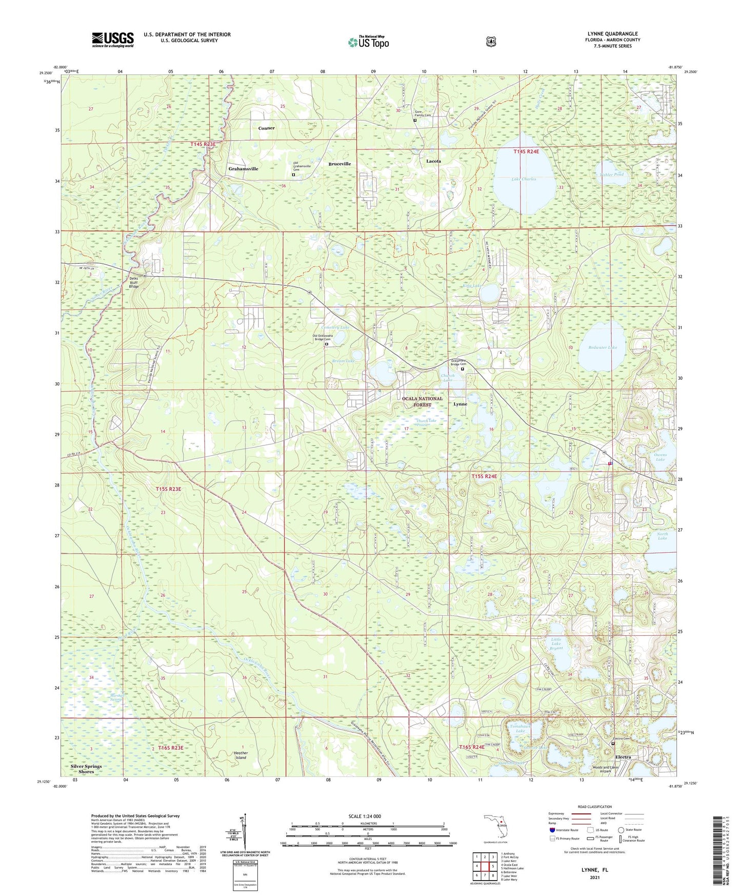
Lynne Florida US Topo Map
Couldn't load pickup availability
Also explore the Lynne Forest Service Topo of this same quad for updated USFS data
2024 topographic map quadrangle Lynne in the state of Florida. Scale: 1:24000. Based on the newly updated USGS 7.5' US Topo map series, this map is in the following counties: Marion. The map contains contour data, water features, and other items you are used to seeing on USGS maps, but also has updated roads and other features. This is the next generation of topographic maps. Printed on high-quality waterproof paper with UV fade-resistant inks.
Quads adjacent to this one:
West: Ocala East
Northwest: Anthony
North: Fort McCoy
Northeast: Lake Kerr
East: Halfmoon Lake
Southeast: Lake Mary
South: Lake Weir
Southwest: Belleview
This map covers the same area as the classic USGS quad with code o29081b8.
Contains the following named places: Bream Lake, Bruceville, Caldwell Landing, Cemetery Lake, Church Lake, Church Lake Prairie, Conner, Conner Landing, Dead River, Deep Woods Mobile Home Park, Delks Bluff Bridge, East Marion Elementary School, East Marion School, Electra, Electra Cemetery, Faith Baptist Church, Forest Corners, Forest Public Library, Gore Family Cemetery, Grahamsville, Grahamsville Landing, Heather Island, King Lake, Lacota, Lake Charles, Lake Waldena Resort Mobile Home Park, Little Lake Bryant, Lynne, Marion County Fire Rescue Station 4 East Marion, Marion County Sheriff's Office - Forest District, New Harvest Church of God, North Lake, Nubys Corner, Ocklawaha Bridge Baptist Church, Ocklawaha Bridge Cemetery, Old Grahamsville Cemetery, Old Ocklawaha Bridge Cemetery, Orange Drain, Owens Lake, Ray Wayside Park, Redwater Lake, Sharps Ferry, Shoesole Lake, Silver River, Stokes Electric Substation, Sunrise Lake, Tall Timber Mobile Home Park, Tishler Pond, Tomahawk Lake, Turkey Landing, Waldena Lake, Woods and Lakes Airpark, ZIP Code: 34488