MyTopo
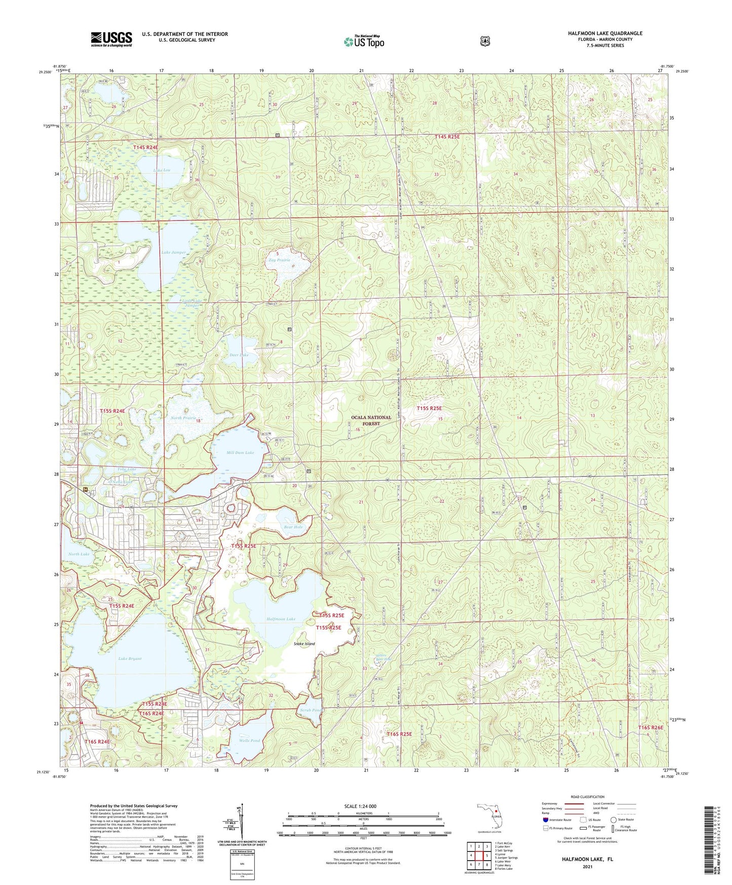
Halfmoon Lake Florida US Topo Map
Couldn't load pickup availability
Also explore the Halfmoon Lake Forest Service Topo of this same quad for updated USFS data
2024 topographic map quadrangle Halfmoon Lake in the state of Florida. Scale: 1:24000. Based on the newly updated USGS 7.5' US Topo map series, this map is in the following counties: Marion. The map contains contour data, water features, and other items you are used to seeing on USGS maps, but also has updated roads and other features. This is the next generation of topographic maps. Printed on high-quality waterproof paper with UV fade-resistant inks.
Quads adjacent to this one:
West: Lynne
Northwest: Fort McCoy
North: Lake Kerr
Northeast: Salt Springs
East: Juniper Springs
Southeast: Farles Lake
South: Lake Mary
Southwest: Lake Weir
This map covers the same area as the classic USGS quad with code o29081b7.
Contains the following named places: Bear Hole, Camp Kiwanis Organizational Campground, Central Tower, Clear Lake, Deer Lake, Deer Lake Camp, East Marion Division, Eckard Camp, First Assembly of God, Forest Evangelical Lutheran Church, Forest Lutheran Church, Forest United Methodist Church, Grand Oaks Mobile Home Park, Halfmoon Lake, Halfmoon lake Campground, Lake Bryant, Lake Bryant Work Center, Lake George Ranger Station, Lake in the Forest Estates Mobile Home Park, Lake Jumper, Lake Lou, Little Lake Jumper, Lynn, Marion County Fire Rescue Station 26 Electra, Mill Dam Lake, Mill Dam Recreation Site, North Prairie, Ocala Wildlife Management Area, O'Nello Lake, Saint Joseph of the Forest Catholic Church, Scrub Pond, Sellers Bear Hole, Snake Island, Tobe Lake, Urbans Mobile Home Park, Wells Pond, Woods and Lakes, Zay Prairie