MyTopo
Lake Miccosukee Florida US Topo Map
Couldn't load pickup availability
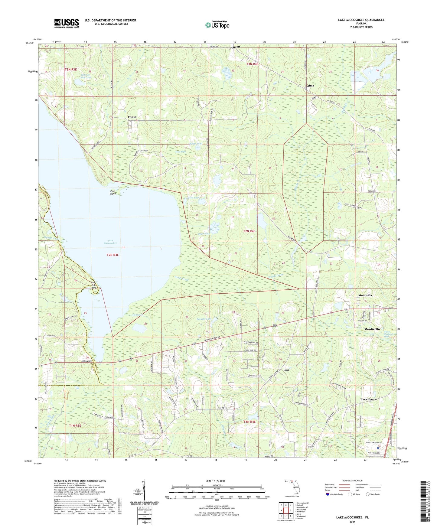
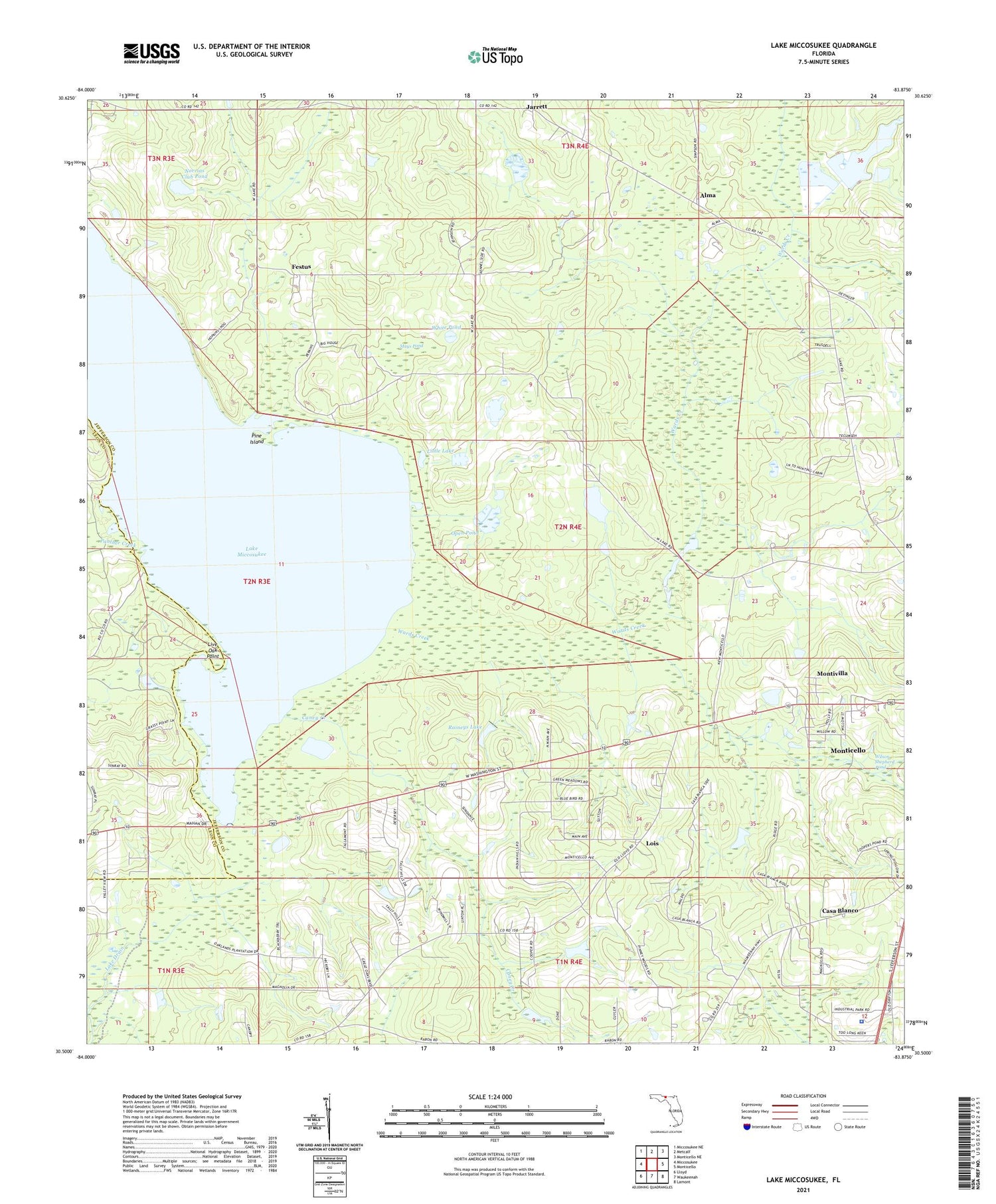
2024 topographic map quadrangle Lake Miccosukee in the state of Florida. Scale: 1:24000. Based on the newly updated USGS 7.5' US Topo map series, this map is in the following counties: Jefferson, Leon. The map contains contour data, water features, and other items you are used to seeing on USGS maps, but also has updated roads and other features. This is the next generation of topographic maps. Printed on high-quality waterproof paper with UV fade-resistant inks.
Quads adjacent to this one:
West: Miccosukee
Northwest: Miccosukee NE
North: Metcalf
Northeast: Monticello NE
East: Monticello
Southeast: Lamont
South: Waukeenah
Southwest: Lloyd
This map covers the same area as the classic USGS quad with code o30083e8.
Contains the following named places: Alma, Aucilla Christian Academy, Caney Creek, Casa Blanco, Casa Blanco Church, Festus, Gulf Atlantic Trailer Park, Harvest Center, Jarrett, Jefferson County Sheriff's Office, Juniors Hill Church, Lake Miccosukee, Little Lake, Live Oak Point, Lois, Macedonia Church, Mays Pond, Monticello Fire Control Headquarters Fire Tower, Montivilla, Mount Olive Church, Norrias Club Pond, Open Pond, Panther Creek, Perkins Plantation Pond, Pine Island, Raineys Lake, Sweetfield Church, Union Branch Church, White Pond, Wilson Shepherd Pond, ZIP Code: 32344