MyTopo
Lamont Florida US Topo Map
Couldn't load pickup availability
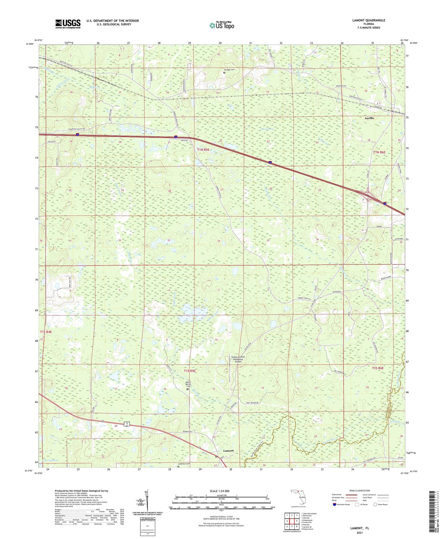
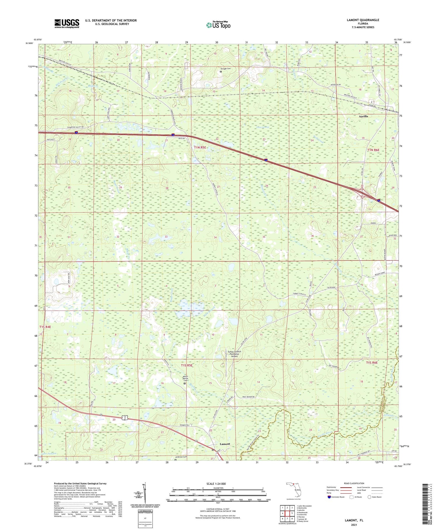
2024 topographic map quadrangle Lamont in the state of Florida. Scale: 1:24000. Based on the newly updated USGS 7.5' US Topo map series, this map is in the following counties: Jefferson, Madison. The map contains contour data, water features, and other items you are used to seeing on USGS maps, but also has updated roads and other features. This is the next generation of topographic maps. Printed on high-quality waterproof paper with UV fade-resistant inks.
Quads adjacent to this one:
West: Waukeenah
Northwest: Lake Miccosukee
North: Monticello
Northeast: Ashville
East: Greenville
Southeast: Shady Grove
South: Lamont SE
Southwest: Wacissa
This map covers the same area as the classic USGS quad with code o30083d7.
Contains the following named places: Alligator Creek, Anderson Cemetery, Aucilla, Aucilla Census Designated Place, Beasley Creek, Buggs Creek, Dixie Branch, Drifton Branch, Edmond Doyles Grant, Friendship Church, Gress Swamp, Lamont, Lamont Census Designated Place, Lamont Post Office, Mill Pond Creek, Mount Marille Cemetery, Mount Marille Church, Sanctified Church, Scruggs Cemetery, Thompson Valley Church, Turkey Scratch Church, Turkey Scratch Plantation Airport